TopoQuest Logo
Do you find TopoQuest useful?
Help keep TopoQuest running and adding new maps/features by donating!
Bitcoin:  19c7KJd3qBynnjoSw5npx9KScwjBe4ifkT
Litecoin:  LXs6TkuXGGXo1vDsWCkWVdjQX94eUKd6ui
Home View Maps Find Maps Find Places Resources & Links


Crow Rock SE, Montana Topographic Map

USGS Map Title: Crow Rock SE, MT
USGS Map MRC: 46106G1
DRG (GeoTIFF) Download: o46106g1.tif


Neighboring USGS Topographic Map Quads:


  Little Chalk Butte, MT  
46106H2
 

  Crow Rock, MT  
46106H1
 

  Combs Ranch, MT  
46105H8
 

  Rock Springs School, MT  
46106G2
 

  Crow Rock SE, MT  
46106G1
 

  Twin Buttes School, MT  
46105G8
 

  Angela, MT  
46106F2
 

  Angela NE, MT  
46106F1
 

  Horse Creek Hill, MT  
46105F8


Map MRC Location:

N47°
W107°
N47°
W106°
H8 H7 H6 H5 H4 H3 H2 H1
G8 G7 G6 G5 G4 G3 G2 G1
F8 F7 F6 F5 F4 F3 F2 F1
E8 E7 E6 E5 E4 E3 E2 E1
D8 D7 D6 D5 D4 D3 D2 D1
C8 C7 C6 C5 C4 C3 C2 C1
B8 B7 B6 B5 B4 B3 B2 B1
A8 A7 A6 A5 A4 A3 A2 A1
N46°
W107°
N46°
W106°

Crow Rock SE, MT USGS 1:24K Topographic Map Preview:
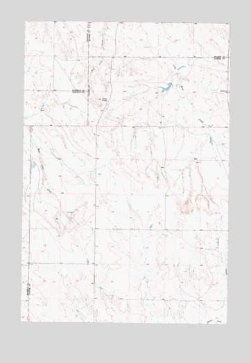
Crow Rock SE, MT USGS Topographic Map
Click on map above to begin viewing in our Map Viewer.

This topographic map contains these locations and features:
Feature Name Type Latitude Longitude GNIS ID View Map
12N45E01BBDD01 WellWellN46.8292°W106.0131°818642View Map
12N45E03BABB01 WellWellN46.8317°W106.0539°818657View Map
12N45E08DACD01 WellWellN46.8078°W106.0845°818432View Map
12N45E09BCCB01 WellWellN46.8117°W106.0797°818464View Map
12N45E11AAAA01 WellWellN46.8175°W106.0184°818516View Map
12N45E18DADD01 WellWellN46.7931°W106.1034°818355View Map
12N45E20AAAA01 WellWellN46.7883°W106.0822°818313View Map
12N45E22AABB01 WellWellN46.7883°W106.0431°818312View Map
12N45E26CAAD01 WellWellN46.7658°W106.0295°818158View Map
12N45E28CBDD01 WellWellN46.7644°W106.0764°818154View Map
12N45E31BBBB01 WellWellN46.7592°W106.1203°818126View Map
12N45E32ACBC01 WellWellN46.7544°W106.0914°818109View Map
13N45E27DDDD01 WellWellN46.8450°W106.0028°818730View Map
13N45E28AADC01 WellWellN46.8575°W106.0256°818851View Map
B-6 Number 4 DamDamN46.8183°W106.1206°796921View Map
Chalk ButteSummitN46.8425°W106.0786°769737View Map
Doran DamDamN46.8483°W106.0372°795084View Map
Doran Number 1 DamDamN46.8550°W106.0306°796331View Map
Fairview School (historical)SchoolN46.8464°W106.0011°771296View Map
Rose School (historical)SchoolN46.8181°W106.1006°1716921View Map
Sisson School (historical)SchoolN46.8031°W106.0811°1716923View Map

Note: Coordinates in the location and feature list above are referenced to NAD83 datum.


Copyright (C) 2008-2025 Ryan Niemi / Sunset Dynamics ... All Rights Reserved