TopoQuest Logo
Do you find TopoQuest useful?
Help keep TopoQuest running and adding new maps/features by donating!
Bitcoin:  19c7KJd3qBynnjoSw5npx9KScwjBe4ifkT
Litecoin:  LXs6TkuXGGXo1vDsWCkWVdjQX94eUKd6ui
Home View Maps Find Maps Find Places Resources & Links


Twin Buttes School, Montana Topographic Map

USGS Map Title: Twin Buttes School, MT
USGS Map MRC: 46105G8
DRG (GeoTIFF) Download: o46105g8.tif


Neighboring USGS Topographic Map Quads:


  Crow Rock, MT  
46106H1
 

  Combs Ranch, MT  
46105H8
 

  Little Sheep Mountain, MT  
46105H7
 

  Crow Rock SE, MT  
46106G1
 

  Twin Buttes School, MT  
46105G8
 

  Morehouse Creek, MT  
46105G7
 

  Angela NE, MT  
46106F1
 

  Horse Creek Hill, MT  
46105F8
 

  Coal Bank Spring, MT  
46105F7


Map MRC Location:

N47°
W106°
N47°
W105°
H8 H7 H6 H5 H4 H3 H2 H1
G8 G7 G6 G5 G4 G3 G2 G1
F8 F7 F6 F5 F4 F3 F2 F1
E8 E7 E6 E5 E4 E3 E2 E1
D8 D7 D6 D5 D4 D3 D2 D1
C8 C7 C6 C5 C4 C3 C2 C1
B8 B7 B6 B5 B4 B3 B2 B1
A8 A7 A6 A5 A4 A3 A2 A1
N46°
W106°
N46°
W105°

Twin Buttes School, MT USGS 1:24K Topographic Map Preview:
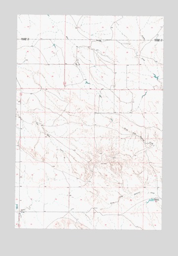
Twin Buttes School, MT USGS Topographic Map
Click on map above to begin viewing in our Map Viewer.

This topographic map contains these locations and features:
Feature Name Type Latitude Longitude GNIS ID View Map
03N47E07BCAB01 WellWellN46.7986°W105.9381°818384View Map
12N46E06AABC01 WellWellN46.8308°W105.9800°818650View Map
12N46E07ACAD01 WellWellN46.8139°W105.9820°818475View Map
12N46E07ACDA01 WellWellN46.8122°W105.9822°818467View Map
12N46E08DABC01 WellWellN46.8094°W105.9589°818442View Map
12N46E25DCAC01 WellWellN46.7628°W105.8770°818141View Map
12N46E30CCCC01 WellWellN46.7600°W105.9961°818133View Map
12N46E31BBBB01 WellWellN46.7594°W105.9961°818128View Map
13N45E24BACB01 WellWellN46.8728°W105.9728°818986View Map
13N45E26CDAC01 WellWellN46.8481°W105.9931°818744View Map
13N46E30ACAB01 WellWellN46.8564°W105.9461°818838View Map
13N46E31DACB01 WellWellN46.8372°W105.9431°818695View Map
13N46E31DBBB01 WellWellN46.8386°W105.9589°818698View Map
Hamlick ReservoirReservoirN46.7673°W105.8848°772104View Map
Hamlick Reservoir DamDamN46.7667°W105.8922°796322View Map
Hartwick School (historical)SchoolN46.7600°W105.9953°772188View Map
Kountz DamDamN46.8383°W105.8806°796324View Map
Mann School (historical)SchoolN46.8467°W105.9422°1716915View Map
Meredith School (historical)SchoolN46.7600°W105.9550°1716916View Map
Twin Buttes SchoolSchoolN46.8597°W105.9289°777845View Map

Note: Coordinates in the location and feature list above are referenced to NAD83 datum.


Copyright (C) 2008-2025 Ryan Niemi / Sunset Dynamics ... All Rights Reserved