TopoQuest Logo
Do you find TopoQuest useful?
Help keep TopoQuest running and adding new maps/features by donating!
Bitcoin:  19c7KJd3qBynnjoSw5npx9KScwjBe4ifkT
Litecoin:  LXs6TkuXGGXo1vDsWCkWVdjQX94eUKd6ui
Home View Maps Find Maps Find Places Resources & Links


Crowder, Oklahoma Topographic Map

USGS Map Title: Crowder, OK
USGS Map MRC: 35095A6
DRG (GeoTIFF) Download: o35095a6.tif


Neighboring USGS Topographic Map Quads:


  Indianola, OK  
35095B7
 

  Canadian, OK  
35095B6
 

  Longtown, OK  
35095B5
 

  Lake McAlester, OK  
35095A7
 

  Crowder, OK  
35095A6
 

  Blocker, OK  
35095A5
 

  McAlester, OK  
34095H7
 

  Krebs, OK  
34095H6
 

  Adamson, OK  
34095H5


Map MRC Location:

N36°
W96°
N36°
W95°
H8 H7 H6 H5 H4 H3 H2 H1
G8 G7 G6 G5 G4 G3 G2 G1
F8 F7 F6 F5 F4 F3 F2 F1
E8 E7 E6 E5 E4 E3 E2 E1
D8 D7 D6 D5 D4 D3 D2 D1
C8 C7 C6 C5 C4 C3 C2 C1
B8 B7 B6 B5 B4 B3 B2 B1
A8 A7 A6 A5 A4 A3 A2 A1
N35°
W96°
N35°
W95°

Crowder, OK USGS 1:24K Topographic Map Preview:
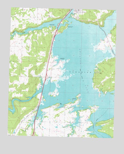
Crowder, OK USGS Topographic Map
Click on map above to begin viewing in our Map Viewer.

This topographic map contains these locations and features:
Feature Name Type Latitude Longitude GNIS ID View Map
Bug TusslePopulated PlaceN35.0309°W95.6900°1090660View Map
Bug Tussle Volunteer Fire DepartmentBuildingN35.0147°W95.6989°2657423View Map
Cardinal Point Recreation AreaParkN35.0745°W95.6897°1090959View Map
Coal CreekStreamN35.0448°W95.7114°1091504View Map
CrowderPopulated PlaceN35.1240°W95.6700°1091853View Map
Crowder CemeteryCemeteryN35.1190°W95.6785°2712530View Map
Crowder Elementary SchoolSchoolN35.1243°W95.6703°1790616View Map
Crowder Fire DepartmentBuildingN35.1235°W95.6751°2657007View Map
Crowder High SchoolSchoolN35.1240°W95.6693°1790311View Map
Crowder Point East Recreation AreaParkN35.1084°W95.6833°1091857View Map
Crowder Point West Recreation AreaParkN35.1079°W95.6997°1091858View Map
Fish CreekStreamN35.0262°W95.6694°1092832View Map
Juniper Point Recreation AreaParkN35.0395°W95.6692°1094277View Map
Massey CemeteryCemeteryN35.0959°W95.6432°1095171View Map
Massey PointPopulated PlaceN35.0643°W95.6450°1095173View Map
ReamsPopulated PlaceN35.0657°W95.7000°1100777View Map
Rock CreekStreamN35.1126°W95.6794°1097317View Map
Town of CrowderCivilN35.1233°W95.6681°2412393View Map
Township of CanadianCivilN35.0626°W95.6669°1824644View Map
W C Ranch Stolport (historical)AirportN35.1198°W95.7042°1102432View Map

Note: Coordinates in the location and feature list above are referenced to NAD83 datum.


Copyright (C) 2008-2025 Ryan Niemi / Sunset Dynamics ... All Rights Reserved