TopoQuest Logo
Do you find TopoQuest useful?
Help keep TopoQuest running and adding new maps/features by donating!
Bitcoin:  19c7KJd3qBynnjoSw5npx9KScwjBe4ifkT
Litecoin:  LXs6TkuXGGXo1vDsWCkWVdjQX94eUKd6ui
Home View Maps Find Maps Find Places Resources & Links


Krebs, Oklahoma Topographic Map

USGS Map Title: Krebs, OK
USGS Map MRC: 34095H6
DRG (GeoTIFF) Download: o34095h6.tif


Neighboring USGS Topographic Map Quads:


  Lake McAlester, OK  
35095A7
 

  Crowder, OK  
35095A6
 

  Blocker, OK  
35095A5
 

  McAlester, OK  
34095H7
 

  Krebs, OK  
34095H6
 

  Adamson, OK  
34095H5
 

  Savanna, OK  
34095G7
 

  Hartshorne SW, OK  
34095G6
 

  Hartshorne, OK  
34095G5


Map MRC Location:

N35°
W96°
N35°
W95°
H8 H7 H6 H5 H4 H3 H2 H1
G8 G7 G6 G5 G4 G3 G2 G1
F8 F7 F6 F5 F4 F3 F2 F1
E8 E7 E6 E5 E4 E3 E2 E1
D8 D7 D6 D5 D4 D3 D2 D1
C8 C7 C6 C5 C4 C3 C2 C1
B8 B7 B6 B5 B4 B3 B2 B1
A8 A7 A6 A5 A4 A3 A2 A1
N34°
W96°
N34°
W95°

Krebs, OK USGS 1:24K Topographic Map Preview:
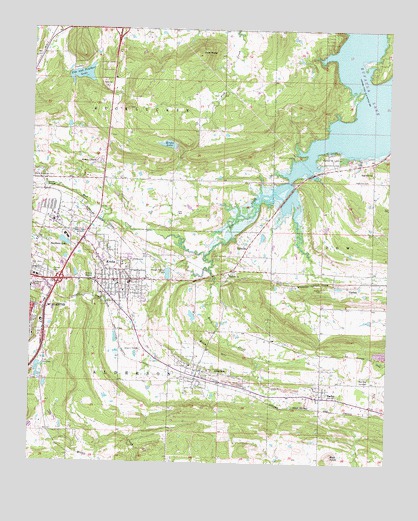
Krebs, OK USGS Topographic Map
Click on map above to begin viewing in our Map Viewer.

This topographic map contains these locations and features:
Feature Name Type Latitude Longitude GNIS ID View Map
AldersonPopulated PlaceN34.9001°W95.6919°1089577View Map
Alderson CemeteryCemeteryN34.8955°W95.6947°2712526View Map
Alderson Volunteer Fire DepartmentBuildingN34.9006°W95.6921°2657098View Map
BachePopulated PlaceN34.8943°W95.6486°1102106View Map
Bache Census Designated PlaceCensusN34.8965°W95.6470°2629905View Map
Bald KnobSummitN34.8779°W95.6442°1089804View Map
Buck CreekStreamN34.9348°W95.6894°1090600View Map
Buck HillSummitN34.9059°W95.6797°1090616View Map
Calvary CemeteryCemeteryN34.9287°W95.7430°1090816View Map
CarbonPopulated PlaceN34.9262°W95.6392°1100261View Map
Carbon CemeteryCemeteryN34.9255°W95.6479°1090956View Map
City of KrebsCivilN34.9299°W95.7200°2411559View Map
Fin and Feather LakeReservoirN34.9867°W95.7331°1751469View Map
Fin Feather Lake DamDamN34.9851°W95.7369°1751468View Map
Gaines Creek Volunteer Fire Department Station 1BuildingN34.9953°W95.6487°2657332View Map
Gaines Creek Volunteer Fire Department Station 2BuildingN34.9951°W95.6480°2657323View Map
High Hill CemeteryCemeteryN34.9568°W95.6325°1093730View Map
High Hill ChurchChurchN34.9593°W95.6314°1093734View Map
Highway 31 Landing Recreation AreaParkN34.9623°W95.6453°1093765View Map
Kiamichi Technology Center McAlesterSchoolN34.9242°W95.7460°1790398View Map
KMCO-FM (McAlester)TowerN34.9870°W95.7030°1102276View Map
KNED-AM (McAlester)TowerN34.9870°W95.7030°1102201View Map
KNED-AM (McAlester)TowerN34.9368°W95.7333°1102202View Map
KrebsPopulated PlaceN34.9279°W95.7158°1094434View Map
Krebs Elementary SchoolSchoolN34.9268°W95.7212°1803528View Map
Krebs Fire DepartmentBuildingN34.9283°W95.7154°2656976View Map
Krebs LakeReservoirN34.9668°W95.7030°1094435View Map
Krebs Police DepartmentBuildingN34.9279°W95.7155°2757687View Map
Lakewood Christian SchoolSchoolN34.9145°W95.7445°2713005View Map
Lakewood Christian School ChurchChurchN34.9162°W95.7447°1798717View Map
McAlester High SchoolSchoolN34.9368°W95.7410°1793761View Map
McAlester Regional Hospital HeliportAirportN34.9362°W95.7489°1102544View Map
Memory GardensCemeteryN34.9618°W95.7267°1095318View Map
Mud CreekStreamN34.9570°W95.6600°1095671View Map
Oak Hill CemeteryCemeteryN34.9312°W95.7483°1096113View Map
Oknoname 121012 DamDamN34.9401°W95.6686°1755557View Map
Oknoname 121012 ReservoirReservoirN34.9401°W95.6693°1755558View Map
Oknoname 121013 DamDamN34.9168°W95.6919°1755559View Map
Oknoname 121013 ReservoirReservoirN34.9174°W95.6937°1755560View Map
Pine KnobSummitN34.9934°W95.6922°1096662View Map
Pittsburg CountyCivilN34.9239°W95.7484°1101848View Map
Red Oak CemeteryCemeteryN34.8993°W95.6330°1097109View Map
RichvillePopulated PlaceN34.9379°W95.6744°1100791View Map
Richville ChurchChurchN34.9295°W95.6811°1097197View Map
Smithson LakeReservoirN34.9385°W95.7387°1098143View Map
Smithson Lake DamDamN34.9384°W95.7403°1755529View Map
Town of AldersonCivilN34.9008°W95.6901°2412346View Map

Note: Coordinates in the location and feature list above are referenced to NAD83 datum.


Copyright (C) 2008-2025 Ryan Niemi / Sunset Dynamics ... All Rights Reserved