TopoQuest Logo
Do you find TopoQuest useful?
Help keep TopoQuest running and adding new maps/features by donating!
Bitcoin:  19c7KJd3qBynnjoSw5npx9KScwjBe4ifkT
Litecoin:  LXs6TkuXGGXo1vDsWCkWVdjQX94eUKd6ui
Home View Maps Find Maps Find Places Resources & Links


Crown Point, New York Topographic Map

USGS Map Title: Crown Point, NY
USGS Map MRC: 43073H4
DRG (GeoTIFF) Download: o43073h4.tif


Neighboring USGS Topographic Map Quads:


  Eagle Lake, NY  
43073H5
 

  Crown Point, NY  
43073H4
 

  Bridport, VT  
43073H3
 

  Graphite, NY  
43073G5
 

  Ticonderoga, NY  
43073G4
 

  Orwell, VT  
43073G3


Map MRC Location:

N44°
W74°
N44°
W73°
H8 H7 H6 H5 H4 H3 H2 H1
G8 G7 G6 G5 G4 G3 G2 G1
F8 F7 F6 F5 F4 F3 F2 F1
E8 E7 E6 E5 E4 E3 E2 E1
D8 D7 D6 D5 D4 D3 D2 D1
C8 C7 C6 C5 C4 C3 C2 C1
B8 B7 B6 B5 B4 B3 B2 B1
A8 A7 A6 A5 A4 A3 A2 A1
N43°
W74°
N43°
W73°

Crown Point, NY USGS 1:24K Topographic Map Preview:
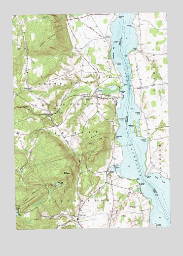
Crown Point, NY USGS Topographic Map
Click on map above to begin viewing in our Map Viewer.

This topographic map contains these locations and features:
Feature Name Type Latitude Longitude GNIS ID View Map
Bliss CemeteryCemeteryN43.9428°W73.3951°1918036View Map
Braisted BrookStreamN43.9787°W73.3985°1456549View Map
Breeds HillSummitN43.9292°W73.4307°944677View Map
Buck MountainSummitN43.9064°W73.4601°945041View Map
Buck Mountain PondLakeN43.9010°W73.4647°945048View Map
Bulwagga MountainSummitN43.9814°W73.4762°945171View Map
Burdick CrossingPopulated PlaceN43.9856°W73.4251°972283View Map
Champlain SpeedwayLocaleN43.9092°W73.4221°974346View Map
Cold Spring ParkPopulated PlaceN43.9984°W73.4748°972331View Map
Coot HillSummitN43.9803°W73.4960°947405View Map
Crown PointPopulated PlaceN43.9503°W73.4371°947853View Map
Crown Point Bible ChurchChurchN43.9502°W73.4572°2615833View Map
Crown Point CenterPopulated PlaceN43.9417°W73.4690°947855View Map
Crown Point Central SchoolSchoolN43.9520°W73.4297°2669008View Map
Crown Point Fire DepartmentBuildingN43.9513°W73.4296°2718638View Map
Dibble HollowValleyN43.9284°W73.4207°948428View Map
FactoryvillePopulated PlaceN43.9517°W73.4415°949797View Map
Fairview CemeteryCemeteryN43.9454°W73.4640°949844View Map
First Congregational ChurchChurchN43.9521°W73.4348°2615993View Map
Fivemile CreekStreamN43.8751°W73.4271°950212View Map
Fivemile PointCapeN43.9048°W73.3937°1457445View Map
Fivemile Point LightLocaleN43.9037°W73.4015°973718View Map
Forestdale CemeteryCemeteryN43.9501°W73.4370°950431View Map
Giards BayBayN43.9792°W73.4001°1457535View Map
Gilligans BayBayN43.9553°W73.4115°951126View Map
Grant BrookStreamN43.9101°W73.4146°951507View Map
Hammond Library of Crown PointBuildingN43.9508°W73.4266°2617298View Map
Hickock PointCapeN43.9831°W73.4176°952682View Map
Indian RidgeRidgeN43.9653°W73.4301°953693View Map
Jones DockLocaleN43.9753°W73.4062°1458034View Map
Keeney MountainSummitN43.8939°W73.4865°954435View Map
Kerby PointCapeN43.8762°W73.3848°954548View Map
Lake SchoolSchoolN43.9564°W73.3962°1458141View Map
Lapham BayBayN43.9245°W73.3943°1458164View Map
Lapham IslandIslandN43.9337°W73.4018°1458165View Map
Leonard BayBayN43.9412°W73.3998°1458195View Map
Manning Personal AirstripAirportN43.9815°W73.3857°1461918View Map
Miller MarshSwampN43.9106°W73.4168°957317View Map
Miller MountainSummitN43.9159°W73.4385°957318View Map
Mine HillSummitN43.9009°W73.4682°957381View Map
Moniter Bay ParkParkN43.9495°W73.4140°973717View Map
Murdocks PointCapeN43.9978°W73.4137°958179View Map
Phelps BrookStreamN43.9467°W73.4996°960276View Map
Phelps RocksSummitN43.9001°W73.3982°960291View Map
Plumies PointCapeN43.9926°W73.4026°1459014View Map
Porters MarshSwampN43.9706°W73.4165°960998View Map
Putnam CreekStreamN43.9578°W73.4098°974245View Map
Putts PointCapeN43.9578°W73.4101°962016View Map
Russell CemeteryCemeteryN43.9688°W73.3999°1918220View Map
Sacred Heart CemeteryCemeteryN43.9521°W73.4216°963184View Map
Sacred Heart ChurchChurchN43.9504°W73.4211°2616863View Map
Schoolhouse BayBayN43.9773°W73.4193°964608View Map
Sheepshead IslandIslandN43.9376°W73.4137°965002View Map
Skyline Drive-In (historical)LocaleN43.9603°W73.4294°2558369View Map
Spar Mill BayBayN43.9289°W73.4165°965941View Map
Spar MineMineN43.9245°W73.4387°965942View Map
Stony CoveBayN43.9026°W73.3821°1459738View Map
Stony PointCapeN43.9031°W73.4015°966584View Map
Street RoadPopulated PlaceN43.8803°W73.4493°966632View Map
Sugar HillSummitN43.9381°W73.4343°966709View Map
Ticonderoga Municipal AirportAirportN43.8770°W73.4132°978335View Map
Wells CemeteryCemeteryN43.9565°W73.4002°1918262View Map
West BridportPopulated PlaceN43.9567°W73.3960°1460471View Map
White ChurchChurchN43.9567°W73.4868°971084View Map
Worcester PondLakeN43.8851°W73.4992°971740View Map

Note: Coordinates in the location and feature list above are referenced to NAD83 datum.


Copyright (C) 2008-2025 Ryan Niemi / Sunset Dynamics ... All Rights Reserved