TopoQuest Logo
Do you find TopoQuest useful?
Help keep TopoQuest running and adding new maps/features by donating!
Bitcoin:  19c7KJd3qBynnjoSw5npx9KScwjBe4ifkT
Litecoin:  LXs6TkuXGGXo1vDsWCkWVdjQX94eUKd6ui
Home View Maps Find Maps Find Places Resources & Links


Eagle Lake, New York Topographic Map

USGS Map Title: Eagle Lake, NY
USGS Map MRC: 43073H5
DRG (GeoTIFF) Download: o43073h5.tif


Neighboring USGS Topographic Map Quads:


  Paradox Lake, NY  
43073H6
 

  Eagle Lake, NY  
43073H5
 

  Crown Point, NY  
43073H4
 

  Pharaoh Mountain, NY  
43073G6
 

  Graphite, NY  
43073G5
 

  Ticonderoga, NY  
43073G4


Map MRC Location:

N44°
W74°
N44°
W73°
H8 H7 H6 H5 H4 H3 H2 H1
G8 G7 G6 G5 G4 G3 G2 G1
F8 F7 F6 F5 F4 F3 F2 F1
E8 E7 E6 E5 E4 E3 E2 E1
D8 D7 D6 D5 D4 D3 D2 D1
C8 C7 C6 C5 C4 C3 C2 C1
B8 B7 B6 B5 B4 B3 B2 B1
A8 A7 A6 A5 A4 A3 A2 A1
N43°
W74°
N43°
W73°

Eagle Lake, NY USGS 1:24K Topographic Map Preview:
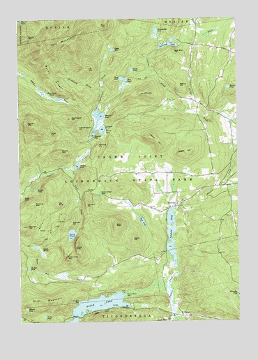
Eagle Lake, NY USGS Topographic Map
Click on map above to begin viewing in our Map Viewer.

This topographic map contains these locations and features:
Feature Name Type Latitude Longitude GNIS ID View Map
Arnold PondLakeN43.8805°W73.6209°942582View Map
Bald PateSummitN43.9151°W73.5696°942876View Map
Beech HillSummitN43.9092°W73.5598°943510View Map
Bennett HillSummitN43.9145°W73.6204°943672View Map
Big Pidgeon HillSummitN43.9592°W73.5946°943936View Map
Black Brook PondsLakeN43.9678°W73.6057°944091View Map
Bloody MountainSummitN43.9928°W73.6190°944277View Map
Blue HillSummitN43.9973°W73.5743°944308View Map
Breakneck BrookStreamN43.9703°W73.5768°944671View Map
Burnt RidgesRidgeN43.9764°W73.6054°945270View Map
Burris PondLakeN43.9714°W73.5048°945284View Map
Butternut BrookStreamN43.9634°W73.5796°945380View Map
Cat MountainSummitN43.9792°W73.5854°946017View Map
Cedar Bridge PondLakeN43.9284°W73.5785°946101View Map
ChilsonPopulated PlaceN43.8773°W73.5287°946580View Map
Crown Point BayBayN43.8859°W73.5651°947854View Map
Cubtown BrookStreamN43.9628°W73.5271°947919View Map
Dudley MountainSummitN43.9456°W73.6010°948761View Map
Dudley PondLakeN43.9393°W73.5923°948763View Map
Eagle CliffCliffN43.8792°W73.5790°948913View Map
Eagle LakeLakeN43.8809°W73.5830°948926View Map
Fleming MountainSummitN43.9237°W73.6160°950275View Map
Furnace MountainSummitN43.9237°W73.5862°950816View Map
Goosepuddle PondLakeN43.9944°W73.5452°951384View Map
Hail MountainSummitN43.9892°W73.6046°951996View Map
Hebron HillSummitN43.9514°W73.5468°952512View Map
Hill Number 8SummitN43.9242°W73.6029°974408View Map
Hogan HillSummitN43.9445°W73.5318°952949View Map
Huse PondLakeN43.9754°W73.5654°953533View Map
Ingalls MarshSwampN43.9042°W73.6121°953713View Map
IronvillePopulated PlaceN43.9226°W73.5357°953785View Map
Knob BrookStreamN43.9381°W73.5935°954782View Map
Knob MountainSummitN43.9059°W73.5923°954785View Map
Knob PondLakeN43.9094°W73.5947°954786View Map
Kumph PondLakeN43.9295°W73.6151°954829View Map
Little Knob MountainSummitN43.9017°W73.5973°955572View Map
Little Pidgeon HillSummitN43.9551°W73.5901°955624View Map
Martin PondLakeN43.8991°W73.6197°956594View Map
Moose MountainSummitN43.9570°W73.6198°957625View Map
Mount LewisSummitN43.9689°W73.5526°955253View Map
Mud PondLakeN43.9163°W73.5545°958086View Map
Mud PondLakeN43.9711°W73.5642°958087View Map
Ore Bed BayBayN43.8831°W73.5910°959450View Map
Overshot PondLakeN43.9571°W73.5795°959662View Map
Penfield Homestead MuseumBuildingN43.9227°W73.5361°2617512View Map
Penfield PondLakeN43.9098°W73.5380°960139View Map
Railroad HillSummitN43.9159°W73.5951°962138View Map
Round PondLakeN43.9544°W73.5770°963002View Map
Sawmill PondLakeN43.9526°W73.5821°964534View Map
Sherman LakeLakeN43.9895°W73.5384°965081View Map
Shop HillSummitN43.9528°W73.6065°965152View Map
Skiff MountainSummitN43.8837°W73.6090°965350View Map
Snake PondLakeN43.8775°W73.6111°965562View Map
Snake PondLakeN43.9263°W73.6227°965563View Map
Snake PondLakeN43.9790°W73.5596°965564View Map
Spar Bed HillSummitN43.9864°W73.5351°965940View Map
Town of Crown PointCivilN43.9536°W73.5254°978879View Map
Trout PondLakeN43.9874°W73.5704°967891View Map
Turtle IslandIslandN43.8817°W73.5726°967985View Map
Walnut HillSummitN43.9726°W73.5326°968713View Map
Winding HillSummitN43.9481°W73.5793°971466View Map

Note: Coordinates in the location and feature list above are referenced to NAD83 datum.


Copyright (C) 2008-2025 Ryan Niemi / Sunset Dynamics ... All Rights Reserved