TopoQuest Logo
Do you find TopoQuest useful?
Help keep TopoQuest running and adding new maps/features by donating!
Bitcoin:  19c7KJd3qBynnjoSw5npx9KScwjBe4ifkT
Litecoin:  LXs6TkuXGGXo1vDsWCkWVdjQX94eUKd6ui
Home View Maps Find Maps Find Places Resources & Links


Cuffietown, Georgia Topographic Map

USGS Map Title: Cuffietown, GA
USGS Map MRC: 31083F7
DRG (GeoTIFF) Download: o31083f7.tif


Neighboring USGS Topographic Map Quads:


  Warwick, GA  
31083G8
 

  Pateville, GA  
31083G7
 

  Arabi, GA  
31083G6
 

  Doles, GA  
31083F8
 

  Cuffietown, GA  
31083F7
 

  Ashburn, GA  
31083F6
 

  Acree, GA  
31083E8
 

  Sylvester, GA  
31083E7
 

  Sumner, GA  
31083E6


Map MRC Location:

N32°
W84°
N32°
W83°
H8 H7 H6 H5 H4 H3 H2 H1
G8 G7 G6 G5 G4 G3 G2 G1
F8 F7 F6 F5 F4 F3 F2 F1
E8 E7 E6 E5 E4 E3 E2 E1
D8 D7 D6 D5 D4 D3 D2 D1
C8 C7 C6 C5 C4 C3 C2 C1
B8 B7 B6 B5 B4 B3 B2 B1
A8 A7 A6 A5 A4 A3 A2 A1
N31°
W84°
N31°
W83°

Cuffietown, GA USGS 1:24K Topographic Map Preview:
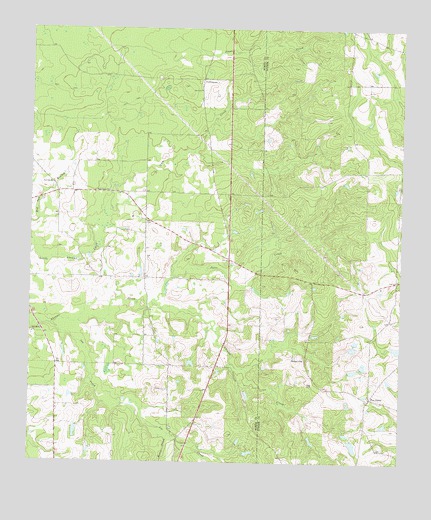
Cuffietown, GA USGS Topographic Map
Click on map above to begin viewing in our Map Viewer.

This topographic map contains these locations and features:
Feature Name Type Latitude Longitude GNIS ID View Map
Beckman BridgeBridgeN31.6585°W83.8093°352143View Map
Bowen School (historical)SchoolN31.6532°W83.8280°343258View Map
Bozeman School (historical)SchoolN31.6432°W83.7599°343186View Map
CuffietownPopulated PlaceN31.7357°W83.8163°326240View Map
Davis ChurchChurchN31.7327°W83.8171°313349View Map
Davis School (historical)SchoolN31.7346°W83.7680°343196View Map
Denby School (historical)SchoolN31.6857°W83.8360°343275View Map
Five PointsPopulated PlaceN31.6441°W83.7596°331715View Map
Fords Chapel (historical)ChurchN31.6352°W83.8657°343283View Map
Gum CreekStreamN31.7030°W83.8488°314962View Map
Gum Creek ChurchChurchN31.7032°W83.8485°314970View Map
Gum Creek School (historical)SchoolN31.7030°W83.8485°343295View Map
Harmony CemeteryCemeteryN31.6555°W83.7827°349378View Map
Harmony ChurchChurchN31.6549°W83.7827°356177View Map
High Springs (historical)Populated PlaceN31.6813°W83.7866°343209View Map
Horse CreekStreamN31.6330°W83.8274°315687View Map
Jeter CreekStreamN31.6713°W83.8335°316108View Map
Joe CreekStreamN31.6646°W83.8677°316123View Map
Prosperity Church (historical)ChurchN31.6780°W83.7510°343224View Map
Prosperity School (historical)SchoolN31.6780°W83.7510°343225View Map
Providence CemeteryCemeteryN31.6616°W83.8743°349404View Map
Providence ChurchChurchN31.6624°W83.8738°321190View Map
Red Oak CemeteryCemeteryN31.7044°W83.8679°349405View Map
Red Oak ChurchChurchN31.7052°W83.8677°321400View Map
Turner County Fire and Rescue Harmony StationBuildingN31.6774°W83.7509°2604143View Map
Unionville School (historical)SchoolN31.7321°W83.8180°343356View Map
Whiddon BridgeBridgeN31.6652°W83.8724°343360View Map
Williams LakeReservoirN31.6290°W83.7649°340907View Map
Williams Lake DamDamN31.6318°W83.7666°340906View Map

Note: Coordinates in the location and feature list above are referenced to NAD83 datum.


Copyright (C) 2008-2024 Ryan Niemi / Sunset Dynamics ... All Rights Reserved