TopoQuest Logo
Do you find TopoQuest useful?
Help keep TopoQuest running and adding new maps/features by donating!
Bitcoin:  19c7KJd3qBynnjoSw5npx9KScwjBe4ifkT
Litecoin:  LXs6TkuXGGXo1vDsWCkWVdjQX94eUKd6ui
Home View Maps Find Maps Find Places Resources & Links


Cullom, Illinois Topographic Map

USGS Map Title: Cullom, IL
USGS Map MRC: 40088H3
DRG (GeoTIFF) Download: o40088h3.tif


Neighboring USGS Topographic Map Quads:


  Dwight, IL  
41088A4
 

  Campus, IL  
41088A3
 

  Buckingham, IL  
41088A2
 

  Saunemin, IL  
40088H4
 

  Cullom, IL  
40088H3
 

  Cabery, IL  
40088H2
 

  Forrest North, IL  
40088G4
 

  Chatsworth North, IL  
40088G3
 

  Piper City, IL  
40088G2


Map MRC Location:

N41°
W89°
N41°
W88°
H8 H7 H6 H5 H4 H3 H2 H1
G8 G7 G6 G5 G4 G3 G2 G1
F8 F7 F6 F5 F4 F3 F2 F1
E8 E7 E6 E5 E4 E3 E2 E1
D8 D7 D6 D5 D4 D3 D2 D1
C8 C7 C6 C5 C4 C3 C2 C1
B8 B7 B6 B5 B4 B3 B2 B1
A8 A7 A6 A5 A4 A3 A2 A1
N40°
W89°
N40°
W88°

Cullom, IL USGS 1:24K Topographic Map Preview:
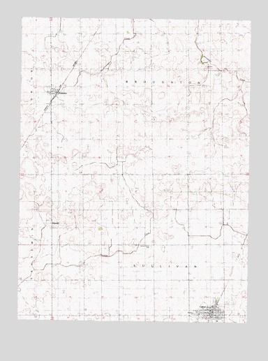
Cullom, IL USGS Topographic Map
Click on map above to begin viewing in our Map Viewer.

This topographic map contains these locations and features:
Feature Name Type Latitude Longitude GNIS ID View Map
Broughton CemeteryCemeteryN40.9801°W88.2747°404930View Map
Center School (historical)SchoolN40.9798°W88.3045°405830View Map
Close School (historical)SchoolN40.9506°W88.3406°406264View Map
CullomPopulated PlaceN40.8778°W88.2692°406881View Map
Cullom Fire DepartmentBuildingN40.8787°W88.2684°2681770View Map
Cullom Post OfficePost OfficeN40.8793°W88.2691°2788788View Map
EmingtonPopulated PlaceN40.9698°W88.3581°408005View Map
Emington Post OfficePost OfficeN40.9693°W88.3561°2788787View Map
Emington School (historical)SchoolN40.9720°W88.3581°1737578View Map
Godbee RLA Airport (historical)AirportN40.9513°W88.2710°2679054View Map
GriswoldPopulated PlaceN40.9131°W88.3539°422764View Map
Griswold School (historical)SchoolN40.9203°W88.3403°409525View Map
Kingdom School (historical)SchoolN40.8920°W88.3389°411500View Map
Lamb School (historical)SchoolN40.8917°W88.3003°411775View Map
Saint John's Catholic CemeteryCemeteryN40.8786°W88.2775°1719414View Map
Saxon (historical)Populated PlaceN40.9150°W88.2514°1737677View Map
Skinner School (historical)SchoolN40.9217°W88.3034°418576View Map
Sullivan Center (historical)Populated PlaceN40.9211°W88.2976°1737685View Map
Sullivan Center CemeteryCemeteryN40.9062°W88.3031°419326View Map
Township of BroughtonCivilN40.9794°W88.3028°428718View Map
Township of SullivanCivilN40.8850°W88.3005°429811View Map
Tri-Point High SchoolSchoolN40.8820°W88.2681°1737689View Map
Village of CullomCivilN40.8783°W88.2697°2398658View Map
Village of EmingtonCivilN40.9702°W88.3578°2398828View Map
West Lawn CemeteryCemeteryN40.8786°W88.2787°1719425View Map

Note: Coordinates in the location and feature list above are referenced to NAD83 datum.


Copyright (C) 2008-2025 Ryan Niemi / Sunset Dynamics ... All Rights Reserved