TopoQuest Logo
Do you find TopoQuest useful?
Help keep TopoQuest running and adding new maps/features by donating!
Bitcoin:  19c7KJd3qBynnjoSw5npx9KScwjBe4ifkT
Litecoin:  LXs6TkuXGGXo1vDsWCkWVdjQX94eUKd6ui
Home View Maps Find Maps Find Places Resources & Links


Piper City, Illinois Topographic Map

USGS Map Title: Piper City, IL
USGS Map MRC: 40088G2
DRG (GeoTIFF) Download: o40088g2.tif


Neighboring USGS Topographic Map Quads:


  Cullom, IL  
40088H3
 

  Cabery, IL  
40088H2
 

  Piper City NE, IL  
40088H1
 

  Chatsworth North, IL  
40088G3
 

  Piper City, IL  
40088G2
 

  La Hogue, IL  
40088G1
 

  Chatsworth South, IL  
40088F3
 

  Buckley NW, IL  
40088F2
 

  Onarga West, IL  
40088F1


Map MRC Location:

N41°
W89°
N41°
W88°
H8 H7 H6 H5 H4 H3 H2 H1
G8 G7 G6 G5 G4 G3 G2 G1
F8 F7 F6 F5 F4 F3 F2 F1
E8 E7 E6 E5 E4 E3 E2 E1
D8 D7 D6 D5 D4 D3 D2 D1
C8 C7 C6 C5 C4 C3 C2 C1
B8 B7 B6 B5 B4 B3 B2 B1
A8 A7 A6 A5 A4 A3 A2 A1
N40°
W89°
N40°
W88°

Piper City, IL USGS 1:24K Topographic Map Preview:
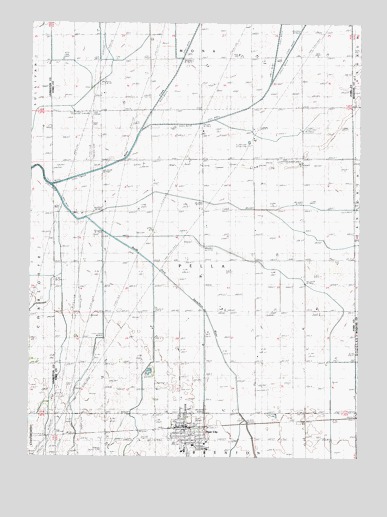
Piper City, IL USGS Topographic Map
Click on map above to begin viewing in our Map Viewer.

This topographic map contains these locations and features:
Feature Name Type Latitude Longitude GNIS ID View Map
Bradbury Airport (historical)AirportN40.7523°W88.2228°427684View Map
Center School (historical)SchoolN40.8059°W88.1828°405826View Map
Crandall School (historical)SchoolN40.8361°W88.1856°406735View Map
Dehm School (historical)SchoolN40.8361°W88.2223°407099View Map
Donahue School (historical)SchoolN40.8636°W88.2234°407299View Map
Gallahue School (historical)SchoolN40.8075°W88.1453°408853View Map
Grubbs FarmsLocaleN40.8519°W88.2150°2703761View Map
Hevener School (historical)SchoolN40.8053°W88.2217°410128View Map
Kelly CreekStreamN40.8284°W88.2420°411369View Map
McDermott School (historical)SchoolN40.7781°W88.1445°413247View Map
McKinney School (historical)SchoolN40.8650°W88.1478°413315View Map
Pine Tree School (historical)SchoolN40.7778°W88.2209°415708View Map
Piper CityPopulated PlaceN40.7567°W88.1912°415733View Map
Piper City Fire DepartmentBuildingN40.7591°W88.1924°2681963View Map
Piper City Post OfficePost OfficeN40.7589°W88.1923°1810595View Map
Read AirportAirportN40.8344°W88.1478°427683View Map
Saint Peter Catholic ChurchChurchN40.7611°W88.1928°2043878View Map
Sand Ridge School (historical)SchoolN40.8359°W88.1464°417953View Map
Sullivan School (historical)SchoolN40.8639°W88.1867°419331View Map
Township of PellaCivilN40.8065°W88.1837°429542View Map
Tri-Point Junior High SchoolSchoolN40.7534°W88.1873°1810606View Map
Village of Piper CityCivilN40.7560°W88.1887°2399679View Map

Note: Coordinates in the location and feature list above are referenced to NAD83 datum.


Copyright (C) 2008-2025 Ryan Niemi / Sunset Dynamics ... All Rights Reserved