TopoQuest Logo
Do you find TopoQuest useful?
Help keep TopoQuest running and adding new maps/features by donating!
Bitcoin:  19c7KJd3qBynnjoSw5npx9KScwjBe4ifkT
Litecoin:  LXs6TkuXGGXo1vDsWCkWVdjQX94eUKd6ui
Home View Maps Find Maps Find Places Resources & Links


Saunemin, Illinois Topographic Map

USGS Map Title: Saunemin, IL
USGS Map MRC: 40088H4
DRG (GeoTIFF) Download: o40088h4.tif


Neighboring USGS Topographic Map Quads:


  Odell, IL  
41088A5
 

  Dwight, IL  
41088A4
 

  Campus, IL  
41088A3
 

  Northeast Pontiac, IL  
40088H5
 

  Saunemin, IL  
40088H4
 

  Cullom, IL  
40088H3
 

  Southeast Pontiac, IL  
40088G5
 

  Forrest North, IL  
40088G4
 

  Chatsworth North, IL  
40088G3


Map MRC Location:

N41°
W89°
N41°
W88°
H8 H7 H6 H5 H4 H3 H2 H1
G8 G7 G6 G5 G4 G3 G2 G1
F8 F7 F6 F5 F4 F3 F2 F1
E8 E7 E6 E5 E4 E3 E2 E1
D8 D7 D6 D5 D4 D3 D2 D1
C8 C7 C6 C5 C4 C3 C2 C1
B8 B7 B6 B5 B4 B3 B2 B1
A8 A7 A6 A5 A4 A3 A2 A1
N40°
W89°
N40°
W88°

Saunemin, IL USGS 1:24K Topographic Map Preview:
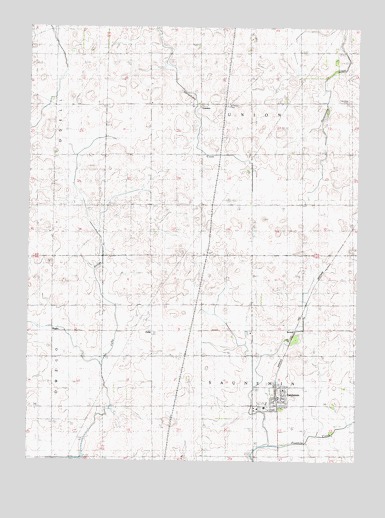
Saunemin, IL USGS Topographic Map
Click on map above to begin viewing in our Map Viewer.

This topographic map contains these locations and features:
Feature Name Type Latitude Longitude GNIS ID View Map
Center School (historical)SchoolN40.9786°W88.4162°405829View Map
Chesebro School (historical)SchoolN40.8909°W88.4523°406026View Map
Dick School (historical)SchoolN40.9492°W88.4528°407194View Map
Eggenberger School (historical)SchoolN40.9495°W88.4159°407814View Map
EylarPopulated PlaceN40.9123°W88.4528°422683View Map
Eylar School (historical)SchoolN40.9189°W88.4523°408149View Map
Hoke School (historical)SchoolN40.9781°W88.4531°410371View Map
Jacobs School (historical)SchoolN40.9500°W88.3778°411021View Map
Jones School (historical)SchoolN40.8895°W88.4914°411226View Map
LorettoPopulated PlaceN40.9778°W88.4348°422922View Map
McCloud School (historical)SchoolN40.9492°W88.4901°413204View Map
Peppard School (historical)SchoolN40.9784°W88.4898°415543View Map
RugbyPopulated PlaceN40.9120°W88.4903°423139View Map
Rugby School (historical)SchoolN40.9200°W88.4912°417033View Map
Saint Mary's Catholic CemeteryCemeteryN40.9784°W88.4242°417568View Map
SauneminPopulated PlaceN40.8931°W88.4053°418036View Map
Saunemin Christian Church (historical)ChurchN40.8925°W88.4020°1737672View Map
Saunemin Elementary SchoolSchoolN40.8917°W88.4089°1737673View Map
Saunemin Fire Protection DistrictBuildingN40.8925°W88.4046°2682611View Map
Saunemin High School (historical)SchoolN40.8906°W88.4098°1737674View Map
Saunemin Post OfficePost OfficeN40.8935°W88.4042°2788844View Map
Saunemin United Methodist ChurchChurchN40.8936°W88.4028°1737675View Map
ScovelPopulated PlaceN40.9117°W88.3984°423169View Map
Sunny Slope CemeteryCemeteryN40.8903°W88.4114°1719420View Map
Telford School (historical)SchoolN40.9792°W88.3764°419581View Map
Township of SauneminCivilN40.8822°W88.4125°429717View Map
Township of UnionCivilN40.9778°W88.4149°429853View Map
Union CemeteryCemeteryN40.9789°W88.3788°405366View Map
Village of SauneminCivilN40.8924°W88.4060°2399763View Map

Note: Coordinates in the location and feature list above are referenced to NAD83 datum.


Copyright (C) 2008-2025 Ryan Niemi / Sunset Dynamics ... All Rights Reserved