TopoQuest Logo
Do you find TopoQuest useful?
Help keep TopoQuest running and adding new maps/features by donating!
Bitcoin:  19c7KJd3qBynnjoSw5npx9KScwjBe4ifkT
Litecoin:  LXs6TkuXGGXo1vDsWCkWVdjQX94eUKd6ui
Home View Maps Find Maps Find Places Resources & Links


Culver, Indiana Topographic Map

USGS Map Title: Culver, IN
USGS Map MRC: 41086B4
DRG (GeoTIFF) Download: o41086b4.tif


Neighboring USGS Topographic Map Quads:


  Knox East, IN  
41086C5
 

  Donaldson, IN  
41086C4
 

  Plymouth, IN  
41086C3
 

  Bass Lake, IN  
41086B5
 

  Culver, IN  
41086B4
 

  Rutland, IN  
41086B3
 

  Winamac, IN  
41086A5
 

  Kewanna, IN  
41086A4
 

  Pershing, IN  
41086A3


Map MRC Location:

N42°
W87°
N42°
W86°
H8 H7 H6 H5 H4 H3 H2 H1
G8 G7 G6 G5 G4 G3 G2 G1
F8 F7 F6 F5 F4 F3 F2 F1
E8 E7 E6 E5 E4 E3 E2 E1
D8 D7 D6 D5 D4 D3 D2 D1
C8 C7 C6 C5 C4 C3 C2 C1
B8 B7 B6 B5 B4 B3 B2 B1
A8 A7 A6 A5 A4 A3 A2 A1
N41°
W87°
N41°
W86°

Culver, IN USGS 1:24K Topographic Map Preview:
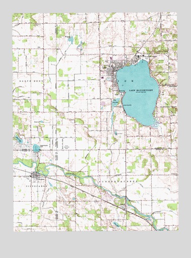
Culver, IN USGS Topographic Map
Click on map above to begin viewing in our Map Viewer.

This topographic map contains these locations and features:
Feature Name Type Latitude Longitude GNIS ID View Map
Chapman DitchCanalN41.1814°W86.4697°432413View Map
Collins DitchCanalN41.1492°W86.3894°432798View Map
Cromley CemeteryCemeteryN41.1795°W86.4428°433144View Map
CulverPopulated PlaceN41.2189°W86.4231°433239View Map
Culver Community Junior-Senior High SchoolSchoolN41.2237°W86.4253°447387View Map
Culver Elementary SchoolSchoolN41.2278°W86.4250°447388View Map
Culver Military and Girls AcademySchoolN41.2248°W86.4028°433240View Map
Culver Police DepartmentBuildingN41.2177°W86.4224°2758241View Map
Culver Post OfficePost OfficeN41.2164°W86.4244°2710751View Map
Culver Union Township Ambulance ServiceBuildingN41.2177°W86.4224°2719267View Map
Culver Union Township Fire DepartmentBuildingN41.2190°W86.4194°2625891View Map
Curtiss DitchCanalN41.1956°W86.3820°433260View Map
DelongPopulated PlaceN41.1384°W86.4164°433458View Map
Demont ArmCanalN41.2023°W86.4920°433467View Map
Fleet Field (historical)AirportN41.2223°W86.3861°449136View Map
Hartz LakeLakeN41.1776°W86.4952°435845View Map
Hawkins DitchCanalN41.2192°W86.4892°435905View Map
Houghton LakeLakeN41.2346°W86.4554°436519View Map
Jacks Field (historical)AirportN41.2153°W86.4389°449138View Map
King LakeLakeN41.1287°W86.4220°437326View Map
Lake MaxinkuckeeReservoirN41.2042°W86.4044°438748View Map
Langenbahn LakeLakeN41.1726°W86.4823°437619View Map
Lost LakeLakeN41.1984°W86.4223°438330View Map
Lowry DitchCanalN41.2484°W86.3895°438383View Map
Masonic CemeteryCemeteryN41.2062°W86.4220°438699View Map
MaxinkuckeePopulated PlaceN41.2084°W86.3814°438747View Map
MontereyPopulated PlaceN41.1570°W86.4828°439355View Map
Monterey Elementary SchoolSchoolN41.1564°W86.4867°447386View Map
Monterey Volunteer Fire DepartmentBuildingN41.1559°W86.4783°2625970View Map
Moore LakeLakeN41.2322°W86.4482°439402View Map
Mount Hope ChurchChurchN41.1570°W86.3764°439585View Map
North Union CemeteryCemeteryN41.2439°W86.4814°440306View Map
Slonaker DitchCanalN41.1359°W86.4661°443627View Map
Thompson DitchCanalN41.1698°W86.4431°444716View Map
Tippecanoe SchoolSchoolN41.1570°W86.4867°444780View Map
Town of CulverCivilN41.2158°W86.4234°2396671View Map
Town of MontereyCivilN41.1562°W86.4821°2396775View Map
Township of AubbeenaubbeeCivilN41.1280°W86.4120°453053View Map
Township of UnionCivilN41.2227°W86.4071°453924View Map
Wagoner DitchCanalN41.1578°W86.4175°445357View Map
Washington CemeteryCemeteryN41.1909°W86.3814°445497View Map
Williams Arm DitchCanalN41.2439°W86.4928°446057View Map
Wilson DitchCanalN41.1656°W86.4256°446144View Map
Zechiel ArmCanalN41.2159°W86.4842°446428View Map
Zion CemeteryCemeteryN41.1895°W86.4539°446447View Map

Note: Coordinates in the location and feature list above are referenced to NAD83 datum.


Copyright (C) 2008-2024 Ryan Niemi / Sunset Dynamics ... All Rights Reserved