TopoQuest Logo
Do you find TopoQuest useful?
Help keep TopoQuest running and adding new maps/features by donating!
Bitcoin:  19c7KJd3qBynnjoSw5npx9KScwjBe4ifkT
Litecoin:  LXs6TkuXGGXo1vDsWCkWVdjQX94eUKd6ui
Home View Maps Find Maps Find Places Resources & Links


Winamac, Indiana Topographic Map

USGS Map Title: Winamac, IN
USGS Map MRC: 41086A5
DRG (GeoTIFF) Download: o41086a5.tif


Neighboring USGS Topographic Map Quads:


  Denham, IN  
41086B6
 

  Bass Lake, IN  
41086B5
 

  Culver, IN  
41086B4
 

  Ripley, IN  
41086A6
 

  Winamac, IN  
41086A5
 

  Kewanna, IN  
41086A4
 

  Buffalo, IN  
40086H6
 

  Star City, IN  
40086H5
 

  Grass Creek, IN  
40086H4


Map MRC Location:

N42°
W87°
N42°
W86°
H8 H7 H6 H5 H4 H3 H2 H1
G8 G7 G6 G5 G4 G3 G2 G1
F8 F7 F6 F5 F4 F3 F2 F1
E8 E7 E6 E5 E4 E3 E2 E1
D8 D7 D6 D5 D4 D3 D2 D1
C8 C7 C6 C5 C4 C3 C2 C1
B8 B7 B6 B5 B4 B3 B2 B1
A8 A7 A6 A5 A4 A3 A2 A1
N41°
W87°
N41°
W86°

Winamac, IN USGS 1:24K Topographic Map Preview:
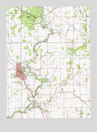
Winamac, IN USGS Topographic Map
Click on map above to begin viewing in our Map Viewer.

This topographic map contains these locations and features:
Feature Name Type Latitude Longitude GNIS ID View Map
Anstis DitchCanalN41.1173°W86.5078°430190View Map
Arens FieldAirportN41.0933°W86.6042°449390View Map
Beason ParkParkN41.1045°W86.5647°430658View Map
Breckenridge DitchCanalN41.0525°W86.5253°431468View Map
Bruce Lake OutletCanalN41.1106°W86.5136°431654View Map
Bunker HillSummitN41.1023°W86.5692°431811View Map
Camp PaxtonParkN41.0003°W86.6236°432054View Map
Crown Hill CemeteryCemeteryN41.0489°W86.6111°433215View Map
Devil LakeLakeN41.0749°W86.5302°433495View Map
Eastern Pulaski Elementary SchoolSchoolN41.0439°W86.5964°447161View Map
Fairview SchoolSchoolN41.0367°W86.5172°434354View Map
Graffis DitchCanalN41.0075°W86.5320°435275View Map
Haschel DitchCanalN41.0850°W86.5361°435858View Map
James DitchCanalN41.1014°W86.5058°436923View Map
Kessi DitchCanalN41.0967°W86.5186°437269View Map
LawtonPopulated PlaceN41.0998°W86.5250°437679View Map
Leidendecker DitchCanalN41.0542°W86.5522°437760View Map
Little Mill CreekStreamN41.0292°W86.5520°438097View Map
Memorial GardensCemeteryN41.0500°W86.6117°438987View Map
Mill CreekStreamN41.0117°W86.5939°439162View Map
Miller DitchCanalN41.0914°W86.5145°439206View Map
Pulaski County Emergency Medical ServicesBuildingN41.0512°W86.6116°2719293View Map
Pulaski County Sheriff's OfficeBuildingN41.0503°W86.6030°2758415View Map
Pulaski Memorial HospitalHospitalN41.0564°W86.5959°2660474View Map
Reed CemeteryCemeteryN41.0553°W86.5750°441851View Map
Reinhold DitchCanalN41.1095°W86.5570°441886View Map
River Bank ChurchChurchN41.0992°W86.5570°442069View Map
Saint Peters CemeteryCemeteryN41.0546°W86.6214°442801View Map
Stone Dilts DitchCanalN41.0828°W86.5936°444204View Map
Thompson DitchCanalN41.0575°W86.5692°444711View Map
Town of WinamacCivilN41.0535°W86.6037°2397747View Map
Township of HarrisonCivilN41.0376°W86.5188°453395View Map
Tyler Weisjahn DitchCanalN41.0659°W86.5247°445028View Map
Vanmeter ParkPopulated PlaceN41.0859°W86.5681°445229View Map
Wilhelm DitchCanalN41.0409°W86.5203°446034View Map
WinamacPopulated PlaceN41.0514°W86.6031°446163View Map
Winamac Community High SchoolSchoolN41.0459°W86.5964°447163View Map
Winamac Community Junior High SchoolSchoolN41.0459°W86.5964°447162View Map
Winamac Police DepartmentBuildingN41.0548°W86.6129°2758445View Map
Winamac State Fish and Wildlife AreaParkN41.1164°W86.6175°446164View Map
Winamac Volunteer Fire DepartmentBuildingN41.0508°W86.6050°2625933View Map

Note: Coordinates in the location and feature list above are referenced to NAD83 datum.


Copyright (C) 2008-2024 Ryan Niemi / Sunset Dynamics ... All Rights Reserved