TopoQuest Logo
Do you find TopoQuest useful?
Help keep TopoQuest running and adding new maps/features by donating!
Bitcoin:  19c7KJd3qBynnjoSw5npx9KScwjBe4ifkT
Litecoin:  LXs6TkuXGGXo1vDsWCkWVdjQX94eUKd6ui
Home View Maps Find Maps Find Places Resources & Links


Cummins Peak, Oregon Topographic Map

USGS Map Title: Cummins Peak, OR
USGS Map MRC: 44123B8
DRG (GeoTIFF) Download: o44123b8.tif


Neighboring USGS Topographic Map Quads:


  Yachats, OR  
44124C1
 

  Cannibal Mountain, OR  
44123C8
 

  Five Rivers, OR  
44123C7
 

  Heceta Head, OR  
44124B1
 

  Cummins Peak, OR  
44123B8
 

  Herman Creek, OR  
44123B7
 

  Mercer Lake, OR  
44124A1
 

  Tiernan, OR  
44123A8
 

  Mapleton, OR  
44123A7


Map MRC Location:

N45°
W124°
N45°
W123°
H8 H7 H6 H5 H4 H3 H2 H1
G8 G7 G6 G5 G4 G3 G2 G1
F8 F7 F6 F5 F4 F3 F2 F1
E8 E7 E6 E5 E4 E3 E2 E1
D8 D7 D6 D5 D4 D3 D2 D1
C8 C7 C6 C5 C4 C3 C2 C1
B8 B7 B6 B5 B4 B3 B2 B1
A8 A7 A6 A5 A4 A3 A2 A1
N44°
W124°
N44°
W123°

Cummins Peak, OR USGS 1:24K Topographic Map Preview:
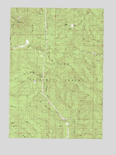
Cummins Peak, OR USGS Topographic Map
Click on map above to begin viewing in our Map Viewer.

This topographic map contains these locations and features:
Feature Name Type Latitude Longitude GNIS ID View Map
Cedar CreekStreamN44.1385°W123.9087°1139501View Map
Clover CampLocaleN44.1354°W123.9951°1139846View Map
Cullen CreekStreamN44.2065°W123.9515°1140529View Map
Cummins PeakSummitN44.2360°W123.9925°1140550View Map
Cummins Peak Weather StationLocaleN44.2362°W123.9929°1135739View Map
Elma CreekStreamN44.1429°W123.9179°1141839View Map
Formander RidgeRidgeN44.1754°W123.9857°1142311View Map
Grizzly RidgeRidgeN44.2123°W123.9443°1135740View Map
Klickitat MountainSummitN44.2350°W123.9276°1144666View Map
Klickitat QuarryMineN44.2337°W123.9179°1135738View Map
Klickitat RidgeRidgeN44.2412°W123.9607°1144667View Map
Lawrence CreekStreamN44.1687°W123.9537°1135741View Map
Left Fork Wilhelm CreekStreamN44.1260°W123.9665°1135748View Map
Madera GraveCemeteryN44.2305°W123.9214°1135176View Map
Maria CreekStreamN44.1790°W123.8946°1145805View Map
McKinney CreekStreamN44.2107°W123.9987°1146008View Map
PawnLocaleN44.1535°W123.9487°1147510View Map
Pawn Post Office (historical)Post OfficeN44.1535°W123.9487°1165769View Map
Pyle CreekStreamN44.1682°W123.8754°1148064View Map
Rogers CreekStreamN44.1576°W123.8776°1148692View Map
Saddle MountainSummitN44.1871°W123.9638°1148909View Map
Saddle Mountain SpringsSpringN44.1874°W123.9666°1153613View Map
Sam CreekStreamN44.1540°W123.9504°1149009View Map
South Fork Tenmile CreekStreamN44.2132°W123.9737°1150029View Map
Taylor CreekStreamN44.1268°W123.9129°1135743View Map
Three ButtesSummitN44.1379°W123.9974°1151147View Map
West Branch North Fork Siuslaw RiverStreamN44.1537°W123.9501°1135742View Map
West Branch Sam CreekStreamN44.1540°W123.9504°1155499View Map
Wildcat CreekStreamN44.2218°W123.9690°1152338View Map

Note: Coordinates in the location and feature list above are referenced to NAD83 datum.


Copyright (C) 2008-2024 Ryan Niemi / Sunset Dynamics ... All Rights Reserved