TopoQuest Logo
Do you find TopoQuest useful?
Help keep TopoQuest running and adding new maps/features by donating!
Bitcoin:  19c7KJd3qBynnjoSw5npx9KScwjBe4ifkT
Litecoin:  LXs6TkuXGGXo1vDsWCkWVdjQX94eUKd6ui
Home View Maps Find Maps Find Places Resources & Links


Acorn Hollow, California Topographic Map

USGS Map Title: Acorn Hollow, CA
USGS Map MRC: 40121A8
DRG (GeoTIFF) Download: o40121a8.tif


Neighboring USGS Topographic Map Quads:


  Tuscan Springs, CA  
40122B1
 

  Dewitt Peak, CA  
40121B8
 

  Panther Spring, CA  
40121B7
 

  Los Molinos, CA  
40122A1
 

  Acorn Hollow, CA  
40121A8
 

  Deer Creek Flat, CA  
40121A7
 

  Vina, CA  
39122H1
 

  Richardson Springs NW, CA  
39121H8
 

  Campbell Mound, CA  
39121H7


Map MRC Location:

N41°
W122°
N41°
W121°
H8 H7 H6 H5 H4 H3 H2 H1
G8 G7 G6 G5 G4 G3 G2 G1
F8 F7 F6 F5 F4 F3 F2 F1
E8 E7 E6 E5 E4 E3 E2 E1
D8 D7 D6 D5 D4 D3 D2 D1
C8 C7 C6 C5 C4 C3 C2 C1
B8 B7 B6 B5 B4 B3 B2 B1
A8 A7 A6 A5 A4 A3 A2 A1
N40°
W122°
N40°
W121°

Acorn Hollow, CA USGS 1:24K Topographic Map Preview:
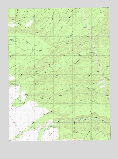
Acorn Hollow, CA USGS Topographic Map
Click on map above to begin viewing in our Map Viewer.

This topographic map contains these locations and features:
Feature Name Type Latitude Longitude GNIS ID View Map
Allen RidgeRidgeN40.1238°W121.9511°1666411View Map
Apperson CabinBuildingN40.0954°W121.9955°1666412View Map
Bald KnobSummitN40.0077°W121.9200°218579View Map
Ballard SpringSpringN40.0990°W121.9217°1666414View Map
Big Dry CreekStreamN40.0385°W121.9783°1655070View Map
Campo Seco RidgeRidgeN40.1196°W121.9678°233620View Map
Carmichael Rock QuarryMineN40.0164°W121.9653°2675418View Map
Delay CampLocaleN40.0485°W121.9069°222246View Map
Favinger PlacePopulated PlaceN40.0446°W121.9775°1658528View Map
Hobson CampLocaleN40.0210°W121.8953°225379View Map
Horseshoe PondLakeN40.0850°W121.9642°1666418View Map
Lee CampLocaleN40.0910°W121.8833°226990View Map
Little Dry CreekStreamN40.0385°W121.9792°1655084View Map
Little Mill CreekStreamN40.1093°W121.8758°1655085View Map
Little North Fork North Fork Dye CreekStreamN40.1152°W121.9908°227316View Map
Magnuson CabinBuildingN40.1063°W121.9039°1666419View Map
Morris FlatFlatN40.0279°W121.8917°1655089View Map
Red RidgeRidgeN40.1235°W121.9053°1666422View Map
Ruffin CabinBuildingN40.1204°W121.8875°1666424View Map
Tenmile (historical)Populated PlaceN40.0710°W121.9505°1666426View Map
Tenmile HollowValleyN40.0599°W121.9561°236108View Map
The NarrowsGapN40.0815°W121.9136°236202View Map
Twentymile HollowValleyN40.0604°W121.9342°1655106View Map
Willow Tree RidgeRidgeN40.1174°W121.9455°1666427View Map

Note: Coordinates in the location and feature list above are referenced to NAD83 datum.


Copyright (C) 2008-2025 Ryan Niemi / Sunset Dynamics ... All Rights Reserved