TopoQuest Logo
Do you find TopoQuest useful?
Help keep TopoQuest running and adding new maps/features by donating!
Bitcoin:  19c7KJd3qBynnjoSw5npx9KScwjBe4ifkT
Litecoin:  LXs6TkuXGGXo1vDsWCkWVdjQX94eUKd6ui
Home View Maps Find Maps Find Places Resources & Links


Tuscan Springs, California Topographic Map

USGS Map Title: Tuscan Springs, CA
USGS Map MRC: 40122B1
DRG (GeoTIFF) Download: o40122b1.tif


Neighboring USGS Topographic Map Quads:


  Bend, CA  
40122C2
 

  Dales, CA  
40122C1
 

  Inskip Hill, CA  
40121C8
 

  Red Bluff East, CA  
40122B2
 

  Tuscan Springs, CA  
40122B1
 

  Dewitt Peak, CA  
40121B8
 

  Gerber, CA  
40122A2
 

  Los Molinos, CA  
40122A1
 

  Acorn Hollow, CA  
40121A8


Map MRC Location:

N41°
W123°
N41°
W122°
H8 H7 H6 H5 H4 H3 H2 H1
G8 G7 G6 G5 G4 G3 G2 G1
F8 F7 F6 F5 F4 F3 F2 F1
E8 E7 E6 E5 E4 E3 E2 E1
D8 D7 D6 D5 D4 D3 D2 D1
C8 C7 C6 C5 C4 C3 C2 C1
B8 B7 B6 B5 B4 B3 B2 B1
A8 A7 A6 A5 A4 A3 A2 A1
N40°
W123°
N40°
W122°

Tuscan Springs, CA USGS 1:24K Topographic Map Preview:
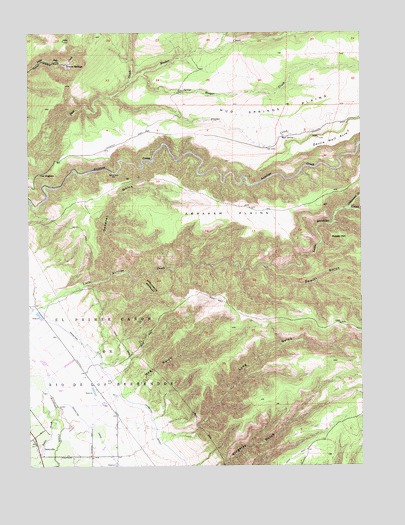
Tuscan Springs, CA USGS Topographic Map
Click on map above to begin viewing in our Map Viewer.

This topographic map contains these locations and features:
Feature Name Type Latitude Longitude GNIS ID View Map
Abraham PlainsPlainN40.1977°W122.0511°217946View Map
Cottonwood CreekStreamN40.1988°W122.0080°221646View Map
DairyvillePopulated PlaceN40.1299°W122.1211°1658367View Map
Dehaven GulchValleyN40.1804°W122.0958°222219View Map
Devils Half AcrePlainN40.2182°W122.0103°222312View Map
Dewitt GulchValleyN40.1824°W122.0378°222337View Map
El Primer Canon or Rio de Los BerreCivilN40.1415°W122.1178°253883View Map
Flume CreekStreamN40.2318°W122.0958°223634View Map
Hog GulchValleyN40.1457°W122.0903°225393View Map
Hooper CreekStreamN40.2385°W122.0844°225544View Map
Long GulchValleyN40.1352°W122.0767°227568View Map
Meeker CreekStreamN40.2343°W122.0897°228479View Map
Mud SpringSpringN40.2198°W122.0304°229259View Map
Mud Springs PlainsPlainN40.2274°W122.0242°229274View Map
Norvell PondLakeN40.1331°W122.0011°1666420View Map
Potato HillSummitN40.1896°W122.0092°230982View Map
The HogbackRidgeN40.2093°W122.1214°236179View Map
Tuscan SpringsSpringN40.2408°W122.1115°236673View Map

Note: Coordinates in the location and feature list above are referenced to NAD83 datum.


Copyright (C) 2008-2025 Ryan Niemi / Sunset Dynamics ... All Rights Reserved