TopoQuest Logo
Do you find TopoQuest useful?
Help keep TopoQuest running and adding new maps/features by donating!
Bitcoin:  19c7KJd3qBynnjoSw5npx9KScwjBe4ifkT
Litecoin:  LXs6TkuXGGXo1vDsWCkWVdjQX94eUKd6ui
Home View Maps Find Maps Find Places Resources & Links


Custer, South Dakota Topographic Map

USGS Map Title: Custer, SD
USGS Map MRC: 43103G5
DRG (GeoTIFF) Download: o43103g5.tif


Neighboring USGS Topographic Map Quads:


  Medicine Mountain, SD  
43103H6
 

  Hill City, SD  
43103H5
 

  Mount Rushmore, SD  
43103H4
 

  Berne, SD  
43103G6
 

  Custer, SD  
43103G5
 

  Iron Mountain, SD  
43103G4
 

  Fourmile, SD  
43103F6
 

  Cicero Peak, SD  
43103F5
 

  Mount Coolidge, SD  
43103F4


Map MRC Location:

N44°
W104°
N44°
W103°
H8 H7 H6 H5 H4 H3 H2 H1
G8 G7 G6 G5 G4 G3 G2 G1
F8 F7 F6 F5 F4 F3 F2 F1
E8 E7 E6 E5 E4 E3 E2 E1
D8 D7 D6 D5 D4 D3 D2 D1
C8 C7 C6 C5 C4 C3 C2 C1
B8 B7 B6 B5 B4 B3 B2 B1
A8 A7 A6 A5 A4 A3 A2 A1
N43°
W104°
N43°
W103°

Custer, SD USGS 1:24K Topographic Map Preview:
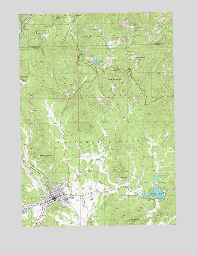
Custer, SD USGS Topographic Map
Click on map above to begin viewing in our Map Viewer.

This topographic map contains these locations and features:
Feature Name Type Latitude Longitude GNIS ID View Map
1881 Courthouse MuseumBuildingN43.7662°W103.6015°2727314View Map
A M Lode MineMineN43.8042°W103.5405°1265007View Map
Aladdin MineMineN43.7542°W103.6019°1264987View Map
Arcade Numbers 1 and 2 Lodes MineMineN43.7792°W103.5163°1264979View Map
Bear GulchValleyN43.8736°W103.6144°1261228View Map
Bet Lode MineMineN43.8083°W103.5266°1265013View Map
Big Horn Lode MineMineN43.7844°W103.5888°1264991View Map
Bismark CreekStreamN43.7805°W103.5152°1267049View Map
Bismark LakeReservoirN43.7761°W103.5150°1267039View Map
Bismark Lake CampgroundLocaleN43.7758°W103.5102°1262975View Map
Bismark Lake DamDamN43.7750°W103.5138°1262864View Map
Black Elk PeakSummitN43.8661°W103.5310°1261770View Map
Bob Marshall Organization CampLocaleN43.7800°W103.5105°1262978View Map
Buckhorn MountainSummitN43.7911°W103.6060°1261361View Map
Calamity PeakSummitN43.7784°W103.5473°1261394View Map
Cathedral SpiresPillarN43.8494°W103.5324°1261421View Map
Cathedral Spires TrailTrailN43.8483°W103.5352°1262976View Map
City of CusterCivilN43.7666°W103.6006°1267345View Map
Clara Belle Camp (historical)Populated PlaceN43.8639°W103.5963°1264598View Map
Clara Belle MineMineN43.8675°W103.5985°1261448View Map
Climax Mica MineMineN43.7653°W103.5574°1264982View Map
Collins Ranch (historical)LocaleN43.7619°W103.6152°1264166View Map
Come Along Lode MineMineN43.7889°W103.5505°1264986View Map
Crazy Horse MemorialLocaleN43.8364°W103.6224°1262979View Map
CusterPopulated PlaceN43.7667°W103.5988°1265633View Map
Custer Ambulance ServiceBuildingN43.7726°W103.5925°2658923View Map
Custer CemeteryCemeteryN43.7781°W103.6159°2555102View Map
Custer City HallBuildingN43.7677°W103.5986°2724705View Map
Custer County CourthouseBuildingN43.7651°W103.6010°2712629View Map
Custer County LibraryBuildingN43.7674°W103.6016°2723450View Map
Custer County Sheriff's OfficeBuildingN43.7652°W103.6009°2755520View Map
Custer Elementary SchoolSchoolN43.7650°W103.5823°2728545View Map
Custer Fire DepartmentBuildingN43.7677°W103.5987°2580836View Map
Custer High SchoolSchoolN43.7653°W103.5813°2728546View Map
Custer Mica Lodes Numbers 1 and 2 MineMineN43.7839°W103.5727°1264984View Map
Custer Middle SchoolSchoolN43.7706°W103.6019°2728554View Map
Custer MountainSummitN43.7522°W103.5363°1261520View Map
Custer Mountain Lode MineMineN43.7555°W103.5655°1265582View Map
Custer Post OfficePost OfficeN43.7672°W103.5977°2709782View Map
Custer Regional HospitalHospitalN43.7727°W103.5941°1263126View Map
Custer State Park - Norbeck Wildlife PreserveParkN43.7814°W103.5291°1263014View Map
Dalmon Mica MineMineN43.7783°W103.5960°1264989View Map
E M Lode MineMineN43.8064°W103.5405°1265006View Map
Earl Lode MineMineN43.7522°W103.5277°1264973View Map
First Find MineMineN43.8686°W103.5805°1265002View Map
Fort Defiance (historical)LocaleN43.7755°W103.5338°1264631View Map
Gap Lode MineMineN43.8655°W103.5607°1261707View Map
Gira and Ainsleys Dike MineMineN43.8500°W103.6149°1264999View Map
Glenerin SchoolSchoolN43.7583°W103.5235°1262980View Map
Grand Junction (historical)LocaleN43.8417°W103.5510°1264629View Map
Homestead Number 2 Prospect MineMineN43.7775°W103.6055°1264995View Map
Homestead Number 3 Prospect MineMineN43.7780°W103.6108°1264994View Map
Hood TunnelTunnelN43.8473°W103.5782°2772086View Map
Hood TunnelTunnelN43.8475°W103.5785°1261831View Map
IXL Fraction MineMineN43.7792°W103.5363°1264978View Map
IXL Lode MineMineN43.7778°W103.5321°1264976View Map
IXL Lode Number 3 MineMineN43.8005°W103.5371°1265010View Map
IXL Number 4 Lode MineMineN43.7772°W103.5305°1264977View Map
Johnson CanyonValleyN43.8637°W103.5848°1261893View Map
Knowles Lode Claim MineMineN43.7822°W103.5974°1264990View Map
Lake MineMineN43.8450°W103.5557°1265586View Map
Little Devils TowerPillarN43.8519°W103.5394°1261970View Map
Lost Bonanza MineMineN43.7930°W103.6041°1264993View Map
Lost Cabin I (historical)LocaleN43.8667°W103.5769°1264630View Map
Lost Cabin TrailTrailN43.8650°W103.5591°1265822View Map
Mica Queen Number 1 Prospect MineMineN43.7797°W103.5624°1264983View Map
Mitchell Number 2 Lode MineMineN43.8047°W103.5346°1265012View Map
Mohawk Mica Prospect MineMineN43.7555°W103.5255°1264975View Map
Needle EyeArchN43.8417°W103.5460°1262110View Map
Needles Eye TunnelTunnelN43.8414°W103.5447°2772085View Map
New Deal Lode MineMineN43.8030°W103.5324°1265004View Map
Noble Mica MineMineN43.8350°W103.5407°1264997View Map
November MineMineN43.8372°W103.5432°1264998View Map
OK Lode MineMineN43.8039°W103.5377°1265009View Map
OK Number 2 Lode MineMineN43.8064°W103.5377°1265005View Map
OK Number 4 Lode MineMineN43.8014°W103.5357°1265011View Map
Old Mike MineMineN43.8183°W103.6169°1262168View Map
OrevillePopulated PlaceN43.8675°W103.6230°1262170View Map
Oreville CampgroundLocaleN43.8747°W103.6149°1263075View Map
Oreville Spar MineMineN43.8569°W103.6238°1265001View Map
Paha Sapa TrailTrailN43.8325°W103.5305°1263059View Map
Phelps Lode MineMineN43.8083°W103.6133°1265585View Map
Pick Lode MineMineN43.8083°W103.5324°1265008View Map
Poppy Lode MineMineN43.8147°W103.5819°1264996View Map
Rossville (historical)LocaleN43.8305°W103.5032°1264131View Map
Saint Elmo MineMineN43.8647°W103.5927°1265589View Map
Saint Elmo PeakSummitN43.8725°W103.5949°1262353View Map
Shamrock Number 1 Lode MineMineN43.7639°W103.5505°1264981View Map
Sky Lode MineMineN43.8464°W103.6235°1265000View Map
Smith Ranch (historical)LocaleN43.7917°W103.5171°1264165View Map
South Dakota State Highway Patrol - Southern Hills OfficeBuildingN43.7617°W103.6093°2755609View Map
Stockade LakeReservoirN43.7683°W103.5168°1267048View Map
Stockade Lake DamDamN43.7647°W103.5141°1262765View Map
Sunday Gulch TrailTrailN43.8486°W103.5705°1262981View Map
Sunshine Mica Prospect MineMineN43.7847°W103.6019°1264992View Map
Surprise Mica MineMineN43.7808°W103.5960°1264988View Map
Sylvan LakeReservoirN43.8460°W103.5634°1262550View Map
Sylvan Lake DamDamN43.8475°W103.5602°1262766View Map
Sylvan Lake Harney TrailTrailN43.8686°W103.5277°1263074View Map
Sylvan Lake Post Office (historical)Post OfficeN43.8461°W103.5644°1926742View Map
Sylvan Lake ResortPopulated PlaceN43.8461°W103.5644°1264613View Map
Sylvanite Lode MineMineN43.7939°W103.5524°1264985View Map
Tenderfoot CreekStreamN43.8658°W103.6241°1262558View Map
Terry and Terry Number 1 Claims MineMineN43.7722°W103.5655°1265583View Map
The NeedlesPillarN43.8369°W103.5494°1262573View Map
Thunderhead MountainSummitN43.8369°W103.6238°1262585View Map
Tiblis Ranch (historical)LocaleN43.8069°W103.6219°1264168View Map
Tillisons MineMineN43.7639°W103.5249°1264980View Map
Tin King MineMineN43.8686°W103.6180°1265587View Map
Tin Queen MineMineN43.8625°W103.5905°1265588View Map
Tungsten Lode MineMineN43.8692°W103.5713°1265003View Map
Upper Pine Creek Natural AreaParkN43.8708°W103.5130°1263058View Map
Victory MineMineN43.7825°W103.5696°1262641View Map
Victory Number 1 Prospect MineMineN43.7903°W103.5338°1265584View Map
Walsh Mica Prospect MineMineN43.7542°W103.5141°1264974View Map
White Horse CreekStreamN43.8689°W103.6224°1262705View Map
White Horse GulchValleyN43.8689°W103.6225°2515332View Map
Wild Rose MineMineN43.7950°W103.5552°1262714View Map
Willow CreekStreamN43.7739°W103.5463°1262725View Map

Note: Coordinates in the location and feature list above are referenced to NAD83 datum.


Copyright (C) 2008-2025 Ryan Niemi / Sunset Dynamics ... All Rights Reserved