TopoQuest Logo
Do you find TopoQuest useful?
Help keep TopoQuest running and adding new maps/features by donating!
Bitcoin:  19c7KJd3qBynnjoSw5npx9KScwjBe4ifkT
Litecoin:  LXs6TkuXGGXo1vDsWCkWVdjQX94eUKd6ui
Home View Maps Find Maps Find Places Resources & Links


Dalzell, Ohio Topographic Map

USGS Map Title: Dalzell, OH
USGS Map MRC: 39081E3
DRG (GeoTIFF) Download: o39081e3.tif


Neighboring USGS Topographic Map Quads:


  Macksburg, OH  
39081F4
 

  Stafford, OH  
39081F3
 

  Graysville, OH  
39081F2
 

  Lower Salem, OH  
39081E4
 

  Dalzell, OH  
39081E3
 

  Rinard Mills, OH  
39081E2
 

  Marietta, OH  
39081D4
 

  Belmont, WV  
39081D3
 

  Raven Rock, WV  
39081D2


Map MRC Location:

N40°
W82°
N40°
W81°
H8 H7 H6 H5 H4 H3 H2 H1
G8 G7 G6 G5 G4 G3 G2 G1
F8 F7 F6 F5 F4 F3 F2 F1
E8 E7 E6 E5 E4 E3 E2 E1
D8 D7 D6 D5 D4 D3 D2 D1
C8 C7 C6 C5 C4 C3 C2 C1
B8 B7 B6 B5 B4 B3 B2 B1
A8 A7 A6 A5 A4 A3 A2 A1
N39°
W82°
N39°
W81°

Dalzell, OH USGS 1:24K Topographic Map Preview:
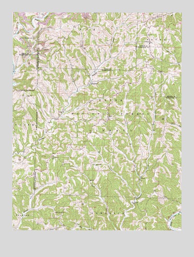
Dalzell, OH USGS Topographic Map
Click on map above to begin viewing in our Map Viewer.

This topographic map contains these locations and features:
Feature Name Type Latitude Longitude GNIS ID View Map
Coon RunStreamN39.5673°W81.3360°1075623View Map
DalzellPopulated PlaceN39.5648°W81.3040°1075673View Map
Dalzell CemeteryCemeteryN39.5637°W81.3046°1963891View Map
Deans ForkStreamN39.5190°W81.2832°1075691View Map
FifteenLocaleN39.5301°W81.2801°1075846View Map
GasvillePopulated PlaceN39.5290°W81.3179°1075897View Map
GermantownPopulated PlaceN39.5840°W81.3176°1075909View Map
Halls ChapelChurchN39.5640°W81.2623°1075986View Map
HeslopPopulated PlaceN39.5159°W81.2843°1076040View Map
Hune BridgeBridgeN39.5106°W81.2504°1050684View Map
Hune Bridge Canoe Access AreaLocaleN39.5098°W81.2507°1077284View Map
Hune Covered BridgeBridgeN39.5106°W81.2504°1077286View Map
LebanonPopulated PlaceN39.6079°W81.2732°1076227View Map
Liberty CemeteryCemeteryN39.5912°W81.2646°1963772View Map
Liberty ChurchChurchN39.5912°W81.2646°1076242View Map
Liberty Township Christian CemeteryCemeteryN39.5923°W81.2973°1963946View Map
Masterton CemeteryCemeteryN39.6122°W81.2756°1076348View Map
Middle Fork Duck CreekStreamN39.6212°W81.3568°1076383View Map
Paw Paw Church CemeteryCemeteryN39.5679°W81.3382°1963929View Map
PawPaw ChurchChurchN39.5679°W81.3376°1076602View Map
Pleasant Hill CemeteryCemeteryN39.5104°W81.3382°1963931View Map
Pleasant Hill ChurchChurchN39.5104°W81.3382°1076655View Map
Rowland LandingBuildingN39.5334°W81.2501°1077271View Map
Scotts Ridge CemeteryCemeteryN39.5379°W81.3137°1963937View Map
Scotts Ridge ChurchChurchN39.5376°W81.3132°1076857View Map
Sycamore ForkStreamN39.5309°W81.2807°1077015View Map
Tick Ridge CemeteryCemeteryN39.5770°W81.3639°1077052View Map
Township of LibertyCivilN39.5564°W81.3031°1087136View Map
Waxler ChurchChurchN39.5415°W81.3443°1077149View Map
Waxler Church CemeteryCemeteryN39.5415°W81.3446°1963945View Map
Zion ChurchChurchN39.6248°W81.3112°1077254View Map

Note: Coordinates in the location and feature list above are referenced to NAD83 datum.


Copyright (C) 2008-2024 Ryan Niemi / Sunset Dynamics ... All Rights Reserved