TopoQuest Logo
Do you find TopoQuest useful?
Help keep TopoQuest running and adding new maps/features by donating!
Bitcoin:  19c7KJd3qBynnjoSw5npx9KScwjBe4ifkT
Litecoin:  LXs6TkuXGGXo1vDsWCkWVdjQX94eUKd6ui
Home View Maps Find Maps Find Places Resources & Links


Graysville, Ohio Topographic Map

USGS Map Title: Graysville, OH
USGS Map MRC: 39081F2
DRG (GeoTIFF) Download: o39081f2.tif


Neighboring USGS Topographic Map Quads:


  Summerfield, OH  
39081G3
 

  Lewisville, OH  
39081G2
 

  Woodsfield, OH  
39081G1
 

  Stafford, OH  
39081F3
 

  Graysville, OH  
39081F2
 

  Antioch, OH  
39081F1
 

  Dalzell, OH  
39081E3
 

  Rinard Mills, OH  
39081E2
 

  New Matamoras, OH  
39081E1


Map MRC Location:

N40°
W82°
N40°
W81°
H8 H7 H6 H5 H4 H3 H2 H1
G8 G7 G6 G5 G4 G3 G2 G1
F8 F7 F6 F5 F4 F3 F2 F1
E8 E7 E6 E5 E4 E3 E2 E1
D8 D7 D6 D5 D4 D3 D2 D1
C8 C7 C6 C5 C4 C3 C2 C1
B8 B7 B6 B5 B4 B3 B2 B1
A8 A7 A6 A5 A4 A3 A2 A1
N39°
W82°
N39°
W81°

Graysville, OH USGS 1:24K Topographic Map Preview:
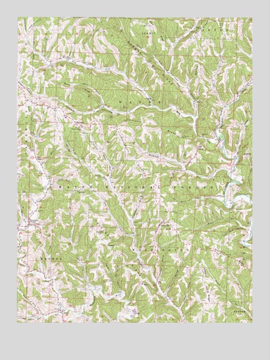
Graysville, OH USGS Topographic Map
Click on map above to begin viewing in our Map Viewer.

This topographic map contains these locations and features:
Feature Name Type Latitude Longitude GNIS ID View Map
Adams HollowValleyN39.6312°W81.1629°1037315View Map
Allen HollowValleyN39.6379°W81.1951°1037371View Map
Barber CemeteryCemeteryN39.7315°W81.1818°1037622View Map
Barber RidgeRidgeN39.7290°W81.1784°1037623View Map
Beardmore CemeteryCemeteryN39.6706°W81.1340°1037731View Map
Bethel Elementary SchoolSchoolN39.6301°W81.2268°1051019View Map
Bethel Township Volunteer Fire DepartmentBuildingN39.6273°W81.2417°2550132View Map
Brister ForkStreamN39.7267°W81.1671°1075445View Map
Broomstick RunStreamN39.6670°W81.1898°1038364View Map
Buhrs RunStreamN39.6617°W81.1251°1038505View Map
Clover RidgeRidgeN39.7206°W81.2229°1039199View Map
Conner RidgeRidgeN39.7051°W81.1823°1039313View Map
Conners Ridge CemeteryCemeteryN39.7017°W81.1612°1079611View Map
Connor Ridge Methodist ChurchChurchN39.7012°W81.1607°1039314View Map
Cook HollowValleyN39.7087°W81.1543°1039334View Map
Cooper HollowValleyN39.6426°W81.1757°1039352View Map
Cranenest ForkStreamN39.7012°W81.1412°1075646View Map
Cronin HollowValleyN39.7134°W81.1782°1039477View Map
Dougherty CemeteryCemeteryN39.6767°W81.1404°1039760View Map
Drum CemeteryCemeteryN39.7012°W81.1412°1039791View Map
Dry RunStreamN39.6879°W81.2382°1039817View Map
EdwinaPopulated PlaceN39.7156°W81.1554°1062749View Map
Edwina Post Office (historical)Post OfficeN39.7154°W81.1554°2037302View Map
Four Acre HollowValleyN39.6640°W81.1279°1040611View Map
GrahamPopulated PlaceN39.6567°W81.2021°1062789View Map
Graham Post Office (historical)Post OfficeN39.6570°W81.2026°2037309View Map
Grange HallBuildingN39.7498°W81.2243°1085246View Map
Grange HallBuildingN39.6284°W81.2390°1085247View Map
GraysvillePopulated PlaceN39.6656°W81.1737°1064749View Map
Graysville Baptist Church (historical)ChurchN39.6672°W81.1735°2110753View Map
Graysville CemeteryCemeteryN39.6672°W81.1741°1083481View Map
Graysville Christian ChurchChurchN39.6640°W81.1712°1079612View Map
Graysville Christian Church CemeteryCemeteryN39.6636°W81.1714°2073977View Map
Graysville Elementary SchoolSchoolN39.6623°W81.1765°1051020View Map
Graysville Volunteer Fire DepartmentBuildingN39.6624°W81.1767°2550005View Map
Hall HollowValleyN39.6437°W81.1979°1041250View Map
Harmon RidgeRidgeN39.6376°W81.1496°1076010View Map
HartshornPopulated PlaceN39.7067°W81.2190°1048822View Map
Hartshorn Post Office (historical)Post OfficeN39.7070°W81.2193°2037313View Map
Hartshorn RidgeRidgeN39.6920°W81.1884°1041379View Map
Hartshorn Ridge CemeteryCemeteryN39.7048°W81.2173°1963763View Map
Hartshorn Ridge ChurchChurchN39.7048°W81.2173°1041380View Map
Henthorn CemeteryCemeteryN39.6420°W81.1993°1041496View Map
Hershey CemeteryCemeteryN39.6703°W81.2396°1041506View Map
HilltopPopulated PlaceN39.6967°W81.1534°1048845View Map
Hines ChapelChurchN39.6920°W81.2396°1041617View Map
Hines Chapel CemeteryCemeteryN39.6923°W81.2398°1963764View Map
Hintshon RidgeRidgeN39.7198°W81.2459°1076053View Map
Hogue HollowValleyN39.7431°W81.2448°1076064View Map
Hunter HollowValleyN39.6931°W81.1346°1060549View Map
Hupp HollowValleyN39.7434°W81.2451°1076098View Map
Indian RunStreamN39.6298°W81.2248°1076113View Map
Joy HollowValleyN39.6373°W81.1709°1042154View Map
Knowlton CemeteryCemeteryN39.6853°W81.2051°1042329View Map
Lamping CemeteryCemeteryN39.6287°W81.1884°1963770View Map
Lamping Homestead Picnic AreaLocaleN39.6304°W81.1868°1083185View Map
Lamping Homestead Picnic Grounds PondReservoirN39.6301°W81.1877°1077979View Map
Lamping Homestead Recreation AreaParkN39.6304°W81.1890°1082388View Map
Lamping TrailTrailN39.6254°W81.1921°1077282View Map
Left Prong Rich ForkStreamN39.7134°W81.1784°1076231View Map
Little Indian RunStreamN39.6276°W81.2373°1076259View Map
Long RunStreamN39.6601°W81.1876°1042752View Map
Mann CemeteryCemeteryN39.6553°W81.1501°1042921View Map
MarrPopulated PlaceN39.6287°W81.2257°1062878View Map
Marr Post Office (historical)Post OfficeN39.6292°W81.2262°2037324View Map
McVay CemeteryCemeteryN39.6445°W81.2426°1077287View Map
Memorial ChapelChurchN39.7456°W81.1532°1077278View Map
Monroe County Emergency Medical Services Squad 6 Bethel and GraysvilleBuildingN39.6273°W81.2417°2550770View Map
Moose RidgeRidgeN39.7365°W81.1557°1076431View Map
Moose Ridge CemeteryCemeteryN39.7431°W81.1543°1043478View Map
Mursh RunStreamN39.6942°W81.2423°1043743View Map
Pleasant RidgeRidgeN39.6529°W81.1982°1044569View Map
Pleasant Ridge CemeteryCemeteryN39.6620°W81.2073°1963790View Map
Pleasant Ridge ChurchChurchN39.6623°W81.2076°1044574View Map
Plum RunStreamN39.6817°W81.2329°1044642View Map
Quail RunStreamN39.6634°W81.2451°1076702View Map
Rias RunStreamN39.6401°W81.2096°1066922View Map
Rich ForkStreamN39.7012°W81.1412°1076732View Map
Rich Fork ChurchChurchN39.7012°W81.1518°1044970View Map
Scott CemeteryCemeteryN39.6645°W81.2115°1046056View Map
Sloan CemeteryCemeteryN39.7020°W81.1968°1046349View Map
Smith HollowValleyN39.7140°W81.2040°1046382View Map
SpraguePopulated PlaceN39.6790°W81.2176°1063031View Map
Sprague Post Office (historical)Post OfficeN39.6792°W81.2179°2037375View Map
Straight Fork RunStreamN39.6837°W81.2018°1046756View Map
Sycamore ValleyPopulated PlaceN39.6665°W81.2434°1049238View Map
Sycamore Valley Post OfficePost OfficeN39.6667°W81.2429°2037379View Map
Tan House RunStreamN39.6745°W81.1398°1046942View Map
Town ForkStreamN39.7087°W81.1557°1077061View Map
Township of BethelCivilN39.6315°W81.2460°1086648View Map
Township of WashingtonCivilN39.6334°W81.1766°1086662View Map
Township of WayneCivilN39.7171°W81.1803°1086663View Map
Valley CemeteryCemeteryN39.7465°W81.1426°1047396View Map
Village of GraysvilleCivilN39.6633°W81.1746°2398199View Map
WayPopulated PlaceN39.6412°W81.1834°1079971View Map
Way Post Office (historical)Post OfficeN39.6417°W81.1832°2037382View Map
Wayne SchoolSchoolN39.7170°W81.1796°1047631View Map
Weber RidgeRidgeN39.7451°W81.1771°1047649View Map
Willison RunStreamN39.7131°W81.1398°1047946View Map
Wolfpen RunStreamN39.6865°W81.1376°1048060View Map

Note: Coordinates in the location and feature list above are referenced to NAD83 datum.


Copyright (C) 2008-2025 Ryan Niemi / Sunset Dynamics ... All Rights Reserved