TopoQuest Logo
Do you find TopoQuest useful?
Help keep TopoQuest running and adding new maps/features by donating!
Bitcoin:  19c7KJd3qBynnjoSw5npx9KScwjBe4ifkT
Litecoin:  LXs6TkuXGGXo1vDsWCkWVdjQX94eUKd6ui
Home View Maps Find Maps Find Places Resources & Links


Rinard Mills, Ohio Topographic Map

USGS Map Title: Rinard Mills, OH
USGS Map MRC: 39081E2
DRG (GeoTIFF) Download: o39081e2.tif


Neighboring USGS Topographic Map Quads:


  Stafford, OH  
39081F3
 

  Graysville, OH  
39081F2
 

  Antioch, OH  
39081F1
 

  Dalzell, OH  
39081E3
 

  Rinard Mills, OH  
39081E2
 

  New Matamoras, OH  
39081E1
 

  Belmont, WV  
39081D3
 

  Raven Rock, WV  
39081D2
 

  Bens Run, WV  
39081D1


Map MRC Location:

N40°
W82°
N40°
W81°
H8 H7 H6 H5 H4 H3 H2 H1
G8 G7 G6 G5 G4 G3 G2 G1
F8 F7 F6 F5 F4 F3 F2 F1
E8 E7 E6 E5 E4 E3 E2 E1
D8 D7 D6 D5 D4 D3 D2 D1
C8 C7 C6 C5 C4 C3 C2 C1
B8 B7 B6 B5 B4 B3 B2 B1
A8 A7 A6 A5 A4 A3 A2 A1
N39°
W82°
N39°
W81°

Rinard Mills, OH USGS 1:24K Topographic Map Preview:
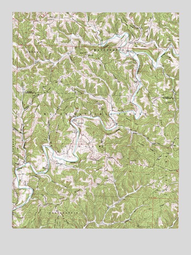
Rinard Mills, OH USGS Topographic Map
Click on map above to begin viewing in our Map Viewer.

This topographic map contains these locations and features:
Feature Name Type Latitude Longitude GNIS ID View Map
Armstrong RidgeRidgeN39.5748°W81.1943°1075277View Map
Bell HillSummitN39.5870°W81.1432°1075343View Map
BloomfieldPopulated PlaceN39.5617°W81.2040°1075412View Map
Boston RunStreamN39.5548°W81.2418°1075427View Map
Carter (historical)Populated PlaceN39.5612°W81.2421°1050686View Map
Clear Fork Little Muskingum RiverStreamN39.6012°W81.1571°1075586View Map
ClinePopulated PlaceN39.6076°W81.1593°1075590View Map
Cline Post Office (historical)Post OfficeN39.6070°W81.1596°2037288View Map
Cross Keys (historical)Populated PlaceN39.5892°W81.2301°1079985View Map
Crosskeys Post Office (historical)Post OfficeN39.5890°W81.2301°2037296View Map
Cullen RidgeRidgeN39.5073°W81.2321°1075660View Map
Dodd HillSummitN39.5748°W81.1429°1075726View Map
Dye RidgeRidgeN39.6051°W81.1534°1075760View Map
Edwards HillSummitN39.5620°W81.1615°1075783View Map
English HillSummitN39.5567°W81.1376°1075811View Map
German CemeteryCemeteryN39.5220°W81.1362°1963902View Map
GlassPopulated PlaceN39.5487°W81.1293°1075926View Map
Graham CemeteryCemeteryN39.5303°W81.1763°1963904View Map
Graham RidgeRidgeN39.5642°W81.2121°1075946View Map
Griffin RidgeRidgeN39.5917°W81.1793°1075968View Map
Hall CemeteryCemeteryN39.5278°W81.2427°1075985View Map
Haney RidgeRidgeN39.6226°W81.2101°1075993View Map
Harris RidgeRidgeN39.5545°W81.1740°1076014View Map
Haught RunStreamN39.5320°W81.2262°1076024View Map
HohmanPopulated PlaceN39.5412°W81.1776°1076065View Map
Hohman RidgeRidgeN39.5420°W81.1698°1076066View Map
Hopewell CemeteryCemeteryN39.5812°W81.2268°1963765View Map
Hopewell ChurchChurchN39.5815°W81.2265°1076077View Map
Hopewell RidgeRidgeN39.5706°W81.2296°1076078View Map
Irish RunStreamN39.5034°W81.1818°1076119View Map
Jackson RunStreamN39.5040°W81.1871°1076134View Map
Knowlton BridgeBridgeN39.6012°W81.1571°1051031View Map
Low Gap CemeteryCemeteryN39.6076°W81.1593°1963774View Map
Low Gap ChurchChurchN39.6076°W81.1579°1076313View Map
Ludlow Catholic CemeteryCemeteryN39.5237°W81.1809°1963917View Map
Ludlow Elementary School (historical)SchoolN39.5595°W81.1993°1071776View Map
Ludlow High School (historical)SchoolN39.5595°W81.1993°1071777View Map
Merrell RidgeRidgeN39.6020°W81.1868°1076379View Map
Merrell Ridge CemeteryCemeteryN39.6009°W81.1932°1963775View Map
Merrell Ridge ChurchChurchN39.6009°W81.1926°1076380View Map
Mount Hope CemeteryCemeteryN39.6217°W81.2184°1963778View Map
Mount Hope ChurchChurchN39.6220°W81.2184°1076450View Map
Mount Vernon ChurchChurchN39.5679°W81.1659°1076461View Map
Muskingum (historical)Populated PlaceN39.5556°W81.2223°1050685View Map
Muskingum Valley Baptist CemeteryCemeteryN39.5367°W81.2137°1963924View Map
Muskingum Valley ChurchChurchN39.5370°W81.2134°1076488View Map
Neff RidgeRidgeN39.5437°W81.2454°1076501View Map
Oakes LandingLocaleN39.5667°W81.1665°1077269View Map
Oldcamp RunStreamN39.5931°W81.1423°1076567View Map
Point Pleasant ChurchChurchN39.5137°W81.2246°1076666View Map
Point Pleasant Church CemeteryCemeteryN39.5126°W81.2268°1963932View Map
Quarry (historical)Populated PlaceN39.5920°W81.2207°1051030View Map
Quarry Post Office (historical)Post OfficeN39.5917°W81.2207°2037372View Map
Rinard Covered BridgeBridgeN39.5370°W81.2229°1077280View Map
Rinard MillsPopulated PlaceN39.5848°W81.1551°1065545View Map
Rinard Mills CemeteryCemeteryN39.5840°W81.1568°1963792View Map
Sacket RunStreamN39.5473°W81.2229°1076785View Map
ShayPopulated PlaceN39.5104°W81.2171°1076872View Map
Shay RidgeRidgeN39.5170°W81.2084°1076873View Map
Smith CemeteryCemeteryN39.6081°W81.2001°1963803View Map
Straight ForkStreamN39.6020°W81.1357°1076976View Map
Tice CemeteryCemeteryN39.5398°W81.2123°1963940View Map
Tice RunStreamN39.5412°W81.2182°1077046View Map
Township of LudlowCivilN39.5483°W81.1954°1087137View Map
Ward (historical)Populated PlaceN39.5015°W81.1482°1050687View Map
Wayne National Forest - Athens Ranger District - Marietta UnitForestN39.5626°W81.1873°1083678View Map
Williams RidgeRidgeN39.5467°W81.1487°1077195View Map
Wilson RunStreamN39.5598°W81.1707°1077205View Map
Wingett RunPopulated PlaceN39.5367°W81.2432°1077208View Map
Wingett RunStreamN39.5376°W81.2398°1077209View Map
Witten RunStreamN39.6065°W81.1826°1077217View Map

Note: Coordinates in the location and feature list above are referenced to NAD83 datum.


Copyright (C) 2008-2024 Ryan Niemi / Sunset Dynamics ... All Rights Reserved