TopoQuest Logo
Do you find TopoQuest useful?
Help keep TopoQuest running and adding new maps/features by donating!
Bitcoin:  19c7KJd3qBynnjoSw5npx9KScwjBe4ifkT
Litecoin:  LXs6TkuXGGXo1vDsWCkWVdjQX94eUKd6ui
Home View Maps Find Maps Find Places Resources & Links


Lower Salem, Ohio Topographic Map

USGS Map Title: Lower Salem, OH
USGS Map MRC: 39081E4
DRG (GeoTIFF) Download: o39081e4.tif


Neighboring USGS Topographic Map Quads:


  Caldwell South, OH  
39081F5
 

  Macksburg, OH  
39081F4
 

  Stafford, OH  
39081F3
 

  Lowell, OH  
39081E5
 

  Lower Salem, OH  
39081E4
 

  Dalzell, OH  
39081E3
 

  Fleming, OH  
39081D5
 

  Marietta, OH  
39081D4
 

  Belmont, WV  
39081D3


Map MRC Location:

N40°
W82°
N40°
W81°
H8 H7 H6 H5 H4 H3 H2 H1
G8 G7 G6 G5 G4 G3 G2 G1
F8 F7 F6 F5 F4 F3 F2 F1
E8 E7 E6 E5 E4 E3 E2 E1
D8 D7 D6 D5 D4 D3 D2 D1
C8 C7 C6 C5 C4 C3 C2 C1
B8 B7 B6 B5 B4 B3 B2 B1
A8 A7 A6 A5 A4 A3 A2 A1
N39°
W82°
N39°
W81°

Lower Salem, OH USGS 1:24K Topographic Map Preview:
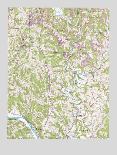
Lower Salem, OH USGS Topographic Map
Click on map above to begin viewing in our Map Viewer.

This topographic map contains these locations and features:
Feature Name Type Latitude Longitude GNIS ID View Map
Bear CreekStreamN39.5209°W81.4865°1037716View Map
Berg ChurchChurchN39.5029°W81.3982°1037867View Map
Berg Church CemeteryCemeteryN39.5023°W81.3979°1963883View Map
BonnPopulated PlaceN39.5315°W81.3854°1062655View Map
Buells (historical)Populated PlaceN39.5223°W81.4840°1061274View Map
Dixon RidgeRidgeN39.5637°W81.4907°1039723View Map
East Fork Duck CreekStreamN39.5615°W81.4098°1075765View Map
ElbaPopulated PlaceN39.6081°W81.4132°1062750View Map
Evangelical CemeteryCemeteryN39.5170°W81.4562°1963896View Map
Flanders CemeteryCemeteryN39.5076°W81.4285°1040497View Map
Good Hope ChurchChurchN39.5720°W81.4518°1040942View Map
Good Hope Church CemeteryCemeteryN39.5726°W81.4521°1963903View Map
Highland Ridge Community ChurchChurchN39.5167°W81.4565°1963905View Map
Hill Grove CemeteryCemeteryN39.5922°W81.4695°1041585View Map
Hill Grove Church (historical)ChurchN39.5745°W81.4893°1963906View Map
HonestyPopulated PlaceN39.5876°W81.4854°1062816View Map
Honesty Post Office (historical)Post OfficeN39.5876°W81.4860°2041267View Map
KilmerPopulated PlaceN39.6034°W81.3785°1062837View Map
Kilmer Post Office (historical)Post OfficeN39.6034°W81.3790°2041270View Map
Liberty Hill CemeteryCemeteryN39.5742°W81.4898°1042517View Map
Lower SalemPopulated PlaceN39.5612°W81.3965°1057819View Map
Lower Salem CemeteryCemeteryN39.5476°W81.3965°1963916View Map
Lutheran CemeteryCemeteryN39.5740°W81.4159°1963918View Map
Mount Ephraim ChurchChurchN39.5954°W81.3771°1043558View Map
Mount Ephriam Church CemeteryCemeteryN39.5956°W81.3765°1963921View Map
New Years CreekStreamN39.5029°W81.4235°1084027View Map
Pawpaw CreekStreamN39.5615°W81.3943°1076603View Map
Salem Township Volunteer Fire DepartmentBuildingN39.5480°W81.3965°2549803View Map
Salem-Liberty Elementary SchoolSchoolN39.5626°W81.4062°1081863View Map
Salem-Liberty High School (historical)SchoolN39.5626°W81.4057°1071782View Map
Shafer CemeteryCemeteryN39.6123°W81.4773°1046119View Map
Shafers ChurchChurchN39.6123°W81.4768°1963699View Map
Smith Ridge CemeteryCemeteryN39.6078°W81.4426°1963938View Map
Smith Ridge ChurchChurchN39.6079°W81.4429°1046385View Map
Township of AureliusCivilN39.6079°W81.4385°1087125View Map
Township of SalemCivilN39.5556°W81.4103°1087143View Map
Village of Lower SalemCivilN39.5634°W81.3942°2399196View Map
WarnerPopulated PlaceN39.5629°W81.4182°1047568View Map
West Fork Duck CreekStreamN39.5620°W81.4098°1047719View Map
WhipplePopulated PlaceN39.5223°W81.4146°1047862View Map
Whipple Community ChurchChurchN39.5215°W81.4115°1060591View Map

Note: Coordinates in the location and feature list above are referenced to NAD83 datum.


Copyright (C) 2008-2025 Ryan Niemi / Sunset Dynamics ... All Rights Reserved