TopoQuest Logo
Do you find TopoQuest useful?
Help keep TopoQuest running and adding new maps/features by donating!
Bitcoin:  19c7KJd3qBynnjoSw5npx9KScwjBe4ifkT
Litecoin:  LXs6TkuXGGXo1vDsWCkWVdjQX94eUKd6ui
Home View Maps Find Maps Find Places Resources & Links


Danville, Ohio Topographic Map

USGS Map Title: Danville, OH
USGS Map MRC: 40082D3
DRG (GeoTIFF) Download: o40082d3.tif


Neighboring USGS Topographic Map Quads:


  Butler, OH  
40082E4
 

  Jelloway, OH  
40082E3
 

  Greer, OH  
40082E2
 

  Mount Vernon, OH  
40082D4
 

  Danville, OH  
40082D3
 

  Brinkhaven, OH  
40082D2
 

  Hunt, OH  
40082C4
 

  Martinsburg, OH  
40082C3
 

  Walhonding, OH  
40082C2


Map MRC Location:

N41°
W83°
N41°
W82°
H8 H7 H6 H5 H4 H3 H2 H1
G8 G7 G6 G5 G4 G3 G2 G1
F8 F7 F6 F5 F4 F3 F2 F1
E8 E7 E6 E5 E4 E3 E2 E1
D8 D7 D6 D5 D4 D3 D2 D1
C8 C7 C6 C5 C4 C3 C2 C1
B8 B7 B6 B5 B4 B3 B2 B1
A8 A7 A6 A5 A4 A3 A2 A1
N40°
W83°
N40°
W82°

Danville, OH USGS 1:24K Topographic Map Preview:
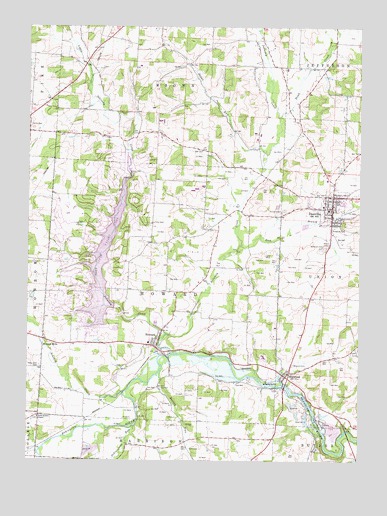
Danville, OH USGS Topographic Map
Click on map above to begin viewing in our Map Viewer.

This topographic map contains these locations and features:
Feature Name Type Latitude Longitude GNIS ID View Map
Amity CemeteryCemeteryN40.4716°W82.3742°1037409View Map
Apple ValleyPopulated PlaceN40.4389°W82.3539°2633220View Map
Apple Valley Census Designated PlaceCensusN40.4389°W82.3481°2628858View Map
Apple Valley Golf CourseLocaleN40.4487°W82.3602°1051993View Map
Apple Valley LakeReservoirN40.4322°W82.3459°1078224View Map
Apple Valley Lake DamDamN40.4217°W82.3432°1078223View Map
Autumn Hills FarmLocaleN40.3953°W82.2892°2710880View Map
Banbury CemeteryCemeteryN40.4774°W82.2718°1961242View Map
Barney RunStreamN40.4012°W82.3249°1065910View Map
Berry School (historical)SchoolN40.4384°W82.3446°1051992View Map
Blanchard Swine FarmsLocaleN40.4131°W82.3072°2710795View Map
Branstool - Critchfield - Shrimplin CemeteryCemeteryN40.4020°W82.3396°1961248View Map
Bratton Hog FarmLocaleN40.4831°W82.2903°2711027View Map
Buckeye CityPopulated PlaceN40.4440°W82.2585°1065556View Map
Buckeye City Post Office (historical)Post OfficeN40.4445°W82.2582°2025591View Map
Bullock FarmsLocaleN40.4933°W82.3367°2710874View Map
DanvillePopulated PlaceN40.4476°W82.2602°1039574View Map
Danville Elementary SchoolSchoolN40.4473°W82.2618°1052000View Map
Danville High SchoolSchoolN40.4484°W82.2638°1051999View Map
Danville Post OfficePost OfficeN40.4473°W82.2596°2021063View Map
Doudy ValleyValleyN40.4803°W82.2763°1067420View Map
Dowd CreekStreamN40.4740°W82.2799°1039771View Map
East Branch Jelloway CreekStreamN40.4365°W82.2957°1039940View Map
East Knox High SchoolSchoolN40.4051°W82.2860°1051997View Map
Eastern Knox County Joint Fire District Station 1BuildingN40.4496°W82.2614°2549921View Map
Eastern Knox County Joint Fire District Station 2BuildingN40.4090°W82.3324°2549221View Map
Grassydell FarmsLocaleN40.4011°W82.3675°2651488View Map
Grove FallsFallsN40.3831°W82.2632°1071861View Map
Harrisburg School (historical)SchoolN40.4870°W82.2638°1052002View Map
Hedge Farm (historical)LocaleN40.4390°W82.3040°1069208View Map
Honey RunStreamN40.3826°W82.2635°1041740View Map
Horn FarmsLocaleN40.3842°W82.3067°2710872View Map
HowardPopulated PlaceN40.4076°W82.3268°1064870View Map
Howard Census Designated PlaceCensusN40.4093°W82.3274°2628904View Map
Howard Post OfficePost OfficeN40.4070°W82.3263°2021068View Map
Howard Sewage Treatment PlantLocaleN40.4142°W82.3264°2678339View Map
Indianfield RunStreamN40.3848°W82.3346°1066046View Map
Jelloway CreekStreamN40.4056°W82.3204°1066050View Map
Linn Wood Farm (historical)LocaleN40.4562°W82.3715°1069212View Map
Little Jelloway CreekStreamN40.4112°W82.3229°1057800View Map
Locust Grove School (historical)SchoolN40.4970°W82.3441°1051994View Map
MillwoodPopulated PlaceN40.3995°W82.2777°1065779View Map
Millwood CemeteryCemeteryN40.4031°W82.2747°1043390View Map
Millwood Post Office (historical)Post OfficeN40.4001°W82.2777°2015940View Map
Monroe MillsPopulated PlaceN40.4081°W82.3690°1065787View Map
Monroe Mills Post Office (historical)Post OfficeN40.4084°W82.3693°2015941View Map
Mount Zion CemeteryCemeteryN40.3751°W82.3518°1043653View Map
Pleasant Hill School (historical)SchoolN40.4676°W82.2888°1052001View Map
Pleasant Valley (historical)Populated PlaceN40.4903°W82.3527°1067424View Map
Ransoms RunStreamN40.3770°W82.3707°1067427View Map
Saint Lukes CemeteryCemeteryN40.4468°W82.2786°1045612View Map
Sapps RunStreamN40.4606°W82.2865°1066189View Map
Schenck CreekStreamN40.3945°W82.3385°1066190View Map
School Number 1 (historical)SchoolN40.4006°W82.3099°1069222View Map
School Number 2 (historical)SchoolN40.4065°W82.3582°1069224View Map
School Number 3 (historical)SchoolN40.4773°W82.2585°1069227View Map
School Number 3 (historical)SchoolN40.4223°W82.2690°1051998View Map
School Number 5 (historical)SchoolN40.4090°W82.3290°1069232View Map
School Number 6 (historical)SchoolN40.4151°W82.2943°1069236View Map
School Number 7 (historical)SchoolN40.4759°W82.3449°1069239View Map
Shadley Valley CreekStreamN40.4992°W82.2891°1066196View Map
Skyline Turkey FarmLocaleN40.4533°W82.3114°2585735View Map
Stone Quarry ChapelChurchN40.3873°W82.3710°1046711View Map
Stone Quarry Chapel CemeteryCemeteryN40.3878°W82.3710°1961281View Map
Township of HowardCivilN40.4234°W82.3242°1086400View Map
Union School (historical)SchoolN40.4415°W82.3065°1051995View Map
Valley Fruit FarmLocaleN40.4106°W82.3572°2710876View Map
Valley View CemeteryCemeteryN40.4023°W82.3704°1047407View Map
Village of DanvilleCivilN40.4471°W82.2607°2398682View Map
Wildcat School (historical)SchoolN40.4753°W82.3213°1051996View Map
Workman CemeteryCemeteryN40.4366°W82.2632°1048139View Map

Note: Coordinates in the location and feature list above are referenced to NAD83 datum.


Copyright (C) 2008-2024 Ryan Niemi / Sunset Dynamics ... All Rights Reserved