TopoQuest Logo
Do you find TopoQuest useful?
Help keep TopoQuest running and adding new maps/features by donating!
Bitcoin:  19c7KJd3qBynnjoSw5npx9KScwjBe4ifkT
Litecoin:  LXs6TkuXGGXo1vDsWCkWVdjQX94eUKd6ui
Home View Maps Find Maps Find Places Resources & Links


Walhonding, Ohio Topographic Map

USGS Map Title: Walhonding, OH
USGS Map MRC: 40082C2
DRG (GeoTIFF) Download: o40082c2.tif


Neighboring USGS Topographic Map Quads:


  Danville, OH  
40082D3
 

  Brinkhaven, OH  
40082D2
 

  Spring Mountain, OH  
40082D1
 

  Martinsburg, OH  
40082C3
 

  Walhonding, OH  
40082C2
 

  Warsaw, OH  
40082C1
 

  Hickman, OH  
40082B3
 

  Perryton, OH  
40082B2
 

  Trinway, OH  
40082B1


Map MRC Location:

N41°
W83°
N41°
W82°
H8 H7 H6 H5 H4 H3 H2 H1
G8 G7 G6 G5 G4 G3 G2 G1
F8 F7 F6 F5 F4 F3 F2 F1
E8 E7 E6 E5 E4 E3 E2 E1
D8 D7 D6 D5 D4 D3 D2 D1
C8 C7 C6 C5 C4 C3 C2 C1
B8 B7 B6 B5 B4 B3 B2 B1
A8 A7 A6 A5 A4 A3 A2 A1
N40°
W83°
N40°
W82°

Walhonding, OH USGS 1:24K Topographic Map Preview:
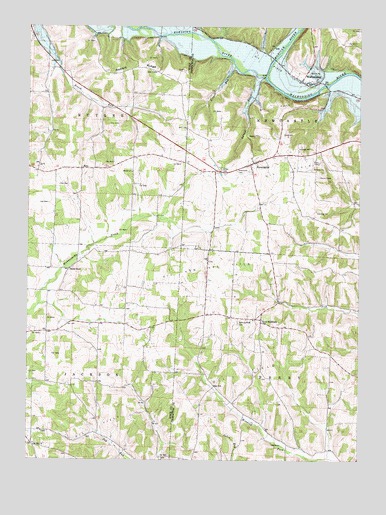
Walhonding, OH USGS Topographic Map
Click on map above to begin viewing in our Map Viewer.

This topographic map contains these locations and features:
Feature Name Type Latitude Longitude GNIS ID View Map
Brush Run School (historical)SchoolN40.3670°W82.2429°1052058View Map
Butler Baptist CemeteryCemeteryN40.3337°W82.2107°1961249View Map
Butler ChurchChurchN40.3331°W82.2107°1038563View Map
California Farm (historical)LocaleN40.3445°W82.2340°1069199View Map
Dennis CemeteryCemeteryN40.3053°W82.2329°1961250View Map
Dennis ChapelChurchN40.3053°W82.2340°1039673View Map
Dry RunStreamN40.3659°W82.2399°1069005View Map
EstoPopulated PlaceN40.3340°W82.2302°1062754View Map
Esto Post Office (historical)Post OfficeN40.3334°W82.2304°2015931View Map
Farmers OrchardsLocaleN40.3469°W82.1922°2515698View Map
Flint CemeteryCemeteryN40.3109°W82.1851°1964110View Map
Giffen CemeteryCemeteryN40.3339°W82.1768°1040859View Map
Jug RunStreamN40.3556°W82.2424°1069006View Map
Jug Run School (historical)SchoolN40.2565°W82.2188°1052056View Map
Kokosing RiverStreamN40.3601°W82.1601°1056385View Map
Laurel RunStreamN40.3603°W82.1613°1042442View Map
Maverick FarmsLocaleN40.2608°W82.1378°2634747View Map
Mohican RiverStreamN40.3601°W82.1601°1066841View Map
Mount Zion CemeteryCemeteryN40.2548°W82.2471°1961270View Map
Mount Zion ChurchChurchN40.2542°W82.2468°1043660View Map
New Castle Methodist ChurchChurchN40.3365°W82.1615°1062548View Map
New GuilfordPopulated PlaceN40.2909°W82.1615°1065117View Map
New Guilford CemeteryCemeteryN40.2898°W82.1703°1043834View Map
New Guilford Methodist ChurchChurchN40.2906°W82.1646°1062549View Map
New Guilford Post Office (historical)Post OfficeN40.2903°W82.1610°1967444View Map
NewcastlePopulated PlaceN40.3351°W82.1657°1065146View Map
Newcastle CemeteryCemeteryN40.3334°W82.1707°1043854View Map
Owls Town (historical)Populated PlaceN40.3598°W82.1571°1067516View Map
Rabbit RidgeRidgeN40.3634°W82.2074°1044836View Map
Rabbit Ridge School (historical)SchoolN40.3617°W82.2021°1052059View Map
Saint Matthews Episcopal CemeteryCemeteryN40.2963°W82.1824°1964137View Map
School Number 4 (historical)SchoolN40.3342°W82.2360°1069231View Map
School Number 5 (historical)SchoolN40.3701°W82.2421°1069233View Map
Scott CemeteryCemeteryN40.2964°W82.1830°1964138View Map
Singer RunStreamN40.3634°W82.1715°1046299View Map
South RunStreamN40.2948°W82.2457°1069007View Map
Stricker School (historical)SchoolN40.2909°W82.2126°1068269View Map
Township of ButlerCivilN40.3483°W82.2365°1086393View Map
Township of JacksonCivilN40.2761°W82.2390°1086401View Map
Township of NewcastleCivilN40.3453°W82.1412°1085923View Map
Township of PerryCivilN40.2730°W82.1455°1085925View Map
WalhondingPopulated PlaceN40.3595°W82.1468°1047499View Map
Walhonding CemeteryCemeteryN40.3632°W82.1416°1964144View Map
Walhonding Post OfficePost OfficeN40.3598°W82.1471°1964093View Map
Widows Point FarmsLocaleN40.3494°W82.1933°2710875View Map
Winding Fork Evangelical CemeteryCemeteryN40.2590°W82.1590°1964150View Map
Winding Fork School (historical)SchoolN40.2620°W82.1651°1050301View Map
Wood School (historical)SchoolN40.3323°W82.2102°1052057View Map

Note: Coordinates in the location and feature list above are referenced to NAD83 datum.


Copyright (C) 2008-2024 Ryan Niemi / Sunset Dynamics ... All Rights Reserved