TopoQuest Logo
Do you find TopoQuest useful?
Help keep TopoQuest running and adding new maps/features by donating!
Bitcoin:  19c7KJd3qBynnjoSw5npx9KScwjBe4ifkT
Litecoin:  LXs6TkuXGGXo1vDsWCkWVdjQX94eUKd6ui
Home View Maps Find Maps Find Places Resources & Links


Jelloway, Ohio Topographic Map

USGS Map Title: Jelloway, OH
USGS Map MRC: 40082E3
DRG (GeoTIFF) Download: o40082e3.tif


Neighboring USGS Topographic Map Quads:


  Lucas, OH  
40082F4
 

  Perrysville, OH  
40082F3
 

  Loudonville, OH  
40082F2
 

  Butler, OH  
40082E4
 

  Jelloway, OH  
40082E3
 

  Greer, OH  
40082E2
 

  Mount Vernon, OH  
40082D4
 

  Danville, OH  
40082D3
 

  Brinkhaven, OH  
40082D2


Map MRC Location:

N41°
W83°
N41°
W82°
H8 H7 H6 H5 H4 H3 H2 H1
G8 G7 G6 G5 G4 G3 G2 G1
F8 F7 F6 F5 F4 F3 F2 F1
E8 E7 E6 E5 E4 E3 E2 E1
D8 D7 D6 D5 D4 D3 D2 D1
C8 C7 C6 C5 C4 C3 C2 C1
B8 B7 B6 B5 B4 B3 B2 B1
A8 A7 A6 A5 A4 A3 A2 A1
N40°
W83°
N40°
W82°

Jelloway, OH USGS 1:24K Topographic Map Preview:
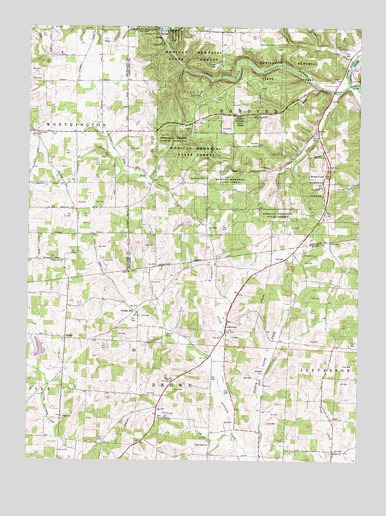
Jelloway, OH USGS Topographic Map
Click on map above to begin viewing in our Map Viewer.

This topographic map contains these locations and features:
Feature Name Type Latitude Longitude GNIS ID View Map
Big Lyons FallsFallsN40.6161°W82.3278°1067813View Map
Bigelow CemeteryCemeteryN40.5131°W82.3618°1961245View Map
Biglow ChurchChurchN40.5126°W82.3616°1038048View Map
Black Fork Mohican RiverStreamN40.6084°W82.2538°1068192View Map
Black Swamp School (historical)SchoolN40.5942°W82.3574°1049921View Map
Bunker Hill CemeteryCemeteryN40.5937°W82.3729°1955058View Map
Church of GodChurchN40.5937°W82.2674°1039106View Map
Clear Fork ChurchChurchN40.5939°W82.3729°1039173View Map
Clear Fork Mohican RiverStreamN40.6084°W82.2538°1065962View Map
College HillPopulated PlaceN40.5434°W82.3349°1062705View Map
Cottage Hill School (historical)SchoolN40.5431°W82.3352°1051948View Map
Hickory Ridge School (historical)SchoolN40.6239°W82.2957°1051124View Map
Horn School (historical)SchoolN40.5387°W82.2624°1051952View Map
Horsetail RunStreamN40.6076°W82.2652°1041808View Map
Ireland CreekStreamN40.5076°W82.2977°1041988View Map
Ireland School (historical)SchoolN40.5198°W82.3413°1051947View Map
Ireland Valley FarmLocaleN40.5225°W82.3367°2651487View Map
JellowayPopulated PlaceN40.5367°W82.3002°1064905View Map
Jelloway Methodist Episcopal CemeteryCemeteryN40.5378°W82.2982°1961258View Map
Jelloway Post Office (historical)Post OfficeN40.5362°W82.2999°2015934View Map
Lake VieringReservoirN40.5320°W82.3702°1078226View Map
Lake Viering DamDamN40.5317°W82.3699°1078225View Map
Little Lyons FallsFallsN40.6193°W82.3292°2375009View Map
Memorial Shrine Forest PreserveForestN40.5928°W82.3204°1051134View Map
Mohican State ForestForestN40.6106°W82.3129°1061527View Map
Mohican State ParkParkN40.6189°W82.2658°2371589View Map
North Bend Church of the BrethrenChurchN40.5045°W82.3054°1043913View Map
North Bend Church of the Brethren CemeteryCemeteryN40.5051°W82.3054°1961271View Map
North Bend School (historical)SchoolN40.5012°W82.3060°1051949View Map
NundaPopulated PlaceN40.5353°W82.3602°1065180View Map
Nunda Post Office (historical)Post OfficeN40.5348°W82.3596°2015943View Map
Oak Grove School (historical)SchoolN40.6003°W82.2874°1051138View Map
Opossum Isle School (historical)SchoolN40.5723°W82.3157°1051140View Map
Pine RunStreamN40.6062°W82.2579°1044470View Map
Pine Run CemeteryCemeteryN40.5798°W82.3606°1044473View Map
Pleasant Hill DamDamN40.6229°W82.3244°1044565View Map
Poll School (historical)SchoolN40.6192°W82.2596°1051146View Map
Raleigh School (historical)SchoolN40.5070°W82.2871°1051950View Map
Red Brush School (historical)SchoolN40.5798°W82.2768°1051147View Map
Salem ChurchChurchN40.5576°W82.3666°1048373View Map
Sand Ridge ChurchChurchN40.5814°W82.3093°1045934View Map
Sandridge CemeteryCemeteryN40.5823°W82.3099°1806369View Map
Schneider LakeReservoirN40.5685°W82.3146°1077769View Map
Schneider Lake DamDamN40.5684°W82.3132°1077768View Map
School Number 1 (historical)SchoolN40.6245°W82.3510°1049922View Map
School Number 2 (historical)SchoolN40.5092°W82.2863°1069223View Map
School Number 3 (historical)SchoolN40.6006°W82.3271°1051155View Map
School Number 4 (historical)SchoolN40.5331°W82.3113°1069230View Map
Shadley Valley CemeteryCemeteryN40.5253°W82.2854°1961280View Map
Spring Valley Farm (historical)LocaleN40.5042°W82.2985°1069245View Map
Township of BrownCivilN40.5086°W82.3188°1086392View Map
Township of HanoverCivilN40.6000°W82.2808°1085705View Map
Union CemeteryCemeteryN40.5801°W82.3749°1047282View Map
Valley School (historical)SchoolN40.5126°W82.2599°1051951View Map
Wesley Chapel CemeteryCemeteryN40.5023°W82.2602°1961283View Map
Wesley ChurchChurchN40.5023°W82.2596°1047701View Map
White Hall School (historical)SchoolN40.5648°W82.3560°1049920View Map
Zion ChurchChurchN40.5231°W82.3204°1048272View Map
Zion Evangelical Lutheran CemeteryCemeteryN40.5234°W82.3196°1961284View Map

Note: Coordinates in the location and feature list above are referenced to NAD83 datum.


Copyright (C) 2008-2025 Ryan Niemi / Sunset Dynamics ... All Rights Reserved