TopoQuest Logo
Do you find TopoQuest useful?
Help keep TopoQuest running and adding new maps/features by donating!
Bitcoin:  19c7KJd3qBynnjoSw5npx9KScwjBe4ifkT
Litecoin:  LXs6TkuXGGXo1vDsWCkWVdjQX94eUKd6ui
Home View Maps Find Maps Find Places Resources & Links


Danville West, Georgia Topographic Map

USGS Map Title: Danville West, GA
USGS Map MRC: 32083E3
DRG (GeoTIFF) Download: o32083e3.tif


Neighboring USGS Topographic Map Quads:


  Marion, GA  
32083F4
 

  Jeffersonville, GA  
32083F3
 

  Stuckey Boone Lake, GA  
32083F2
 

  Tarversville, GA  
32083E4
 

  Danville West, GA  
32083E3
 

  Danville East, GA  
32083E2
 

  Westlake, GA  
32083D4
 

  Cochran, GA  
32083D3
 

  Chester, GA  
32083D2


Map MRC Location:

N33°
W84°
N33°
W83°
H8 H7 H6 H5 H4 H3 H2 H1
G8 G7 G6 G5 G4 G3 G2 G1
F8 F7 F6 F5 F4 F3 F2 F1
E8 E7 E6 E5 E4 E3 E2 E1
D8 D7 D6 D5 D4 D3 D2 D1
C8 C7 C6 C5 C4 C3 C2 C1
B8 B7 B6 B5 B4 B3 B2 B1
A8 A7 A6 A5 A4 A3 A2 A1
N32°
W84°
N32°
W83°

Danville West, GA USGS 1:24K Topographic Map Preview:
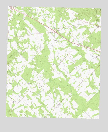
Danville West, GA USGS Topographic Map
Click on map above to begin viewing in our Map Viewer.

This topographic map contains these locations and features:
Feature Name Type Latitude Longitude GNIS ID View Map
Aires-Meadows CemeteryCemeteryN32.5496°W83.3321°345406View Map
Brown HillPopulated PlaceN32.5524°W83.2604°342368View Map
Brown Hill ChurchChurchN32.5502°W83.2624°311870View Map
Brown Hill School (historical)SchoolN32.5504°W83.2621°334611View Map
CaryPopulated PlaceN32.5149°W83.3049°312398View Map
Cason LakeReservoirN32.5767°W83.3609°340546View Map
Cason Lake DamDamN32.5752°W83.3616°340545View Map
Cochran - Bleckley Fire Department Cary Road StationBuildingN32.5158°W83.3045°2604847View Map
Cool Springs Primitive Baptist ChurchChurchN32.5721°W83.2929°355286View Map
Cool Springs School (historical)SchoolN32.5721°W83.2929°345415View Map
Danville AirparkAirportN32.5817°W83.2694°351744View Map
Edgewood ChurchChurchN32.5952°W83.3293°345422View Map
Elsharath Missionary ChurchChurchN32.5382°W83.3457°355683View Map
Exit 8CrossingN32.6238°W83.3702°1705076View Map
Exit 9CrossingN32.5982°W83.3127°1705077View Map
Fowler CemeteryCemeteryN32.6041°W83.2909°314326View Map
Gum Swamp BranchStreamN32.5543°W83.3224°314980View Map
Harvey BranchStreamN32.5357°W83.2891°315221View Map
Hasty BranchStreamN32.5779°W83.3602°315224View Map
Higgsville Volunteer Fire DepartmentBuildingN32.6013°W83.3377°2604746View Map
Land DamDamN32.5302°W83.2515°336272View Map
Land LakeReservoirN32.5323°W83.2534°336273View Map
Lizzy Harold CemeteryCemeteryN32.5376°W83.3716°317266View Map
Lizzy Harold ChurchChurchN32.5382°W83.3716°317267View Map
Lucy ChapelChurchN32.5879°W83.3088°317474View Map
Mount Calvary ChurchChurchN32.5143°W83.3052°334612View Map
Mount Zion CemeteryCemeteryN32.6010°W83.3077°345444View Map
Mount Zion ChurchChurchN32.6007°W83.3063°318983View Map
Mount Zion School (historical)SchoolN32.6010°W83.3068°345446View Map
Twiggs AcademySchoolN32.6226°W83.3449°324438View Map
Twiggs County South SchoolSchoolN32.5876°W83.3746°324440View Map

Note: Coordinates in the location and feature list above are referenced to NAD83 datum.


Copyright (C) 2008-2025 Ryan Niemi / Sunset Dynamics ... All Rights Reserved