TopoQuest Logo
Do you find TopoQuest useful?
Help keep TopoQuest running and adding new maps/features by donating!
Bitcoin:  19c7KJd3qBynnjoSw5npx9KScwjBe4ifkT
Litecoin:  LXs6TkuXGGXo1vDsWCkWVdjQX94eUKd6ui
Home View Maps Find Maps Find Places Resources & Links


Tarversville, Georgia Topographic Map

USGS Map Title: Tarversville, GA
USGS Map MRC: 32083E4
DRG (GeoTIFF) Download: o32083e4.tif


Neighboring USGS Topographic Map Quads:


  Warner Robins NE, GA  
32083F5
 

  Marion, GA  
32083F4
 

  Jeffersonville, GA  
32083F3
 

  Warner Robins SE, GA  
32083E5
 

  Tarversville, GA  
32083E4
 

  Danville West, GA  
32083E3
 

  Hayneville, GA  
32083D5
 

  Westlake, GA  
32083D4
 

  Cochran, GA  
32083D3


Map MRC Location:

N33°
W84°
N33°
W83°
H8 H7 H6 H5 H4 H3 H2 H1
G8 G7 G6 G5 G4 G3 G2 G1
F8 F7 F6 F5 F4 F3 F2 F1
E8 E7 E6 E5 E4 E3 E2 E1
D8 D7 D6 D5 D4 D3 D2 D1
C8 C7 C6 C5 C4 C3 C2 C1
B8 B7 B6 B5 B4 B3 B2 B1
A8 A7 A6 A5 A4 A3 A2 A1
N32°
W84°
N32°
W83°

Tarversville, GA USGS 1:24K Topographic Map Preview:
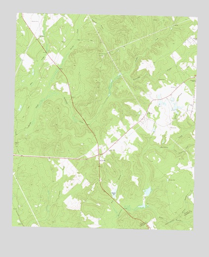
Tarversville, GA USGS Topographic Map
Click on map above to begin viewing in our Map Viewer.

This topographic map contains these locations and features:
Feature Name Type Latitude Longitude GNIS ID View Map
Beckham CemeteryCemeteryN32.6201°W83.4843°354519View Map
Burns CemeteryCemeteryN32.5415°W83.3854°312056View Map
District PathPopulated PlaceN32.6129°W83.3791°331558View Map
Dogwood BranchStreamN32.6168°W83.4566°313528View Map
English CemeteryCemeteryN32.6029°W83.4379°345423View Map
Faulk CemeteryCemeteryN32.6010°W83.4393°314083View Map
Faulk LakeReservoirN32.5741°W83.3998°336136View Map
Faulk Lake DamDamN32.5718°W83.3999°336135View Map
Greater New Hope ChurchChurchN32.6115°W83.4841°314811View Map
Hendrick PondReservoirN32.5209°W83.4299°315328View Map
Hendricks Lake DamDamN32.5182°W83.4293°340120View Map
Hogan BranchStreamN32.5132°W83.4085°315515View Map
Johnson BranchStreamN32.5582°W83.3816°316147View Map
Larson PondReservoirN32.5294°W83.3931°316655View Map
Little Shellstone CreekStreamN32.5477°W83.3904°317196View Map
Mill BranchStreamN32.5071°W83.4280°318167View Map
Mount CalvaryPopulated PlaceN32.6099°W83.4852°334739View Map
Mount OlivePopulated PlaceN32.5835°W83.3874°334740View Map
Mount Olive ChurchChurchN32.5838°W83.3882°318752View Map
New Hope CemeteryCemeteryN32.6024°W83.4368°319355View Map
New Hope Church (historical)ChurchN32.6029°W83.4355°334742View Map
New Richland Baptist ChurchChurchN32.5688°W83.4080°319521View Map
Richland CreekStreamN32.5743°W83.4805°321578View Map
Sanders CemeteryCemeteryN32.5874°W83.3966°322441View Map
Scuffle CreekStreamN32.5901°W83.4249°322670View Map
Shiloh ChurchChurchN32.5482°W83.4982°322871View Map
Shiloh School (historical)SchoolN32.5479°W83.4985°345453View Map
South Twiggs DivisionCivilN32.5964°W83.4415°1936602View Map
TarversvillePopulated PlaceN32.5401°W83.4399°356583View Map
Vaughn CemeteryCemeteryN32.5732°W83.3771°324672View Map
Walters CemeteryCemeteryN32.5601°W83.3918°324817View Map
Wilson BranchStreamN32.5057°W83.3868°310365View Map

Note: Coordinates in the location and feature list above are referenced to NAD83 datum.


Copyright (C) 2008-2025 Ryan Niemi / Sunset Dynamics ... All Rights Reserved