TopoQuest Logo
Do you find TopoQuest useful?
Help keep TopoQuest running and adding new maps/features by donating!
Bitcoin:  19c7KJd3qBynnjoSw5npx9KScwjBe4ifkT
Litecoin:  LXs6TkuXGGXo1vDsWCkWVdjQX94eUKd6ui
Home View Maps Find Maps Find Places Resources & Links


Marion, Georgia Topographic Map

USGS Map Title: Marion, GA
USGS Map MRC: 32083F4
DRG (GeoTIFF) Download: o32083f4.tif


Neighboring USGS Topographic Map Quads:


  Macon East, GA  
32083G5
 

  Dry Branch, GA  
32083G4
 

  Massey Hill, GA  
32083G3
 

  Warner Robins NE, GA  
32083F5
 

  Marion, GA  
32083F4
 

  Jeffersonville, GA  
32083F3
 

  Warner Robins SE, GA  
32083E5
 

  Tarversville, GA  
32083E4
 

  Danville West, GA  
32083E3


Map MRC Location:

N33°
W84°
N33°
W83°
H8 H7 H6 H5 H4 H3 H2 H1
G8 G7 G6 G5 G4 G3 G2 G1
F8 F7 F6 F5 F4 F3 F2 F1
E8 E7 E6 E5 E4 E3 E2 E1
D8 D7 D6 D5 D4 D3 D2 D1
C8 C7 C6 C5 C4 C3 C2 C1
B8 B7 B6 B5 B4 B3 B2 B1
A8 A7 A6 A5 A4 A3 A2 A1
N32°
W84°
N32°
W83°

Marion, GA USGS 1:24K Topographic Map Preview:
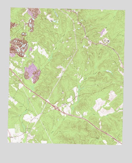
Marion, GA USGS Topographic Map
Click on map above to begin viewing in our Map Viewer.

This topographic map contains these locations and features:
Feature Name Type Latitude Longitude GNIS ID View Map
Beckham CemeteryCemeteryN32.6257°W83.4880°345408View Map
Beech Spring Academy (historical)SchoolN32.6379°W83.4791°345409View Map
Beech Spring CemeteryCemeteryN32.6383°W83.4791°345410View Map
Beech Spring ChurchChurchN32.6382°W83.4791°354529View Map
Buck BranchStreamN32.6774°W83.4749°311947View Map
BullardPopulated PlaceN32.6304°W83.4971°354908View Map
Bullard School (historical)SchoolN32.6307°W83.4977°345411View Map
Exit 7CrossingN32.6579°W83.4474°1705075View Map
Finch CemeteryCemeteryN32.7287°W83.4563°314121View Map
FitzpatrickPopulated PlaceN32.7488°W83.4374°355810View Map
Glover CemeteryCemeteryN32.7007°W83.4746°345427View Map
Jones - Denson CemeteryCemeteryN32.7192°W83.4222°345433View Map
Land CemeteryCemeteryN32.7008°W83.4730°316610View Map
Lanier LakeReservoirN32.7453°W83.4502°316644View Map
Lanier Lake DamDamN32.7454°W83.4502°340734View Map
Linda Melton Late CemeteryCemeteryN32.7112°W83.4888°345437View Map
Mallory LakeReservoirN32.7384°W83.4517°317648View Map
Mallory Lake DamDamN32.7382°W83.4516°340736View Map
MarionPopulated PlaceN32.6624°W83.4371°326386View Map
Marion CemeteryCemeteryN32.6612°W83.4372°345440View Map
Marion School (historical)SchoolN32.6624°W83.4382°345442View Map
Mount Zion ChurchChurchN32.7196°W83.4010°345445View Map
Mount Zion School (historical)SchoolN32.7193°W83.4013°334741View Map
New Mount Zion ChurchChurchN32.7315°W83.4193°334743View Map
North Twiggs DivisionCivilN32.7450°W83.4113°1936601View Map
O'Daniel CemeteryCemeteryN32.6485°W83.4716°319727View Map
Old Marion ChurchChurchN32.6615°W83.4374°345448View Map
Pearce CemeteryCemeteryN32.6588°W83.4841°320318View Map
Richland CemeteryCemeteryN32.6307°W83.4004°345451View Map
Richland ChurchChurchN32.6307°W83.4007°321577View Map
Richland School (historical)SchoolN32.6304°W83.4010°345452View Map
RipleyPopulated PlaceN32.7251°W83.4171°356499View Map
Rosebud ChurchChurchN32.7446°W83.4268°334745View Map
Shiloh ChurchChurchN32.7321°W83.4185°334746View Map
State of GeorgiaCivilN32.6386°W83.4271°1705317View Map
Stone LakeReservoirN32.6935°W83.3932°340550View Map
Stone Lake DamDamN32.6935°W83.3932°340549View Map
Turvin CreekStreamN32.6496°W83.4363°324429View Map
Twiggs CountyCivilN32.6672°W83.4271°345456View Map
Wall CemeteryCemeteryN32.7407°W83.4624°324794View Map
White Spring ChurchChurchN32.7149°W83.4924°325193View Map
White Springs School (historical)SchoolN32.7146°W83.4924°334747View Map
WWST-FM (Jeffersonville)TowerN32.7243°W83.4243°352712View Map

Note: Coordinates in the location and feature list above are referenced to NAD83 datum.


Copyright (C) 2008-2024 Ryan Niemi / Sunset Dynamics ... All Rights Reserved