TopoQuest Logo
Do you find TopoQuest useful?
Help keep TopoQuest running and adding new maps/features by donating!
Bitcoin:  19c7KJd3qBynnjoSw5npx9KScwjBe4ifkT
Litecoin:  LXs6TkuXGGXo1vDsWCkWVdjQX94eUKd6ui
Home View Maps Find Maps Find Places Resources & Links


Darfur, Minnesota Topographic Map

USGS Map Title: Darfur, MN
USGS Map MRC: 44094A7
DRG (GeoTIFF) Download: o44094a7.tif


Neighboring USGS Topographic Map Quads:


  Springfield, MN  
44094B8
 

  Leavenworth, MN  
44094B7
 

  Lake Hanska West, MN  
44094B6
 

  Comfrey, MN  
44094A8
 

  Darfur, MN  
44094A7
 

  Godahl, MN  
44094A6
 

  Mountain Lake, MN  
43094H8
 

  Butterfield, MN  
43094H7
 

  Saint James West, MN  
43094H6


Map MRC Location:

N45°
W95°
N45°
W94°
H8 H7 H6 H5 H4 H3 H2 H1
G8 G7 G6 G5 G4 G3 G2 G1
F8 F7 F6 F5 F4 F3 F2 F1
E8 E7 E6 E5 E4 E3 E2 E1
D8 D7 D6 D5 D4 D3 D2 D1
C8 C7 C6 C5 C4 C3 C2 C1
B8 B7 B6 B5 B4 B3 B2 B1
A8 A7 A6 A5 A4 A3 A2 A1
N44°
W95°
N44°
W94°

Darfur, MN USGS 1:24K Topographic Map Preview:
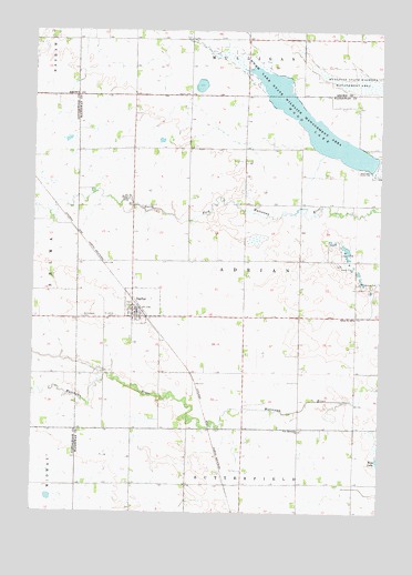
Darfur, MN USGS Topographic Map
Click on map above to begin viewing in our Map Viewer.

This topographic map contains these locations and features:
Feature Name Type Latitude Longitude GNIS ID View Map
Bethlehem CemeteryCemeteryN44.0505°W94.8578°640047View Map
Bethlehem Lutheran ChurchChurchN44.0522°W94.8397°2050955View Map
City of DarfurCivilN44.0538°W94.8357°2393719View Map
DarfurPopulated PlaceN44.0513°W94.8380°642638View Map
Darfur (historical)LocaleN44.0533°W94.8369°2050956View Map
Darfur Branch LibraryBuildingN44.0519°W94.8392°2050950View Map
Darfur City HallBuildingN44.0519°W94.8392°2050951View Map
Darfur Fire DepartmentBuildingN44.0520°W94.8377°2050952View Map
Darfur Post OfficePost OfficeN44.0519°W94.8392°2050953View Map
First Mennonite CemeteryCemeteryN44.0213°W94.7780°2050989View Map
First Mennonite ChurchChurchN44.0213°W94.7786°643662View Map
Haseman Post CemeteryCemeteryN44.0213°W94.8091°2050988View Map
Saint Johns CemeteryCemeteryN44.0508°W94.8453°650659View Map
Salem CemeteryCemeteryN44.1086°W94.8192°2063769View Map
School Number 2492SchoolN44.0508°W94.7591°651592View Map
Township of AdrianCivilN44.0652°W94.7987°663382View Map
Wood LakeReservoirN44.1007°W94.7743°654336View Map
Wood Lake State Wildlife Management AreaParkN44.1033°W94.7800°654340View Map

Note: Coordinates in the location and feature list above are referenced to NAD83 datum.


Copyright (C) 2008-2025 Ryan Niemi / Sunset Dynamics ... All Rights Reserved