TopoQuest Logo
Do you find TopoQuest useful?
Help keep TopoQuest running and adding new maps/features by donating!
Bitcoin:  19c7KJd3qBynnjoSw5npx9KScwjBe4ifkT
Litecoin:  LXs6TkuXGGXo1vDsWCkWVdjQX94eUKd6ui
Home View Maps Find Maps Find Places Resources & Links


Mountain Lake, Minnesota Topographic Map

USGS Map Title: Mountain Lake, MN
USGS Map MRC: 43094H8
DRG (GeoTIFF) Download: o43094h8.tif


Neighboring USGS Topographic Map Quads:


  Sanborn SE, MN  
44095A1
 

  Comfrey, MN  
44094A8
 

  Darfur, MN  
44094A7
 

  Bingham Lake, MN  
43095H1
 

  Mountain Lake, MN  
43094H8
 

  Butterfield, MN  
43094H7
 

  Windom, MN  
43095G1
 

  Bergen, MN  
43094G8
 

  Mountain Lake SE, MN  
43094G7


Map MRC Location:

N44°
W95°
N44°
W94°
H8 H7 H6 H5 H4 H3 H2 H1
G8 G7 G6 G5 G4 G3 G2 G1
F8 F7 F6 F5 F4 F3 F2 F1
E8 E7 E6 E5 E4 E3 E2 E1
D8 D7 D6 D5 D4 D3 D2 D1
C8 C7 C6 C5 C4 C3 C2 C1
B8 B7 B6 B5 B4 B3 B2 B1
A8 A7 A6 A5 A4 A3 A2 A1
N43°
W95°
N43°
W94°

Mountain Lake, MN USGS 1:24K Topographic Map Preview:
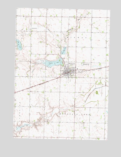
Mountain Lake, MN USGS Topographic Map
Click on map above to begin viewing in our Map Viewer.

This topographic map contains these locations and features:
Feature Name Type Latitude Longitude GNIS ID View Map
Alliance Missionary ChurchChurchN43.9405°W94.9328°2051094View Map
Bennett State Wildlife Management AreaParkN43.8869°W94.9880°639927View Map
Bethany Christian SchoolSchoolN43.9441°W94.9289°2051099View Map
Bethel Mennonite ChurchChurchN43.9388°W94.9319°2051090View Map
City of Mountain LakeCivilN43.9414°W94.9272°2395134View Map
County Ditch Number ThirtysevenCanalN43.9869°W94.8994°642016View Map
Evangelical Mennonite Brethren ChurchChurchN43.9450°W94.9300°2051087View Map
First Mennonite ChurchChurchN43.9380°W94.9350°2051089View Map
First Presbyterian ChurchChurchN43.9436°W94.9269°2051095View Map
Good Smaritan VillageHospitalN43.9425°W94.9361°2051097View Map
Heritage Village MuseumBuildingN43.9416°W94.9189°2051081View Map
Lakeview Gospel ChurchChurchN43.9494°W94.9350°2051091View Map
Lawcon ParkParkN43.9458°W94.9369°2051061View Map
Long LakeReservoirN43.9643°W94.9948°647109View Map
Mennonite Brethren ChurchChurchN43.9333°W94.9280°2051088View Map
Mennonite CemeteryCemeteryN43.9627°W94.9394°647767View Map
Mountain County ParkParkN43.9208°W94.8919°2051020View Map
Mountain LakePopulated PlaceN43.9388°W94.9297°648194View Map
Mountain LakeReservoirN43.9481°W94.9482°648195View Map
Mountain LakeLocaleN43.9375°W94.9300°2051086View Map
Mountain Lake Assembly of God ChurchChurchN43.9380°W94.9344°2051093View Map
Mountain Lake City ParkParkN43.9391°W94.9308°2051062View Map
Mountain Lake DamDamN43.9527°W94.9380°1776175View Map
Mountain Lake Golf ClubLocaleN43.9444°W94.9419°2051082View Map
Mountain Lake High SchoolSchoolN43.9416°W94.9258°2051098View Map
Mountain Lake Medical ClinicHospitalN43.9386°W94.9322°2051096View Map
Mountain Lake Police DepartmentBuildingN43.9385°W94.9307°2051085View Map
Mountain Lake Post OfficePost OfficeN43.9383°W94.9300°2051084View Map
Mountain Lake Public LibraryBuildingN43.9397°W94.9292°2051083View Map
Mountain Lake State Wildlife Management AreaParkN43.9488°W94.9642°648196View Map
Mountain Lake Volunteer Fire Department and Ambulance ServiceBuildingN43.9403°W94.9285°2666377View Map
Saint John's Lutheran CemeteryCemeteryN43.9486°W94.9358°2051002View Map
Township of MidwayCivilN43.9792°W94.9190°664967View Map
Township of Mountain LakeCivilN43.8910°W94.9192°665055View Map
Trinity Evangelical Lutheran ChurchChurchN43.9397°W94.9219°2051092View Map

Note: Coordinates in the location and feature list above are referenced to NAD83 datum.


Copyright (C) 2008-2025 Ryan Niemi / Sunset Dynamics ... All Rights Reserved