TopoQuest Logo
Do you find TopoQuest useful?
Help keep TopoQuest running and adding new maps/features by donating!
Bitcoin:  19c7KJd3qBynnjoSw5npx9KScwjBe4ifkT
Litecoin:  LXs6TkuXGGXo1vDsWCkWVdjQX94eUKd6ui
Home View Maps Find Maps Find Places Resources & Links


De Soto, Mississippi Topographic Map

USGS Map Title: De Soto, MS
USGS Map MRC: 31088H6
DRG (GeoTIFF) Download: o31088h6.tif


Neighboring USGS Topographic Map Quads:


  Wautubbee, MS  
32088A7
 

  Quitman, MS  
32088A6
 

  Sykes, MS  
32088A5
 

  Hale, MS  
31088H7
 

  De Soto, MS  
31088H6
 

  Carmichael, MS  
31088H5
 

  Eucutta, MS  
31088G7
 

  Shubuta, MS  
31088G6
 

  Matherville, MS  
31088G5


Map MRC Location:

N32°
W89°
N32°
W88°
H8 H7 H6 H5 H4 H3 H2 H1
G8 G7 G6 G5 G4 G3 G2 G1
F8 F7 F6 F5 F4 F3 F2 F1
E8 E7 E6 E5 E4 E3 E2 E1
D8 D7 D6 D5 D4 D3 D2 D1
C8 C7 C6 C5 C4 C3 C2 C1
B8 B7 B6 B5 B4 B3 B2 B1
A8 A7 A6 A5 A4 A3 A2 A1
N31°
W89°
N31°
W88°

De Soto, MS USGS 1:24K Topographic Map Preview:
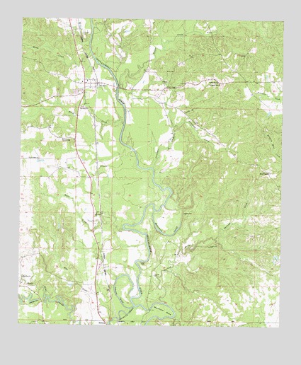
De Soto, MS USGS Topographic Map
Click on map above to begin viewing in our Map Viewer.

This topographic map contains these locations and features:
Feature Name Type Latitude Longitude GNIS ID View Map
Barber Lake (historical)LakeN31.9432°W88.6973°687490View Map
Bethea CemeteryCemeteryN31.9210°W88.6714°666876View Map
Bethel CemeteryCemeteryN31.9746°W88.6800°666881View Map
Bethel ChurchChurchN31.9788°W88.6773°666915View Map
Black CreekStreamN31.9571°W88.7006°667212View Map
Bogue HomoStreamN31.8868°W88.7356°690983View Map
Brown ChapelChurchN31.9724°W88.6800°667623View Map
Center Ridge Baptist ChurchChurchN31.9429°W88.7412°668250View Map
Center Ridge CemeteryCemeteryN31.9424°W88.7414°709417View Map
Center Ridge School (historical)SchoolN31.9432°W88.7414°709418View Map
Church of GodChurchN31.9510°W88.7298°668457View Map
Coonipper CreekStreamN31.9390°W88.6864°668806View Map
Covington CemeteryCemeteryN31.9943°W88.7209°668890View Map
De SotoPopulated PlaceN31.9738°W88.7134°669157View Map
De Soto Baptist ChurchChurchN31.9749°W88.7187°687503View Map
De Soto CemeteryCemeteryN31.9713°W88.7200°709422View Map
Desoto Volunteer Fire DepartmentBuildingN31.9737°W88.7224°2668070View Map
Duke Lake DamDamN31.9668°W88.7134°680964View Map
Fallen CreekStreamN31.9727°W88.7034°669901View Map
Garland CreekStreamN31.8843°W88.6803°670320View Map
Gin (historical)Populated PlaceN31.9157°W88.6306°687514View Map
Heard CemeteryCemeteryN31.9001°W88.6898°671051View Map
Hephzibah ChurchChurchN31.8940°W88.7484°671122View Map
Hepzibah CemeteryCemeteryN31.8940°W88.7481°709437View Map
Johnson CutoffGutN31.8927°W88.7025°671944View Map
Liberty Hill CemeteryCemeteryN31.9082°W88.6589°672462View Map
Liberty Hill Church (historical)ChurchN31.9082°W88.6584°687528View Map
Little Zion Church (historical)ChurchN31.9010°W88.7112°687530View Map
Little Zion School (historical)SchoolN31.9015°W88.7112°709440View Map
Martinere BendBendN31.8807°W88.6814°673199View Map
McCormick CutoffLakeN31.9124°W88.6796°673314View Map
Mike CreekStreamN31.8777°W88.7045°673558View Map
North Shubuta Oil FieldOilfieldN31.8835°W88.7320°709454View Map
Oak Grove ChurchChurchN31.9207°W88.7131°675032View Map
Oak Grove School (historical)SchoolN31.9207°W88.7137°709455View Map
Old Spring Hill ChurchChurchN31.9740°W88.6550°675258View Map
Polly BranchStreamN31.9588°W88.6712°676187View Map
Raymond Harris Pond DamDamN31.9385°W88.6800°680951View Map
Rocky CreekStreamN31.9865°W88.7170°676787View Map
Saint John School (historical)SchoolN31.9632°W88.7220°709468View Map
Saint Johns ChurchChurchN31.9635°W88.7217°677078View Map
Sels PrairiePopulated PlaceN31.9382°W88.6309°692218View Map
Shubuta CreekStreamN31.8829°W88.6942°690990View Map
Soot CreekStreamN31.8790°W88.6756°677978View Map
Spring Hill Baptist ChurchChurchN31.9746°W88.6559°678115View Map
Spring Hill Negro School (historical)SchoolN31.9824°W88.6550°709476View Map
Starling Mill (historical)LocaleN31.8877°W88.7442°687557View Map
SumrallPopulated PlaceN31.9071°W88.7125°711141View Map
Watts CreekStreamN31.9149°W88.7000°679387View Map
Winston Gate (historical)LocaleN31.8771°W88.6361°687569View Map
Young Blood CreekStreamN31.9952°W88.6681°687570View Map

Note: Coordinates in the location and feature list above are referenced to NAD83 datum.


Copyright (C) 2008-2025 Ryan Niemi / Sunset Dynamics ... All Rights Reserved