TopoQuest Logo
Do you find TopoQuest useful?
Help keep TopoQuest running and adding new maps/features by donating!
Bitcoin:  19c7KJd3qBynnjoSw5npx9KScwjBe4ifkT
Litecoin:  LXs6TkuXGGXo1vDsWCkWVdjQX94eUKd6ui
Home View Maps Find Maps Find Places Resources & Links


Carmichael, Mississippi Topographic Map

USGS Map Title: Carmichael, MS
USGS Map MRC: 31088H5
DRG (GeoTIFF) Download: o31088h5.tif


Neighboring USGS Topographic Map Quads:


  Quitman, MS  
32088A6
 

  Sykes, MS  
32088A5
 

  Hinton, AL  
32088A4
 

  De Soto, MS  
31088H6
 

  Carmichael, MS  
31088H5
 

  Melvin, AL  
31088H4
 

  Shubuta, MS  
31088G6
 

  Matherville, MS  
31088G5
 

  Isney, AL  
31088G4


Map MRC Location:

N32°
W89°
N32°
W88°
H8 H7 H6 H5 H4 H3 H2 H1
G8 G7 G6 G5 G4 G3 G2 G1
F8 F7 F6 F5 F4 F3 F2 F1
E8 E7 E6 E5 E4 E3 E2 E1
D8 D7 D6 D5 D4 D3 D2 D1
C8 C7 C6 C5 C4 C3 C2 C1
B8 B7 B6 B5 B4 B3 B2 B1
A8 A7 A6 A5 A4 A3 A2 A1
N31°
W89°
N31°
W88°

Carmichael, MS USGS 1:24K Topographic Map Preview:
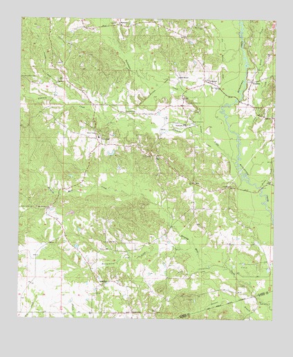
Carmichael, MS USGS Topographic Map
Click on map above to begin viewing in our Map Viewer.

This topographic map contains these locations and features:
Feature Name Type Latitude Longitude GNIS ID View Map
Andrew ChapelChurchN31.9521°W88.5875°666265View Map
Andrews Chapel CemeteryCemeteryN31.9526°W88.5875°709410View Map
Bass Everett CemeteryCemeteryN31.9965°W88.5356°666561View Map
Beckman Lake DamDamN31.9168°W88.6000°680943View Map
Bell School (historical)SchoolN31.9610°W88.5673°687492View Map
Berry CemeteryCemeteryN31.9418°W88.5581°666849View Map
Berry Church (historical)ChurchN31.9354°W88.5567°687494View Map
Bolingchessa CreekStreamN31.9021°W88.5364°667407View Map
BrewerPopulated PlaceN31.9749°W88.6061°691727View Map
Brush CreekStreamN31.9710°W88.5064°667666View Map
Bryan School (historical)SchoolN31.9007°W88.5220°687497View Map
Calvary Hill ChurchChurchN31.9068°W88.5814°667950View Map
CarmichaelPopulated PlaceN31.9515°W88.5848°668067View Map
Carmichael CemeteryCemeteryN31.9651°W88.5414°668069View Map
Carmichael Oil FieldOilfieldN31.9538°W88.5864°668071View Map
Carmichael SchoolSchoolN31.9504°W88.5861°709415View Map
Carmichael Volunteer Fire DepartmentBuildingN31.9506°W88.5870°2667909View Map
Cedar CreekStreamN31.9510°W88.5178°668183View Map
Cedar School (historical)SchoolN31.9877°W88.5009°687499View Map
Claude Mauley Lake DamDamN31.9418°W88.5784°680953View Map
CrandallPopulated PlaceN31.9746°W88.5323°668926View Map
Davis Poultry FarmLocaleN31.9111°W88.5231°2664460View Map
Double CreekStreamN31.9302°W88.5070°669345View Map
Evans BridgeBridgeN31.9299°W88.5061°687510View Map
Fivemile CreekStreamN31.9415°W88.5181°670008View Map
HornPopulated PlaceN31.9318°W88.5398°691943View Map
Horne School (historical)SchoolN31.9318°W88.5392°709438View Map
Indian MoundLocaleN31.9754°W88.5475°671695View Map
Junction CityPopulated PlaceN31.9610°W88.5731°691974View Map
Junction City Oil FieldOilfieldN31.9863°W88.5978°672057View Map
LangsdalePopulated PlaceN31.8890°W88.5845°691997View Map
Lees ChapelChurchN31.9718°W88.5278°672391View Map
Liberty Church (historical)ChurchN31.9207°W88.6178°687527View Map
Lindsey School (historical)SchoolN31.9324°W88.6084°687529View Map
Little Rock ChurchChurchN31.9304°W88.5211°672665View Map
Lucky School (historical)SchoolN31.9168°W88.5873°687531View Map
MannassaPopulated PlaceN31.9974°W88.5764°692040View Map
Mannassa CemeteryCemeteryN31.9979°W88.5792°709442View Map
Mannassa Methodist ChurchChurchN31.9982°W88.5789°709443View Map
Mannassa School (historical)SchoolN31.9990°W88.5606°687532View Map
MathervillePopulated PlaceN31.8774°W88.5689°692049View Map
Mount Nebo ChurchChurchN31.9635°W88.5100°674090View Map
Mount Olive ChurchChurchN31.9210°W88.6117°674126View Map
Mount Olive School (historical)SchoolN31.9213°W88.6111°709448View Map
Poplar Springs ChurchChurchN31.8824°W88.5061°676239View Map
Providence CemeteryCemeteryN31.9421°W88.5603°709462View Map
Providence ChurchChurchN31.9427°W88.5603°676378View Map
Quitman Lookout TowerTowerN31.9752°W88.6242°711299View Map
Shady Grove CemeteryCemeteryN31.9576°W88.5403°677542View Map
Shady Grove ChurchChurchN31.9563°W88.5436°677565View Map
Supervisor District 5CivilN31.9574°W88.5718°711817View Map
Tallabogue CreekStreamN31.9638°W88.5256°678543View Map
Theads BridgeBridgeN31.9660°W88.5178°687558View Map
Theadsville Volunteer Fire DepartmentBuildingN31.9647°W88.5117°2667846View Map
ThreadvillePopulated PlaceN31.9743°W88.5114°678734View Map
Union Church (historical)ChurchN31.9849°W88.6098°687560View Map
West Langsdale Oil FieldOilfieldN31.8968°W88.5286°679505View Map
White Liberty CemeteryCemeteryN31.9207°W88.6184°679595View Map
Zion ChapelChurchN31.9324°W88.5014°679984View Map

Note: Coordinates in the location and feature list above are referenced to NAD83 datum.


Copyright (C) 2008-2025 Ryan Niemi / Sunset Dynamics ... All Rights Reserved