TopoQuest Logo
Do you find TopoQuest useful?
Help keep TopoQuest running and adding new maps/features by donating!
Bitcoin:  19c7KJd3qBynnjoSw5npx9KScwjBe4ifkT
Litecoin:  LXs6TkuXGGXo1vDsWCkWVdjQX94eUKd6ui
Home View Maps Find Maps Find Places Resources & Links


De Soto, Wisconsin Topographic Map

USGS Map Title: De Soto, WI
USGS Map MRC: 43091D2
DRG (GeoTIFF) Download: o43091d2.tif


Neighboring USGS Topographic Map Quads:


  Reno, MN  
43091E3
 

  Genoa, WI  
43091E2
 

  Newton, WI  
43091E1
 

  New Albin, IA  
43091D3
 

  De Soto, WI  
43091D2
 

  Retreat, WI  
43091D1
 

  Church, IA  
43091C3
 

  Lansing, IA  
43091C2
 

  Ferryville, WI  
43091C1


Map MRC Location:

N44°
W92°
N44°
W91°
H8 H7 H6 H5 H4 H3 H2 H1
G8 G7 G6 G5 G4 G3 G2 G1
F8 F7 F6 F5 F4 F3 F2 F1
E8 E7 E6 E5 E4 E3 E2 E1
D8 D7 D6 D5 D4 D3 D2 D1
C8 C7 C6 C5 C4 C3 C2 C1
B8 B7 B6 B5 B4 B3 B2 B1
A8 A7 A6 A5 A4 A3 A2 A1
N43°
W92°
N43°
W91°

De Soto, WI USGS 1:24K Topographic Map Preview:
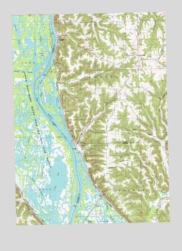
De Soto, WI USGS Topographic Map
Click on map above to begin viewing in our Map Viewer.

This topographic map contains these locations and features:
Feature Name Type Latitude Longitude GNIS ID View Map
Asbury RidgeRidgeN43.4964°W91.1676°1560970View Map
Asbury School (historical)SchoolN43.4950°W91.1626°1840709View Map
Bates HollowValleyN43.3855°W91.1408°1561303View Map
Battle Bluff Prairie State Natural AreaParkN43.4564°W91.2007°2060496View Map
Battle CreekStreamN43.4514°W91.2141°2760699View Map
Battle HollowValleyN43.4569°W91.2124°1561307View Map
Battle Hollow School (historical)SchoolN43.4586°W91.2112°1840710View Map
Battle IslandIslandN43.4580°W91.2304°1561308View Map
Battle SloughGutN43.4572°W91.2287°1561311View Map
Bean HollowValleyN43.4318°W91.1254°1561336View Map
Big LakeLakeN43.4021°W91.2162°454615View Map
Big SloughChannelN43.4194°W91.2401°454626View Map
Conway LakeLakeN43.4031°W91.2492°2729927View Map
Cooley Valley School (historical)SchoolN43.4233°W91.1274°1840716View Map
De SotoPopulated PlaceN43.4230°W91.1990°1563761View Map
De Soto High SchoolSchoolN43.4284°W91.1954°1833821View Map
De Soto Middle SchoolSchoolN43.4286°W91.1953°2715682View Map
De Soto Volunteer Fire DepartmentBuildingN43.4217°W91.1986°2697912View Map
DeSoto BayBayN43.4464°W91.2135°1563762View Map
Elm Park School (historical)SchoolN43.3928°W91.1276°1846359View Map
Ferry SloughGutN43.4083°W91.1954°1846362View Map
Fish LakeLakeN43.4839°W91.2369°2729922View Map
Green LakeLakeN43.4527°W91.2233°2746959View Map
Henderson IslandIslandN43.4766°W91.2279°457394View Map
Henderson SloughGutN43.3866°W91.1854°1566299View Map
Howarth RidgeRidgeN43.4028°W91.1751°1566770View Map
Howarth School (historical)SchoolN43.4008°W91.1735°1846386View Map
Hummingbird SloughGutN43.3932°W91.2041°2746961View Map
Lansing Big Lake Public Hunting AreaParkN43.4011°W91.2176°463776View Map
Launsom LakeLakeN43.4211°W91.2210°2729925View Map
Lawrence HillSummitN43.4161°W91.1762°1567891View Map
Lawrence RidgeRidgeN43.4353°W91.1735°1834472View Map
Lawrence Ridge CemeteryCemeteryN43.4080°W91.1748°1846394View Map
Little SloughGutN43.4405°W91.2414°2783857View Map
Lost ChannelGutN43.4850°W91.2273°2729924View Map
McDonald SloughChannelN43.4082°W91.2307°458905View Map
Middle SloughChannelN43.3958°W91.2301°459054View Map
Minnesota SloughStreamN43.4816°W91.2318°459140View Map
Partridge School (historical)SchoolN43.4744°W91.1529°1840723View Map
Paulson HollowValleyN43.3908°W91.1328°1571094View Map
Peck LakeLakeN43.4473°W91.2250°2746960View Map
Phillipi LakeLakeN43.3908°W91.2359°2729926View Map
Pigpen SloughStreamN43.4930°W91.2487°460135View Map
Red MoundPopulated PlaceN43.4725°W91.1449°1577788View Map
Rush Creek State Natural AreaParkN43.3797°W91.1362°2059858View Map
Sunnyside School (historical)SchoolN43.4555°W91.1604°1840727View Map
Town of WheatlandCivilN43.4599°W91.1635°1584422View Map
Upper Iowa RiverStreamN43.4664°W91.2337°462496View Map
VictoryPopulated PlaceN43.4855°W91.2126°1576083View Map
Victory Census Designated PlaceCensusN43.4831°W91.2055°2586566View Map
Village of De SotoCivilN43.4284°W91.1964°1583078View Map
Wheatland Volunteer Fire DepartmentBuildingN43.4721°W91.1447°2697908View Map
Winneshiek BluffCliffN43.4316°W91.2057°1576882View Map

Note: Coordinates in the location and feature list above are referenced to NAD83 datum.


Copyright (C) 2008-2025 Ryan Niemi / Sunset Dynamics ... All Rights Reserved