TopoQuest Logo
Do you find TopoQuest useful?
Help keep TopoQuest running and adding new maps/features by donating!
Bitcoin:  19c7KJd3qBynnjoSw5npx9KScwjBe4ifkT
Litecoin:  LXs6TkuXGGXo1vDsWCkWVdjQX94eUKd6ui
Home View Maps Find Maps Find Places Resources & Links


Genoa, Wisconsin Topographic Map

USGS Map Title: Genoa, WI
USGS Map MRC: 43091E2
DRG (GeoTIFF) Download: o43091e2.tif


Neighboring USGS Topographic Map Quads:


  Brownsville, MN  
43091F3
 

  Stoddard, WI  
43091F2
 

  Coon Valley, WI  
43091F1
 

  Reno, MN  
43091E3
 

  Genoa, WI  
43091E2
 

  Newton, WI  
43091E1
 

  New Albin, IA  
43091D3
 

  De Soto, WI  
43091D2
 

  Retreat, WI  
43091D1


Map MRC Location:

N44°
W92°
N44°
W91°
H8 H7 H6 H5 H4 H3 H2 H1
G8 G7 G6 G5 G4 G3 G2 G1
F8 F7 F6 F5 F4 F3 F2 F1
E8 E7 E6 E5 E4 E3 E2 E1
D8 D7 D6 D5 D4 D3 D2 D1
C8 C7 C6 C5 C4 C3 C2 C1
B8 B7 B6 B5 B4 B3 B2 B1
A8 A7 A6 A5 A4 A3 A2 A1
N43°
W92°
N43°
W91°

Genoa, WI USGS 1:24K Topographic Map Preview:
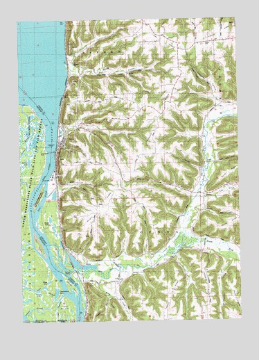
Genoa, WI USGS Topographic Map
Click on map above to begin viewing in our Map Viewer.

This topographic map contains these locations and features:
Feature Name Type Latitude Longitude GNIS ID View Map
Bad Axe LandingLocaleN43.5200°W91.2224°1834435View Map
Bad Axe RiverStreamN43.5203°W91.2224°1561062View Map
Bad Axe Valley School (historical)SchoolN43.5197°W91.1946°1843067View Map
Commodore LakeLakeN43.5125°W91.2301°641421View Map
Cox CreekStreamN43.5508°W91.1496°1563465View Map
Deadman HollowValleyN43.5891°W91.1350°1563780View Map
Elgar LakeLakeN43.5162°W91.2351°643241View Map
GenoaPopulated PlaceN43.5766°W91.2243°1565460View Map
Genoa Fish Hatchery Pond 3 DamDamN43.5224°W91.2157°1793130View Map
Genoa Fish Hatchery Pond One DamDamN43.5222°W91.2184°1793132View Map
Genoa Generating StationBuildingN43.5592°W91.2319°2392410View Map
Genoa National Fish HatcheryLocaleN43.5227°W91.2146°2729921View Map
Genoa RidgeRidgeN43.5647°W91.2082°1565462View Map
Genoa Volunteer Fire DepartmentBuildingN43.5786°W91.2251°2697962View Map
German CemeteryCemeteryN43.5166°W91.1943°1565476View Map
Gillette IslandIslandN43.5150°W91.2235°644146View Map
Goose LakeLakeN43.5104°W91.2393°644236View Map
Heck PointCapeN43.5164°W91.2126°1566259View Map
Hickory RidgeRidgeN43.5902°W91.1632°1566362View Map
Hickory Ridge School (historical)SchoolN43.5891°W91.1785°1843076View Map
Indian SloughStreamN43.5022°W91.2476°645423View Map
Island Number One Hundred ThirtyfiveIslandN43.5030°W91.2257°645506View Map
Italian HollowValleyN43.5552°W91.2282°1567045View Map
Johnson RidgeRidgeN43.5136°W91.1435°1567245View Map
Krause CemeteryCemeteryN43.6144°W91.1423°1567639View Map
Lepke School (historical)SchoolN43.6158°W91.1374°1843078View Map
Lock and Dam 8DamN43.5698°W91.2301°646987View Map
Lock and Dam Number 8DamN43.5700°W91.2318°1793080View Map
Lock and Dam Number 8DamN43.5705°W91.2321°1834476View Map
Lost ChannelChannelN43.5083°W91.2301°647196View Map
Mound RidgeRidgeN43.5466°W91.2043°1569794View Map
Mound Ridge School (historical)SchoolN43.5547°W91.1929°1843082View Map
North Fork Bad Axe RiverStreamN43.5278°W91.1646°1570427View Map
Pond One 0ReservoirN43.5199°W91.2352°1793133View Map
Pond Three 0LocaleN43.5227°W91.2113°1793131View Map
Pool 8ReservoirN43.5753°W91.2314°1793081View Map
Riley CreekStreamN43.5200°W91.2043°1572315View Map
Riverside CemeteryCemeteryN43.6075°W91.2185°1572357View Map
Riverside School (historical)SchoolN43.6102°W91.2193°1843087View Map
RomancePopulated PlaceN43.5522°W91.1449°1577795View Map
Romance Prairie State Natural AreaParkN43.5536°W91.1400°2085475View Map
Romance SchoolSchoolN43.5625°W91.1462°1572555View Map
Saint Charles Elementary SchoolSchoolN43.5731°W91.2248°2715772View Map
Saint Johns ChurchChurchN43.5172°W91.1937°1573086View Map
South Fork Bad Axe RiverStreamN43.5278°W91.1643°1574437View Map
Spring CouleeValleyN43.6048°W91.2207°1574608View Map
Thief SloughGutN43.5495°W91.2377°1575349View Map
Thompson HollowValleyN43.5251°W91.1314°1575380View Map
Town of GenoaCivilN43.5411°W91.1764°1583263View Map
Twin IslandIslandN43.5319°W91.2407°653411View Map
Victory RidgeRidgeN43.5033°W91.1960°1576087View Map
Village of GenoaCivilN43.5735°W91.2261°1583262View Map
Waller LakesLakeN43.5418°W91.2323°1576171View Map
Zabolio LakeLakeN43.5640°W91.2468°654431View Map

Note: Coordinates in the location and feature list above are referenced to NAD83 datum.


Copyright (C) 2008-2024 Ryan Niemi / Sunset Dynamics ... All Rights Reserved