TopoQuest Logo
Do you find TopoQuest useful?
Help keep TopoQuest running and adding new maps/features by donating!
Bitcoin:  19c7KJd3qBynnjoSw5npx9KScwjBe4ifkT
Litecoin:  LXs6TkuXGGXo1vDsWCkWVdjQX94eUKd6ui
Home View Maps Find Maps Find Places Resources & Links


Reno, Minnesota Topographic Map

USGS Map Title: Reno, MN
USGS Map MRC: 43091E3
DRG (GeoTIFF) Download: o43091e3.tif


Neighboring USGS Topographic Map Quads:


  Caledonia, MN  
43091F4
 

  Brownsville, MN  
43091F3
 

  Stoddard, WI  
43091F2
 

  Eitzen, MN  
43091E4
 

  Reno, MN  
43091E3
 

  Genoa, WI  
43091E2
 

  Waukon NW, IA  
43091D4
 

  New Albin, IA  
43091D3
 

  De Soto, WI  
43091D2


Map MRC Location:

N44°
W92°
N44°
W91°
H8 H7 H6 H5 H4 H3 H2 H1
G8 G7 G6 G5 G4 G3 G2 G1
F8 F7 F6 F5 F4 F3 F2 F1
E8 E7 E6 E5 E4 E3 E2 E1
D8 D7 D6 D5 D4 D3 D2 D1
C8 C7 C6 C5 C4 C3 C2 C1
B8 B7 B6 B5 B4 B3 B2 B1
A8 A7 A6 A5 A4 A3 A2 A1
N43°
W92°
N43°
W91°

Reno, MN USGS 1:24K Topographic Map Preview:
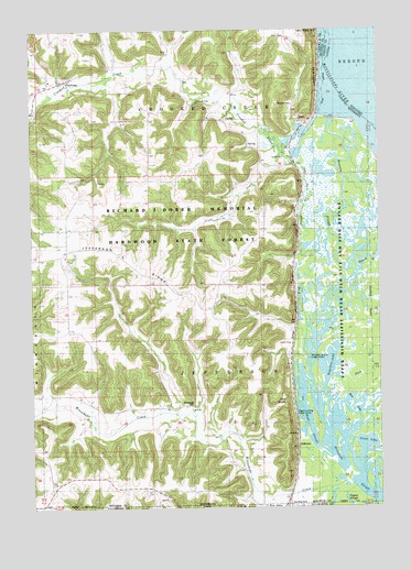
Reno, MN USGS Topographic Map
Click on map above to begin viewing in our Map Viewer.

This topographic map contains these locations and features:
Feature Name Type Latitude Longitude GNIS ID View Map
Bluff SloughGutN43.5625°W91.2790°640311View Map
Church of Peace CemeteryCemeteryN43.6058°W91.3151°641213View Map
Clear CreekStreamN43.5927°W91.2843°641267View Map
Crooked CreekStreamN43.5733°W91.2685°642456View Map
Dark SloughStreamN43.5341°W91.2646°642640View Map
Fairy RockSummitN43.6244°W91.2735°643528View Map
FreeburgPopulated PlaceN43.6111°W91.3643°643918View Map
Freeburg Post Office (historical)Post OfficeN43.6111°W91.3643°2050503View Map
Goose LakeLakeN43.5166°W91.2533°644237View Map
Hayshore LakeLakeN43.5378°W91.2673°644797View Map
Ice Haul SloughStreamN43.5141°W91.2690°645324View Map
JeffersonPopulated PlaceN43.5141°W91.2804°654638View Map
Jefferson RidgeRidgeN43.5672°W91.3476°645601View Map
Middle SloughGutN43.6211°W91.2544°2746958View Map
Millstone Landing Public AccessLocaleN43.5391°W91.2757°654829View Map
Mud LakeLakeN43.5249°W91.2556°648210View Map
New Albin CemeteryCemeteryN43.5001°W91.2919°1948937View Map
Old Methodist CemeteryCemeteryN43.6189°W91.3255°2050422View Map
Pickerel SloughStreamN43.5614°W91.2579°649385View Map
Pigpen SloughGutN43.5028°W91.2632°649403View Map
RenoLocaleN43.6011°W91.2751°2050487View Map
RenoPopulated PlaceN43.6011°W91.2751°649929View Map
Reno Bottoms Canoe TrailChannelN43.5835°W91.2626°2729531View Map
Reno Post Office (historical)Post OfficeN43.6011°W91.2751°2050488View Map
Richards Group Structure DamDamN43.6133°W91.3001°1776472View Map
Running SloughStreamN43.5614°W91.2579°650387View Map
Saint Nicholas Catholic CemeteryCemeteryN43.6122°W91.3640°2050423View Map
Sand SloughGutN43.5155°W91.2559°651170View Map
Township of Crooked CreekCivilN43.6069°W91.3225°663890View Map
Township of JeffersonCivilN43.5358°W91.3019°664578View Map
Twin BluffsCliffN43.5278°W91.2837°653408View Map
Visgers Landing Public AccessLocaleN43.5244°W91.2801°654987View Map
Winnebago CemeteryCemeteryN43.5269°W91.3168°654265View Map
Winnebago CreekStreamN43.5100°W91.2629°654266View Map

Note: Coordinates in the location and feature list above are referenced to NAD83 datum.


Copyright (C) 2008-2024 Ryan Niemi / Sunset Dynamics ... All Rights Reserved