TopoQuest Logo
Do you find TopoQuest useful?
Help keep TopoQuest running and adding new maps/features by donating!
Bitcoin:  19c7KJd3qBynnjoSw5npx9KScwjBe4ifkT
Litecoin:  LXs6TkuXGGXo1vDsWCkWVdjQX94eUKd6ui
Home View Maps Find Maps Find Places Resources & Links


Lincoln, Texas Topographic Map

USGS Map Title: Lincoln, TX
USGS Map MRC: 30096C8
DRG (GeoTIFF) Download: o30096c8.tif


Neighboring USGS Topographic Map Quads:


  Lexington, TX  
30097D1
 

  Tanglewood, TX  
30096D8
 

  Deanville, TX  
30096D7
 

  Fedor, TX  
30097C1
 

  Lincoln, TX  
30096C8
 

  Dime Box, TX  
30096C7
 

  Paige, TX  
30097B1
 

  Giddings, TX  
30096B8
 

  Ledbetter, TX  
30096B7


Map MRC Location:

N31°
W97°
N31°
W96°
H8 H7 H6 H5 H4 H3 H2 H1
G8 G7 G6 G5 G4 G3 G2 G1
F8 F7 F6 F5 F4 F3 F2 F1
E8 E7 E6 E5 E4 E3 E2 E1
D8 D7 D6 D5 D4 D3 D2 D1
C8 C7 C6 C5 C4 C3 C2 C1
B8 B7 B6 B5 B4 B3 B2 B1
A8 A7 A6 A5 A4 A3 A2 A1
N30°
W97°
N30°
W96°

Lincoln, TX USGS 1:24K Topographic Map Preview:
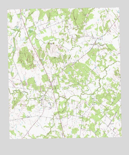
Lincoln, TX USGS Topographic Map
Click on map above to begin viewing in our Map Viewer.

This topographic map contains these locations and features:
Feature Name Type Latitude Longitude GNIS ID View Map
Blue Buck CreekStreamN30.3508°W96.9694°1372635View Map
Buzzard KnobsSummitN30.3410°W96.9539°1331771View Map
C and H LakeReservoirN30.3036°W96.9801°1863723View Map
C and H Lake DamDamN30.3019°W96.9803°1863722View Map
Cedar CreekStreamN30.3355°W96.9325°1332393View Map
Christ ChurchChurchN30.2824°W96.9066°1332803View Map
Copperas CemeteryCemeteryN30.3477°W96.9161°1333330View Map
Copperas CreekStreamN30.3433°W96.9136°1373210View Map
Doak Spring BranchStreamN30.3655°W96.9789°1334417View Map
Doak Spring SchoolSchoolN30.3605°W96.9450°1334418View Map
Doak SpringsSpringN30.3585°W96.9753°1998517View Map
Doak SpringsPopulated PlaceN30.3594°W96.9694°2034825View Map
Elm CreekStreamN30.2883°W96.9325°1373647View Map
Evergreen CemeteryCemeteryN30.2676°W96.9529°1335574View Map
Field BranchStreamN30.3349°W96.9303°1335766View Map
Gloyna CemeteryCemeteryN30.3160°W96.9394°1336601View Map
Gum SpringSpringN30.3327°W96.9872°1337127View Map
Indian Camp BranchStreamN30.3502°W96.9730°1374197View Map
Knox LakeLakeN30.3447°W96.8985°1339197View Map
Lee CountyCivilN30.3107°W96.9657°1383929View Map
LeoPopulated PlaceN30.3660°W96.9850°1378579View Map
LincolnPopulated PlaceN30.2874°W96.9633°1339937View Map
Lincoln Post OfficePost OfficeN30.2878°W96.9637°2732037View Map
Lincoln Volunteer Fire DepartmentBuildingN30.2840°W96.9645°2552468View Map
Lincoln-Dime Box DivisionCivilN30.3173°W96.9019°1938922View Map
LoebauPopulated PlaceN30.2877°W96.9053°1378593View Map
Loebau SidingLocaleN30.2635°W96.8880°1340325View Map
Marsh HollowValleyN30.3563°W96.9564°1374802View Map
Molty Smith LakeSwampN30.3538°W96.9746°1341795View Map
Moore BranchStreamN30.3385°W96.8858°1341860View Map
Mount Olive ChurchChurchN30.3463°W96.9039°1342074View Map
New Bethel CemeteryCemeteryN30.3738°W96.9778°1342431View Map
New Bethel ChurchChurchN30.3710°W96.9858°1342432View Map
Pin Oak CreekStreamN30.3458°W96.9422°1375456View Map
Saint James ChurchChurchN30.3477°W96.9097°1345912View Map
Saint Johns SchoolSchoolN30.2713°W96.9778°1345956View Map
Saint Peters CemeteryCemeteryN30.2802°W96.9591°1346100View Map
Scott CemeteryCemeteryN30.3716°W96.8886°1346813View Map
Smith ChapelChurchN30.2719°W96.8928°1347264View Map
The Colony Public LibraryBuildingN30.3005°W96.8855°2014733View Map
Warsaw BranchStreamN30.3672°W96.9780°1376648View Map
Wimberry LakeLakeN30.3577°W96.9894°1350282View Map

Note: Coordinates in the location and feature list above are referenced to NAD83 datum.


Copyright (C) 2008-2025 Ryan Niemi / Sunset Dynamics ... All Rights Reserved