TopoQuest Logo
Do you find TopoQuest useful?
Help keep TopoQuest running and adding new maps/features by donating!
Bitcoin:  19c7KJd3qBynnjoSw5npx9KScwjBe4ifkT
Litecoin:  LXs6TkuXGGXo1vDsWCkWVdjQX94eUKd6ui
Home View Maps Find Maps Find Places Resources & Links


Deerfield, Tennessee Topographic Map

USGS Map Title: Deerfield, TN
USGS Map MRC: 35087C4
DRG (GeoTIFF) Download: o35087c4.tif


Neighboring USGS Topographic Map Quads:


  Riverside, TN  
35087D5
 

  Henryville, TN  
35087D4
 

  Summertown, TN  
35087D3
 

  Ovilla, TN  
35087C5
 

  Deerfield, TN  
35087C4
 

  Ethridge, TN  
35087C3
 

  Westpoint, TN  
35087B5
 

  Long Branch, TN  
35087B4
 

  Lawrenceburg, TN  
35087B3


Map MRC Location:

N36°
W88°
N36°
W87°
H8 H7 H6 H5 H4 H3 H2 H1
G8 G7 G6 G5 G4 G3 G2 G1
F8 F7 F6 F5 F4 F3 F2 F1
E8 E7 E6 E5 E4 E3 E2 E1
D8 D7 D6 D5 D4 D3 D2 D1
C8 C7 C6 C5 C4 C3 C2 C1
B8 B7 B6 B5 B4 B3 B2 B1
A8 A7 A6 A5 A4 A3 A2 A1
N35°
W88°
N35°
W87°

Deerfield, TN USGS 1:24K Topographic Map Preview:
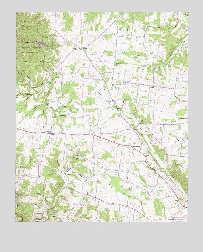
Deerfield, TN USGS Topographic Map
Click on map above to begin viewing in our Map Viewer.

This topographic map contains these locations and features:
Feature Name Type Latitude Longitude GNIS ID View Map
Bradley HollowValleyN35.2587°W87.4738°1278191View Map
Burns BranchStreamN35.3284°W87.4875°1279083View Map
CenterPopulated PlaceN35.3540°W87.4517°1280119View Map
Center School (historical)SchoolN35.3537°W87.4528°1317723View Map
Commissioner District 15CivilN35.2644°W87.3943°2464333View Map
DeerfieldPopulated PlaceN35.3029°W87.4750°1306320View Map
Deerfield Baptist ChurchChurchN35.3034°W87.4670°1641978View Map
Deerfield CemeteryCemeteryN35.3031°W87.4661°1641979View Map
Deerfield Church of ChristChurchN35.3015°W87.4556°1308160View Map
Deerfield Division (historical)CensusN35.3079°W87.4995°1648818View Map
Deerfield School (historical)SchoolN35.3031°W87.4653°1317724View Map
Dry BranchStreamN35.3204°W87.4789°1282876View Map
Dryden BranchStreamN35.2537°W87.4759°1283032View Map
Greenwood CemeteryCemeteryN35.3142°W87.4670°1641990View Map
Greenwood ChurchChurchN35.3142°W87.4681°1286202View Map
Howardville School (historical)SchoolN35.2820°W87.3995°1303011View Map
HudsonPopulated PlaceN35.3312°W87.4009°1315271View Map
Hudson School (historical)SchoolN35.3315°W87.4106°1303012View Map
Kelly SpringSpringN35.2548°W87.4803°1290043View Map
Kelly Spring BranchStreamN35.2526°W87.4803°1290046View Map
Kidd BranchStreamN35.3204°W87.4789°1290139View Map
Kilburn HollowValleyN35.2652°W87.4994°1290147View Map
Lourdes LakeLakeN35.3331°W87.4713°1292111View Map
Lutts BranchStreamN35.3159°W87.4722°1292319View Map
Macedonia CemeteryCemeteryN35.3395°W87.4317°1642004View Map
Macedonia ChurchChurchN35.3395°W87.4317°1292411View Map
Midway ChurchChurchN35.3456°W87.4284°1293732View Map
Mount Lebanon School (historical)SchoolN35.2665°W87.4506°1303032View Map
O K Missionary Baptist ChurchChurchN35.2598°W87.4195°1308199View Map
O K School (historical)SchoolN35.2601°W87.4200°1303039View Map
Park Grove ChurchChurchN35.3115°W87.3756°1296784View Map
Parker BranchStreamN35.3737°W87.3767°1296793View Map
Patterson BranchStreamN35.3231°W87.4809°1296924View Map
Pleasant Grove CemeteryCemeteryN35.2948°W87.4164°1297803View Map
Pleasant Grove ChurchChurchN35.3026°W87.4114°1297814View Map
Red HillPopulated PlaceN35.3059°W87.4156°1299049View Map
Sowell BranchStreamN35.2790°W87.3900°1270931View Map
Sowers BranchStreamN35.3198°W87.4784°1270937View Map
Spring BranchStreamN35.3070°W87.4136°1271045View Map
Sunnybrook CreekStreamN35.3167°W87.4242°1271862View Map
Theasing BranchStreamN35.3301°W87.4889°1272452View Map
Veterans of Foreign Wars DamDamN35.3567°W87.4867°1307108View Map
Veterans of Foreign Wars LakeReservoirN35.3567°W87.4867°1307107View Map
VFW LakeLakeN35.3561°W87.4810°1273319View Map
Wolfpen BranchStreamN35.3465°W87.4997°1274989View Map

Note: Coordinates in the location and feature list above are referenced to NAD83 datum.


Copyright (C) 2008-2024 Ryan Niemi / Sunset Dynamics ... All Rights Reserved