TopoQuest Logo
Do you find TopoQuest useful?
Help keep TopoQuest running and adding new maps/features by donating!
Bitcoin:  19c7KJd3qBynnjoSw5npx9KScwjBe4ifkT
Litecoin:  LXs6TkuXGGXo1vDsWCkWVdjQX94eUKd6ui
Home View Maps Find Maps Find Places Resources & Links


Deerfield, Indiana Topographic Map

USGS Map Title: Deerfield, IN
USGS Map MRC: 40084C8
DRG (GeoTIFF) Download: o40084c8.tif


Neighboring USGS Topographic Map Quads:


  Blaine, IN  
40085D1
 

  Portland, IN  
40084D8
 

  Fort Recovery, OH  
40084D7
 

  Ridgeville, IN  
40085C1
 

  Deerfield, IN  
40084C8
 

  Cosmos, OH  
40084C7
 

  Maxville, IN  
40085B1
 

  Winchester, IN  
40084B8
 

  Union City, IN  
40084B7


Map MRC Location:

N41°
W85°
N41°
W84°
H8 H7 H6 H5 H4 H3 H2 H1
G8 G7 G6 G5 G4 G3 G2 G1
F8 F7 F6 F5 F4 F3 F2 F1
E8 E7 E6 E5 E4 E3 E2 E1
D8 D7 D6 D5 D4 D3 D2 D1
C8 C7 C6 C5 C4 C3 C2 C1
B8 B7 B6 B5 B4 B3 B2 B1
A8 A7 A6 A5 A4 A3 A2 A1
N40°
W85°
N40°
W84°

Deerfield, IN USGS 1:24K Topographic Map Preview:
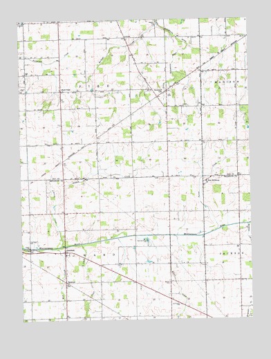
Deerfield, IN USGS Topographic Map
Click on map above to begin viewing in our Map Viewer.

This topographic map contains these locations and features:
Feature Name Type Latitude Longitude GNIS ID View Map
AntiochPopulated PlaceN40.3678°W84.9422°430199View Map
Bluff PointPopulated PlaceN40.3459°W84.9772°431262View Map
Boundary CityPopulated PlaceN40.3445°W84.9219°431379View Map
Buckeye CreekStreamN40.3734°W84.9247°431744View Map
Clear CreekStreamN40.2817°W84.9677°432608View Map
DeerfieldPopulated PlaceN40.2787°W84.9764°433436View Map
Flyin S RanchLocaleN40.3025°W84.9844°2710739View Map
Goshen CreekStreamN40.2975°W84.9822°435231View Map
Harshman CreekStreamN40.2895°W84.8769°435817View Map
Hawkins CemeteryCemeteryN40.3731°W84.9261°435902View Map
Kunce CemeteryCemeteryN40.3470°W84.9991°437476View Map
Lawn Dale CemeteryCemeteryN40.2831°W84.9961°437664View Map
Miller CreekStreamN40.2848°W84.9194°439199View Map
Mud CreekStreamN40.2800°W84.9841°439813View Map
New PittsburgPopulated PlaceN40.3075°W84.8991°449701View Map
O'Brien CreekStreamN40.2975°W84.9825°440385View Map
Old Prospect CemeteryCemeteryN40.2563°W84.9139°440586View Map
Porter CreekStreamN40.2873°W84.8936°441464View Map
R and R Hog FarmsLocaleN40.2608°W84.9278°2710732View Map
RandolphPopulated PlaceN40.2662°W84.9758°441763View Map
Reitenour CemeteryCemeteryN40.2792°W84.9939°441889View Map
Township of PikeCivilN40.3529°W84.9594°453734View Map
Township of WardCivilN40.2658°W84.9587°453973View Map
Weimer CemeteryCemeteryN40.2656°W84.9200°439991View Map
Woodbury FarmsLocaleN40.2672°W84.9961°2710734View Map
Zoar ChurchChurchN40.3528°W84.9966°446494View Map

Note: Coordinates in the location and feature list above are referenced to NAD83 datum.


Copyright (C) 2008-2024 Ryan Niemi / Sunset Dynamics ... All Rights Reserved