TopoQuest Logo
Do you find TopoQuest useful?
Help keep TopoQuest running and adding new maps/features by donating!
Bitcoin:  19c7KJd3qBynnjoSw5npx9KScwjBe4ifkT
Litecoin:  LXs6TkuXGGXo1vDsWCkWVdjQX94eUKd6ui
Home View Maps Find Maps Find Places Resources & Links


West Pierrepont, New York Topographic Map

USGS Map Title: West Pierrepont, NY
USGS Map MRC: 44075D1
DRG (GeoTIFF) Download: o44075d1.tif


Neighboring USGS Topographic Map Quads:


  Canton, NY  
44075E2
 

  Pierrepont, NY  
44075E1
 

  Colton, NY  
44074E8
 

  Hermon, NY  
44075D2
 

  West Pierrepont, NY  
44075D1
 

  Albert Marsh, NY  
44074D8
 

  South Edwards, NY  
44075C2
 

  Degrasse, NY  
44075C1
 

  Tooley Pond, NY  
44074C8


Map MRC Location:

N45°
W76°
N45°
W75°
H8 H7 H6 H5 H4 H3 H2 H1
G8 G7 G6 G5 G4 G3 G2 G1
F8 F7 F6 F5 F4 F3 F2 F1
E8 E7 E6 E5 E4 E3 E2 E1
D8 D7 D6 D5 D4 D3 D2 D1
C8 C7 C6 C5 C4 C3 C2 C1
B8 B7 B6 B5 B4 B3 B2 B1
A8 A7 A6 A5 A4 A3 A2 A1
N44°
W76°
N44°
W75°

West Pierrepont, NY USGS 1:24K Topographic Map Preview:
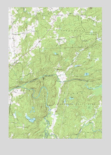
West Pierrepont, NY USGS Topographic Map
Click on map above to begin viewing in our Map Viewer.

This topographic map contains these locations and features:
Feature Name Type Latitude Longitude GNIS ID View Map
Alder BrookStreamN44.3895°W75.0227°975880View Map
Austins CornersLocaleN44.4684°W75.0252°975907View Map
Backus HillSummitN44.4156°W75.1030°975909View Map
Barbour HillSummitN44.4184°W75.0196°975918View Map
Bear CreekStreamN44.3831°W75.0052°975937View Map
Big SwampSwampN44.4045°W75.0174°975969View Map
Black BrookStreamN44.4203°W75.1241°975979View Map
Boyd PondLakeN44.3935°W75.0953°976007View Map
Brouses CornersLocaleN44.4409°W75.0608°976036View Map
Buck BrookStreamN44.4345°W75.0591°976046View Map
Buck PondLakeN44.4689°W75.0043°976052View Map
Bullhead PondLakeN44.4442°W75.0351°976059View Map
Burns FlatFlatN44.3887°W75.0763°976063View Map
Cedar SpringSpringN44.4267°W75.0013°976099View Map
ClarePopulated PlaceN44.4015°W75.0624°976139View Map
Clear LakeLakeN44.4365°W75.0209°976150View Map
Cold BrookStreamN44.3806°W75.0296°976161View Map
Conkey BranchStreamN44.4612°W75.0194°976177View Map
Coopers CornersLocaleN44.3903°W75.1166°976186View Map
Dean BrookStreamN44.4965°W75.0613°976232View Map
Deans CornersLocaleN44.4695°W75.0602°976233View Map
Deer Lick BrookStreamN44.4940°W75.0977°976234View Map
Donnerville State ForestForestN44.4248°W75.0930°976255View Map
Elm FlatFlatN44.4009°W75.0046°976293View Map
Endersbees CornersLocaleN44.4745°W75.1188°976299View Map
Harper FallsFallsN44.4353°W75.0746°977227View Map
Horseshoe PondLakeN44.4133°W75.0411°976459View Map
La Rock CreekStreamN44.4287°W75.0202°976529View Map
Lampsons FallsFallsN44.4056°W75.0713°977232View Map
Middle Branch Grass RiverStreamN44.3798°W75.0744°976655View Map
Moores AirportAirportN44.3878°W75.0678°977981View Map
Moores CornersLocaleN44.4928°W75.0283°976671View Map
Mud PondLakeN44.4106°W75.0496°976703View Map
North Branch Grass RiverStreamN44.4245°W75.1074°976730View Map
O'Brien BrookStreamN44.4362°W75.0533°976748View Map
Owens CornersLocaleN44.4470°W75.1155°976784View Map
Palmer HillSummitN44.4262°W75.0866°976788View Map
Pelkys FallsFallsN44.4290°W75.0202°977238View Map
Reynolds CornersLocaleN44.3862°W75.1055°976884View Map
Saint Lawrence CountyCivilN44.4964°W75.0690°977309View Map
Shingle PondLakeN44.4562°W75.0626°976988View Map
South Branch Grass RiverStreamN44.3801°W75.0744°977028View Map
Tamarack BranchStreamN44.4415°W75.0377°977095View Map
Taylor Creek State ForestForestN44.4831°W75.0191°977251View Map
The StillwaterStreamN44.4228°W75.0180°977110View Map
Van House CornersLocaleN44.4776°W75.0946°977168View Map
Van Rensselaer CreekStreamN44.4959°W75.0694°977169View Map
West PierrepontPopulated PlaceN44.4926°W75.0596°977256View Map

Note: Coordinates in the location and feature list above are referenced to NAD83 datum.


Copyright (C) 2008-2024 Ryan Niemi / Sunset Dynamics ... All Rights Reserved