TopoQuest Logo
Do you find TopoQuest useful?
Help keep TopoQuest running and adding new maps/features by donating!
Bitcoin:  19c7KJd3qBynnjoSw5npx9KScwjBe4ifkT
Litecoin:  LXs6TkuXGGXo1vDsWCkWVdjQX94eUKd6ui
Home View Maps Find Maps Find Places Resources & Links


Hermon, New York Topographic Map

USGS Map Title: Hermon, NY
USGS Map MRC: 44075D2
DRG (GeoTIFF) Download: o44075d2.tif


Neighboring USGS Topographic Map Quads:


  Rensselaer Falls, NY  
44075E3
 

  Canton, NY  
44075E2
 

  Pierrepont, NY  
44075E1
 

  Bigelow, NY  
44075D3
 

  Hermon, NY  
44075D2
 

  West Pierrepont, NY  
44075D1
 

  Edwards, NY  
44075C3
 

  South Edwards, NY  
44075C2
 

  Degrasse, NY  
44075C1


Map MRC Location:

N45°
W76°
N45°
W75°
H8 H7 H6 H5 H4 H3 H2 H1
G8 G7 G6 G5 G4 G3 G2 G1
F8 F7 F6 F5 F4 F3 F2 F1
E8 E7 E6 E5 E4 E3 E2 E1
D8 D7 D6 D5 D4 D3 D2 D1
C8 C7 C6 C5 C4 C3 C2 C1
B8 B7 B6 B5 B4 B3 B2 B1
A8 A7 A6 A5 A4 A3 A2 A1
N44°
W76°
N44°
W75°

Hermon, NY USGS 1:24K Topographic Map Preview:
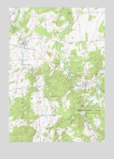
Hermon, NY USGS Topographic Map
Click on map above to begin viewing in our Map Viewer.

This topographic map contains these locations and features:
Feature Name Type Latitude Longitude GNIS ID View Map
Acres SchoolSchoolN44.4928°W75.2497°975874View Map
Beaver MeadowFlatN44.3845°W75.1697°975945View Map
Blanchard HillSummitN44.4017°W75.1333°975988View Map
Bullock CreekStreamN44.3870°W75.1888°976060View Map
Cancross CreekStreamN44.3892°W75.2035°976077View Map
Clarks CornersLocaleN44.4381°W75.1302°976144View Map
Danes CornersPopulated PlaceN44.4695°W75.1427°976219View Map
Derbys CornersPopulated PlaceN44.4084°W75.1524°976242View Map
Devils ElbowBendN44.4476°W75.1888°976244View Map
Earl IslandIslandN44.4465°W75.1763°976267View Map
Edmond BrookStreamN44.4353°W75.1677°976282View Map
Fairbanks CornersLocaleN44.4273°W75.2127°976301View Map
First Baptist ChurchChurchN44.4657°W75.2308°2597590View Map
Fordhams CornersPopulated PlaceN44.4003°W75.1927°976323View Map
Gibbons BrookStreamN44.4351°W75.1966°976344View Map
Hamilton HillSummitN44.4178°W75.1555°976401View Map
Hepburn Library of HermonBuildingN44.4669°W75.2307°2599063View Map
HermonPopulated PlaceN44.4673°W75.2305°976430View Map
Hermon Census Designated PlaceCensusN44.4670°W75.2312°2786716View Map
Hermon Fire DepartmentBuildingN44.4665°W75.2304°2718340View Map
Jacksons FallsFallsN44.4948°W75.1691°977231View Map
Kimball HillSummitN44.4473°W75.1435°976521View Map
Lazy River Game Bird FarmLocaleN44.4706°W75.1931°2559385View Map
MarshvillePopulated PlaceN44.4512°W75.2319°976631View Map
PalmervillePopulated PlaceN44.4176°W75.1280°976790View Map
Pleasant CreekStreamN44.4317°W75.1363°976831View Map
Plumb BrookStreamN44.4278°W75.1335°976840View Map
Plumb Brook FallsFallsN44.3978°W75.1496°2788110View Map
Putnams CornersLocaleN44.4676°W75.1710°976858View Map
RussellPopulated PlaceN44.4295°W75.1499°976917View Map
Russell Fire DepartmentBuildingN44.4290°W75.1502°2718473View Map
Russell Public LibraryBuildingN44.4291°W75.1502°2599224View Map
Russell Rescue SquadBuildingN44.4290°W75.1501°2720223View Map
Scotts CornersLocaleN44.4570°W75.1519°976970View Map
StalbirdPopulated PlaceN44.4001°W75.2063°977053View Map
StellavillePopulated PlaceN44.4806°W75.2430°977065View Map
Town of RussellCivilN44.4055°W75.1408°979442View Map
Village of Hermon (historical)CivilN44.4670°W75.2312°2390890View Map
Whippoorwill CornersLocaleN44.4037°W75.1555°977264View Map
Whippoorwill Corners State ForestForestN44.4034°W75.1408°977265View Map
WNYS-AM (Canton)TowerN44.4851°W75.2238°977586View Map

Note: Coordinates in the location and feature list above are referenced to NAD83 datum.


Copyright (C) 2008-2025 Ryan Niemi / Sunset Dynamics ... All Rights Reserved