TopoQuest Logo
Do you find TopoQuest useful?
Help keep TopoQuest running and adding new maps/features by donating!
Bitcoin:  19c7KJd3qBynnjoSw5npx9KScwjBe4ifkT
Litecoin:  LXs6TkuXGGXo1vDsWCkWVdjQX94eUKd6ui
Home View Maps Find Maps Find Places Resources & Links


Anthony, West Virginia Topographic Map

USGS Map Title: Anthony, WV
USGS Map MRC: 37080H3
DRG (GeoTIFF) Download: o37080h3.tif


Neighboring USGS Topographic Map Quads:


  Trout, WV  
38080A4
 

  Droop, WV  
38080A3
 

  Denmar, WV  
38080A2
 

  Williamsburg, WV  
37080H4
 

  Anthony, WV  
37080H3
 

  Alvon, WV  
37080H2
 

  Lewisburg, WV  
37080G4
 

  White Sulphur Springs, WV  
37080G3
 

  Jerrys Run, VA  
37080G2


Map MRC Location:

N38°
W81°
N38°
W80°
H8 H7 H6 H5 H4 H3 H2 H1
G8 G7 G6 G5 G4 G3 G2 G1
F8 F7 F6 F5 F4 F3 F2 F1
E8 E7 E6 E5 E4 E3 E2 E1
D8 D7 D6 D5 D4 D3 D2 D1
C8 C7 C6 C5 C4 C3 C2 C1
B8 B7 B6 B5 B4 B3 B2 B1
A8 A7 A6 A5 A4 A3 A2 A1
N37°
W81°
N37°
W80°

Anthony, WV USGS 1:24K Topographic Map Preview:
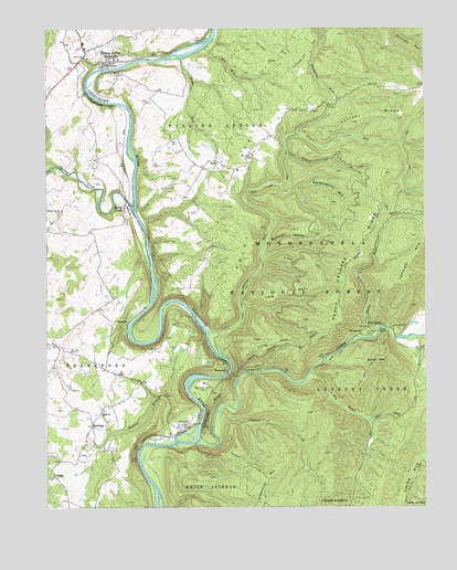
Anthony, WV USGS Topographic Map
Click on map above to begin viewing in our Map Viewer.

This topographic map contains these locations and features:
Feature Name Type Latitude Longitude GNIS ID View Map
AnthonyPopulated PlaceN37.8960°W80.3320°1553732View Map
Anthony Baptist ChurchChurchN37.8962°W80.3317°1556419View Map
Anthony Boat LaunchLocaleN37.8965°W80.3251°1553594View Map
Anthony CreekStreamN37.8918°W80.3262°1550109View Map
Anthony Post OfficePost OfficeN37.8951°W80.3306°1559379View Map
AutoPopulated PlaceN37.9654°W80.3192°1550127View Map
Auto Post OfficePost OfficeN37.9635°W80.3234°1559381View Map
Big DraftValleyN37.9104°W80.2887°1550292View Map
Big Draft WildernessReserveN37.8954°W80.2889°2767361View Map
Big RunStreamN37.9951°W80.3229°1550312View Map
Big Run TrailTrailN37.9896°W80.3106°1550340View Map
Blue BendBendN37.9210°W80.2640°1550391View Map
Blue BendPopulated PlaceN37.9218°W80.2687°1550392View Map
Blue Bend CampgroundLocaleN37.9204°W80.2709°1553578View Map
Blue Bend Loop TrailTrailN37.9079°W80.2773°1550393View Map
Blueline HollowValleyN37.9437°W80.3031°1550401View Map
Blueline TrailTrailN37.9387°W80.2904°1550402View Map
Boardinghouse RunStreamN37.9607°W80.2990°1553595View Map
Boardinghouse RunStreamN37.9604°W80.2984°1549531View Map
Boggs RunStreamN37.9923°W80.3312°1550414View Map
Burdett School (historical)SchoolN37.9837°W80.3379°1556256View Map
Burns Cave Number 2 SpringSpringN37.9604°W80.3642°1557490View Map
Civil War TrailTrailN37.9587°W80.2684°1550714View Map
Clendenin School (historical)SchoolN37.9790°W80.2945°1556266View Map
Coles Mountain TrailTrailN37.8823°W80.2537°1550767View Map
Dodson BranchStreamN37.8921°W80.3337°1550933View Map
Eastern DistrictCivilN37.9377°W80.3193°1928256View Map
Enon Baptist ChurchChurchN37.8998°W80.3567°1551063View Map
Falling SpringPopulated PlaceN37.9918°W80.3540°1551093View Map
Falling Spring School (historical)SchoolN37.9962°W80.3623°1558001View Map
Gabbert School (historical)SchoolN37.9446°W80.3217°1556287View Map
GardnerPopulated PlaceN37.9232°W80.3484°1554530View Map
Gilboa School (historical)SchoolN37.9368°W80.3584°1556291View Map
Greenbrier River TrailTrailN37.9951°W80.2987°1551295View Map
Greenbrier Youth CampLocaleN37.9076°W80.3226°1551299View Map
Gunpowder RidgeRidgeN37.9015°W80.3204°1551314View Map
Gunpowder Ridge OverlookLocaleN37.9098°W80.3115°1553593View Map
HenningPopulated PlaceN37.8962°W80.3598°1551411View Map
Henning Church of GodChurchN37.8887°W80.3640°1556435View Map
Henning School (historical)SchoolN37.8893°W80.3637°1556299View Map
Hopkins MountainSummitN37.9460°W80.2528°1551493View Map
Laurel CreekStreamN37.9001°W80.3187°1551703View Map
Laurel RunStreamN37.9201°W80.3217°1551737View Map
Laurel Run TrailTrailN37.9507°W80.3009°1551747View Map
Long SpurRidgeN37.9310°W80.2951°1551935View Map
Morning Side CemeteryCemeteryN37.9898°W80.3652°2586204View Map
Panther RidgeRidgeN37.9765°W80.2590°1552422View Map
Peach Orchard RidgeRidgeN37.9412°W80.2715°1552441View Map
Peach Orchard TrailTrailN37.9223°W80.2801°1552442View Map
Pleasant View School (historical)SchoolN37.9710°W80.3587°1556352View Map
Poley RidgeRidgeN37.9515°W80.3098°1552530View Map
Red RunStreamN37.9940°W80.2503°1552616View Map
Renick BridgeBridgeN37.9892°W80.3564°2646949View Map
Renick Post OfficePost OfficeN37.9930°W80.3616°1559659View Map
Renick Volunteer Fire DepartmentBuildingN37.9906°W80.3656°2577735View Map
Rocky RunStreamN37.9212°W80.2659°1552718View Map
Round MountainSummitN37.9137°W80.2656°1555531View Map
South Boundary TrailTrailN37.8865°W80.3092°1552963View Map
Spring CreekPopulated PlaceN37.9540°W80.3490°1555689View Map
Spring CreekStreamN37.9532°W80.3467°1553002View Map
Town of Falling SpringCivilN37.9927°W80.3575°2390175View Map
VagoPopulated PlaceN37.8829°W80.3723°1555866View Map
Walnut Grove CemeteryCemeteryN37.9523°W80.3698°1553363View Map
Walnut Grove Church (historical)ChurchN37.9529°W80.3698°1559377View Map
Woodland School (historical)SchoolN37.9646°W80.3262°1556389View Map
WoodmanPopulated PlaceN37.9121°W80.3154°1556021View Map

Note: Coordinates in the location and feature list above are referenced to NAD83 datum.


Copyright (C) 2008-2024 Ryan Niemi / Sunset Dynamics ... All Rights Reserved