TopoQuest Logo
Do you find TopoQuest useful?
Help keep TopoQuest running and adding new maps/features by donating!
Bitcoin:  19c7KJd3qBynnjoSw5npx9KScwjBe4ifkT
Litecoin:  LXs6TkuXGGXo1vDsWCkWVdjQX94eUKd6ui
Home View Maps Find Maps Find Places Resources & Links


Trout, West Virginia Topographic Map

USGS Map Title: Trout, WV
USGS Map MRC: 38080A4
DRG (GeoTIFF) Download: o38080a4.tif


Neighboring USGS Topographic Map Quads:


  Richwood, WV  
38080B5
 

  Fork Mountain, WV  
38080B4
 

  Lobelia, WV  
38080B3
 

  Duo, WV  
38080A5
 

  Trout, WV  
38080A4
 

  Droop, WV  
38080A3
 

  Cornstalk, WV  
37080H5
 

  Williamsburg, WV  
37080H4
 

  Anthony, WV  
37080H3


Map MRC Location:

N39°
W81°
N39°
W80°
H8 H7 H6 H5 H4 H3 H2 H1
G8 G7 G6 G5 G4 G3 G2 G1
F8 F7 F6 F5 F4 F3 F2 F1
E8 E7 E6 E5 E4 E3 E2 E1
D8 D7 D6 D5 D4 D3 D2 D1
C8 C7 C6 C5 C4 C3 C2 C1
B8 B7 B6 B5 B4 B3 B2 B1
A8 A7 A6 A5 A4 A3 A2 A1
N38°
W81°
N38°
W80°

Trout, WV USGS 1:24K Topographic Map Preview:
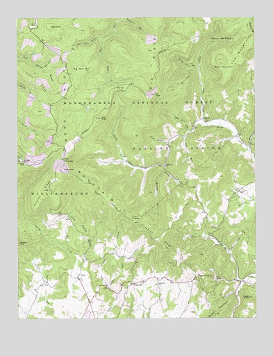
Trout, WV USGS Topographic Map
Click on map above to begin viewing in our Map Viewer.

This topographic map contains these locations and features:
Feature Name Type Latitude Longitude GNIS ID View Map
Baldwin School (historical)SchoolN38.0629°W80.4295°1556242View Map
Band of Hope ChurchChurchN38.0301°W80.3917°1550164View Map
Beard Lick RunStreamN38.1040°W80.4045°1550201View Map
Bee KnobSummitN38.0929°W80.4276°1550236View Map
Bee Lick RunStreamN38.0779°W80.4101°1553615View Map
Beverly ForkStreamN38.0635°W80.4226°1550280View Map
Big Bull HillSummitN38.1032°W80.4623°1550287View Map
Big RidgeRidgeN38.1057°W80.4304°1550303View Map
Blue KnobSummitN38.1215°W80.4823°1553931View Map
Blue Knob BranchStreamN38.1168°W80.4548°1550395View Map
Boggs KnobSummitN38.0082°W80.3784°1550413View Map
Brushy Flat School (historical)SchoolN38.0451°W80.3895°1556253View Map
Bull RunStreamN38.1043°W80.4887°1550552View Map
Camel BranchStreamN38.0732°W80.4201°1550591View Map
Camel BranchStreamN38.0779°W80.4098°1550592View Map
Carr BranchStreamN38.0140°W80.4523°1550639View Map
Charley KnobSummitN38.0318°W80.4995°1554111View Map
Charley RunStreamN38.0051°W80.4817°1550675View Map
Cherry Low PlaceBasinN38.1157°W80.3934°1550684View Map
Chestnut RidgeRidgeN38.0326°W80.4270°1550696View Map
Chestnut Ridge School (historical)SchoolN38.0518°W80.4067°1556265View Map
Cold KnobSummitN38.0621°W80.4754°1554173View Map
Cold Knob MountainRidgeN38.0685°W80.4737°1550757View Map
Cold Knob School (historical)SchoolN38.0396°W80.4709°1556270View Map
CordovaPopulated PlaceN38.0637°W80.4220°1550793View Map
Daniel RidgeRidgeN38.0526°W80.4854°1550869View Map
Dry RunStreamN38.0148°W80.3826°1550974View Map
Ellis KnobSummitN38.0835°W80.4559°1551056View Map
EstyPopulated PlaceN38.0151°W80.3829°1554412View Map
First Baptist Church of TroutChurchN38.0168°W80.4684°1556424View Map
Friars HillPopulated PlaceN38.0143°W80.4392°1554512View Map
Grassy KnobSummitN38.0651°W80.4970°1554597View Map
Grassy Knob Lookout TowerLocaleN38.0651°W80.4967°1556433View Map
LeonardPopulated PlaceN38.0829°W80.4034°1554942View Map
Little Roaring CreekStreamN38.0232°W80.4667°1551887View Map
Loop MountainRidgeN38.0957°W80.4140°1551937View Map
Low GapGapN38.0660°W80.4751°1551952View Map
Lowe SpringSpringN38.0043°W80.3915°1557551View Map
McMillion ChurchChurchN38.0143°W80.4262°1552040View Map
Mount Pleasant ChurchChurchN38.0137°W80.4879°1552214View Map
Mount Vale School (historical)SchoolN38.0254°W80.4654°1556331View Map
New Ellis ChapelChurchN38.0529°W80.3834°1552296View Map
New Piedmont School (historical)SchoolN38.0054°W80.4637°1556337View Map
Panther Camp CreekStreamN38.0798°W80.3998°1552415View Map
Pretty RidgeRidgeN38.1015°W80.4959°1552557View Map
Reed CemeteryCemeteryN38.0435°W80.4776°1552627View Map
Reid GapGapN38.0962°W80.4479°1552631View Map
Roaring CreekStreamN38.0107°W80.4695°1552683View Map
Rockcamp ChurchChurchN38.0743°W80.3767°1556356View Map
Rockcamp RunStreamN38.0704°W80.3792°1552705View Map
Short MountainSummitN38.1079°W80.3923°1552879View Map
Tom RunStreamN38.0751°W80.4112°1553248View Map
TroutPopulated PlaceN38.0168°W80.4679°1553262View Map
Trout Post OfficePost OfficeN38.0171°W80.4679°1559399View Map
Twin SugarsSummitN38.0398°W80.4379°1553299View Map
Vires School (historical)SchoolN38.0140°W80.4884°1556380View Map
Walton RunStreamN38.0340°W80.4354°1553366View Map
Williams SpringSpringN38.0182°W80.4762°1557622View Map
Wolfpen RunStreamN38.0615°W80.4226°1553508View Map

Note: Coordinates in the location and feature list above are referenced to NAD83 datum.


Copyright (C) 2008-2025 Ryan Niemi / Sunset Dynamics ... All Rights Reserved