TopoQuest Logo
Do you find TopoQuest useful?
Help keep TopoQuest running and adding new maps/features by donating!
Bitcoin:  19c7KJd3qBynnjoSw5npx9KScwjBe4ifkT
Litecoin:  LXs6TkuXGGXo1vDsWCkWVdjQX94eUKd6ui
Home View Maps Find Maps Find Places Resources & Links


Jerrys Run, Virginia Topographic Map

USGS Map Title: Jerrys Run, VA
USGS Map MRC: 37080G2
DRG (GeoTIFF) Download: o37080g2.tif


Neighboring USGS Topographic Map Quads:


  Anthony, WV  
37080H3
 

  Alvon, WV  
37080H2
 

  Rucker Gap, VA  
37080H1
 

  White Sulphur Springs, WV  
37080G3
 

  Jerrys Run, VA  
37080G2
 

  Callaghan, VA  
37080G1
 

  Glace, WV  
37080F3
 

  Alleghany, VA  
37080F2
 

  Jordan Mines, VA  
37080F1


Map MRC Location:

N38°
W81°
N38°
W80°
H8 H7 H6 H5 H4 H3 H2 H1
G8 G7 G6 G5 G4 G3 G2 G1
F8 F7 F6 F5 F4 F3 F2 F1
E8 E7 E6 E5 E4 E3 E2 E1
D8 D7 D6 D5 D4 D3 D2 D1
C8 C7 C6 C5 C4 C3 C2 C1
B8 B7 B6 B5 B4 B3 B2 B1
A8 A7 A6 A5 A4 A3 A2 A1
N37°
W81°
N37°
W80°

Jerrys Run, VA USGS 1:24K Topographic Map Preview:
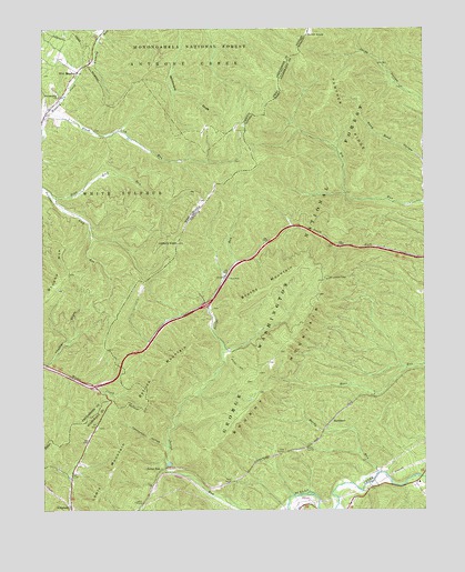
Jerrys Run, VA USGS Topographic Map
Click on map above to begin viewing in our Map Viewer.

This topographic map contains these locations and features:
Feature Name Type Latitude Longitude GNIS ID View Map
BackbonePopulated PlaceN37.7732°W80.1553°1495217View Map
Batick MountainSummitN37.7901°W80.2045°1481492View Map
Brushy MountainSummitN37.8085°W80.2462°1554011View Map
Brushy MountainSummitN37.8107°W80.1712°1495318View Map
Brushy Mountain LookoutLocaleN37.8104°W80.1553°1673680View Map
Brushy Mountain TrailTrailN37.7871°W80.1865°1482074View Map
Cannonball HollowValleyN37.7666°W80.2097°1482308View Map
Dunlap School (historical)SchoolN37.7573°W80.1267°1673686View Map
Dunlap Volunteer Fire and Rescue Main StationBuildingN37.7516°W80.1491°2721129View Map
Hardy RunStreamN37.7598°W80.1403°1483937View Map
Hickory KnobSummitN37.8196°W80.2053°1484066View Map
Interchange 1CrossingN37.8035°W80.1962°1673694View Map
Interchange 183CrossingN37.7823°W80.2334°1556444View Map
Jerrys RunLocaleN37.7607°W80.2109°1484431View Map
Kelly TunnelTunnelN37.7573°W80.1881°1484544View Map
Lake TunnelTunnelN37.7648°W80.1709°1484646View Map
Lewis MountainSummitN37.7598°W80.2278°1484786View Map
Moore TunnelTunnelN37.7665°W80.1637°1485545View Map
Panther RidgeRidgeN37.8521°W80.1517°1486057View Map
Pond Lick RunStreamN37.8315°W80.2462°1552535View Map
Slash Lick RunStreamN37.8532°W80.2481°1552920View Map
Smith KnobSummitN37.8735°W80.1628°1496235View Map
Stack MineMineN37.7623°W80.1342°1673713View Map
Thacker DraftValleyN37.7885°W80.2476°1553203View Map
Wild MeadowPopulated PlaceN37.8640°W80.2381°1553445View Map
Wild Meadow Baptist ChurchChurchN37.8573°W80.2442°1553446View Map
Wild Meadow TrailTrailN37.8562°W80.2095°1553656View Map
WXMD-FM (White Sulphur Springs)TowerN37.8301°W80.1973°1559855View Map

Note: Coordinates in the location and feature list above are referenced to NAD83 datum.


Copyright (C) 2008-2025 Ryan Niemi / Sunset Dynamics ... All Rights Reserved