TopoQuest Logo
Do you find TopoQuest useful?
Help keep TopoQuest running and adding new maps/features by donating!
Bitcoin:  19c7KJd3qBynnjoSw5npx9KScwjBe4ifkT
Litecoin:  LXs6TkuXGGXo1vDsWCkWVdjQX94eUKd6ui
Home View Maps Find Maps Find Places Resources & Links


Delectable Mountain, Vermont Topographic Map

USGS Map Title: Delectable Mountain, VT
USGS Map MRC: 43072F6
DRG (GeoTIFF) Download: o43072f6.tif


Neighboring USGS Topographic Map Quads:


  Rochester, VT  
43072G7
 

  Bethel, VT  
43072G6
 

  South Royalton, VT  
43072G5
 

  Pico Peak, VT  
43072F7
 

  Delectable Mountain, VT  
43072F6
 

  Woodstock North, VT  
43072F5
 

  Killington Peak, VT  
43072E7
 

  Plymouth, VT  
43072E6
 

  Woodstock South, VT  
43072E5


Map MRC Location:

N44°
W73°
N44°
W72°
H8 H7 H6 H5 H4 H3 H2 H1
G8 G7 G6 G5 G4 G3 G2 G1
F8 F7 F6 F5 F4 F3 F2 F1
E8 E7 E6 E5 E4 E3 E2 E1
D8 D7 D6 D5 D4 D3 D2 D1
C8 C7 C6 C5 C4 C3 C2 C1
B8 B7 B6 B5 B4 B3 B2 B1
A8 A7 A6 A5 A4 A3 A2 A1
N43°
W73°
N43°
W72°

Delectable Mountain, VT USGS 1:24K Topographic Map Preview:
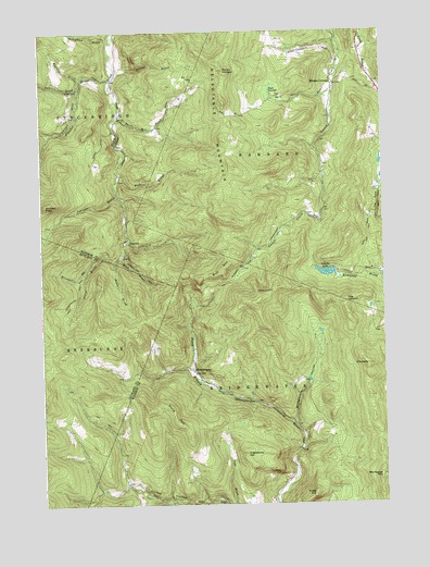
Delectable Mountain, VT USGS Topographic Map
Click on map above to begin viewing in our Map Viewer.

This topographic map contains these locations and features:
Feature Name Type Latitude Longitude GNIS ID View Map
Barnard Town ForestForestN43.7006°W72.6670°1922248View Map
Barnard TrailTrailN43.6876°W72.6765°1456260View Map
Basin BrookStreamN43.6898°W72.7229°1456288View Map
Boutwell BrookStreamN43.7378°W72.7343°1460635View Map
Bridgewater HollowValleyN43.6465°W72.6579°1456567View Map
Broughton BrookStreamN43.7490°W72.7232°1456593View Map
Bull HillSummitN43.6870°W72.6837°1456635View Map
Burbee PeakSummitN43.7045°W72.7487°1456654View Map
ChateauguayPopulated PlaceN43.6603°W72.6948°1456862View Map
Cobb HillSummitN43.6276°W72.6512°1456937View Map
Dalton BrookStreamN43.7395°W72.7220°1457092View Map
Dana HillSummitN43.6473°W72.7015°1457100View Map
Davis Hill BrookStreamN43.7270°W72.7215°1457122View Map
Delectable MountainSummitN43.7312°W72.6826°1457143View Map
Dimick BrookStreamN43.6273°W72.7126°1457174View Map
Fletcher BrookStreamN43.7370°W72.7237°1460875View Map
Freestone HillSummitN43.6387°W72.6762°1457490View Map
Johnson BrookStreamN43.7070°W72.7218°1458022View Map
Lakota LakeReservoirN43.6863°W72.6458°1458153View Map
Lakota Lake DamDamN43.6862°W72.6429°1766595View Map
Mink BrookStreamN43.6912°W72.7201°1458493View Map
Montague HillSummitN43.6317°W72.6268°1458519View Map
Morgan CornersPopulated PlaceN43.7362°W72.6426°1458535View Map
Mount HungerSummitN43.7398°W72.6826°1457933View Map
NotownPopulated PlaceN43.6951°W72.7182°1460441View Map
Nye CemeteryCemeteryN43.7334°W72.6635°1922502View Map
Nyes SwampSwampN43.7348°W72.6657°1458801View Map
Perkins BrookStreamN43.7128°W72.7207°1458939View Map
PinnacleSummitN43.6617°W72.6312°1458983View Map
Taggart BrookStreamN43.7348°W72.7357°1461506View Map
The LookoutSummitN43.6790°W72.6390°1459872View Map
Town of BridgewaterCivilN43.6254°W72.6670°1462050View Map
Windfall BrookStreamN43.6870°W72.7329°1460294View Map

Note: Coordinates in the location and feature list above are referenced to NAD83 datum.


Copyright (C) 2008-2024 Ryan Niemi / Sunset Dynamics ... All Rights Reserved