TopoQuest Logo
Do you find TopoQuest useful?
Help keep TopoQuest running and adding new maps/features by donating!
Bitcoin:  19c7KJd3qBynnjoSw5npx9KScwjBe4ifkT
Litecoin:  LXs6TkuXGGXo1vDsWCkWVdjQX94eUKd6ui
Home View Maps Find Maps Find Places Resources & Links


Suplee, Oregon Topographic Map

USGS Map Title: Suplee, OR
USGS Map MRC: 44119A6
DRG (GeoTIFF) Download: o44119a6.tif


Neighboring USGS Topographic Map Quads:


  Mud Spring, OR  
44119B7
 

  Powell Mountain, OR  
44119B6
 

  Suplee Butte, OR  
44119B5
 

  Angell Butte, OR  
44119A7
 

  Suplee, OR  
44119A6
 

  Funny Butte, OR  
44119A5
 

  Twelvemile Reservoir, OR  
43119H7
 

  Delintment Lake, OR  
43119H6
 

  Big Mowich Mountain, OR  
43119H5


Map MRC Location:

N45°
W120°
N45°
W119°
H8 H7 H6 H5 H4 H3 H2 H1
G8 G7 G6 G5 G4 G3 G2 G1
F8 F7 F6 F5 F4 F3 F2 F1
E8 E7 E6 E5 E4 E3 E2 E1
D8 D7 D6 D5 D4 D3 D2 D1
C8 C7 C6 C5 C4 C3 C2 C1
B8 B7 B6 B5 B4 B3 B2 B1
A8 A7 A6 A5 A4 A3 A2 A1
N44°
W120°
N44°
W119°

Suplee, OR USGS 1:24K Topographic Map Preview:
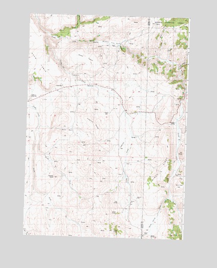
Suplee, OR USGS Topographic Map
Click on map above to begin viewing in our Map Viewer.

This topographic map contains these locations and features:
Feature Name Type Latitude Longitude GNIS ID View Map
Bernard RanchLocaleN44.1076°W119.6819°1156326View Map
Camp CreekStreamN44.1174°W119.7411°1139208View Map
Colpitts ButteSummitN44.0596°W119.6947°1157472View Map
Cow CampLocaleN44.0229°W119.7441°1156301View Map
Cow CampLocaleN44.0365°W119.7250°1156302View Map
Delore SpringSpringN44.0138°W119.6781°1157475View Map
Dry Rock CreekStreamN44.1190°W119.7119°1638211View Map
H Bernard Ranch (historical)LocaleN44.0482°W119.6850°1156303View Map
Henshaw SpringSpringN44.0660°W119.6343°1157468View Map
Little Bear CreekStreamN44.1021°W119.6491°1157568View Map
Long SpringSpringN44.0199°W119.6771°1157476View Map
Miners FlatFlatN44.1096°W119.6886°1157466View Map
Negro CreekStreamN44.0882°W119.6283°2504724View Map
North Fork Trout CreekStreamN44.0626°W119.7405°1157464View Map
O'Henry ReservoirReservoirN44.0785°W119.6475°1157469View Map
Pitt ButteSummitN44.0485°W119.6272°1157471View Map
Pole CreekStreamN44.0882°W119.6283°1116521View Map
Robertson RanchLocaleN44.0226°W119.6633°1156325View Map
Rock CreekStreamN44.1118°W119.7225°1157581View Map
Smith BasinBasinN44.0596°W119.7191°1157474View Map
Soda SpringSpringN44.0853°W119.6982°1157467View Map
Soda TableSummitN44.0976°W119.6948°1157473View Map
South Fork Trout CreekStreamN44.0628°W119.7403°1156674View Map
Stewart Post Office (historical)Post OfficeN44.0838°W119.6969°1164702View Map
SupleePopulated PlaceN44.0693°W119.6766°1150695View Map
Suplee Hot SpringSpringN44.0021°W119.6505°1157479View Map
Suplee Post Office (historical)Post OfficeN44.0693°W119.6766°1166013View Map
Warm Springs CreekStreamN44.0232°W119.6366°1151894View Map
Weberg ButteSummitN44.0333°W119.7269°1157477View Map
Weberg RanchLocaleN44.0026°W119.6558°1157478View Map
Windy RidgeRidgeN44.0390°W119.6425°1152519View Map

Note: Coordinates in the location and feature list above are referenced to NAD83 datum.


Copyright (C) 2008-2025 Ryan Niemi / Sunset Dynamics ... All Rights Reserved