TopoQuest Logo
Do you find TopoQuest useful?
Help keep TopoQuest running and adding new maps/features by donating!
Bitcoin:  19c7KJd3qBynnjoSw5npx9KScwjBe4ifkT
Litecoin:  LXs6TkuXGGXo1vDsWCkWVdjQX94eUKd6ui
Home View Maps Find Maps Find Places Resources & Links


Angell Butte, Oregon Topographic Map

USGS Map Title: Angell Butte, OR
USGS Map MRC: 44119A7
DRG (GeoTIFF) Download: o44119a7.tif


Neighboring USGS Topographic Map Quads:


  Paulina, OR  
44119B8
 

  Mud Spring, OR  
44119B7
 

  Powell Mountain, OR  
44119B6
 

  Maupin Butte, OR  
44119A8
 

  Angell Butte, OR  
44119A7
 

  Suplee, OR  
44119A6
 

  Hardin Ranch, OR  
43119H8
 

  Twelvemile Reservoir, OR  
43119H7
 

  Delintment Lake, OR  
43119H6


Map MRC Location:

N45°
W120°
N45°
W119°
H8 H7 H6 H5 H4 H3 H2 H1
G8 G7 G6 G5 G4 G3 G2 G1
F8 F7 F6 F5 F4 F3 F2 F1
E8 E7 E6 E5 E4 E3 E2 E1
D8 D7 D6 D5 D4 D3 D2 D1
C8 C7 C6 C5 C4 C3 C2 C1
B8 B7 B6 B5 B4 B3 B2 B1
A8 A7 A6 A5 A4 A3 A2 A1
N44°
W120°
N44°
W119°

Angell Butte, OR USGS 1:24K Topographic Map Preview:
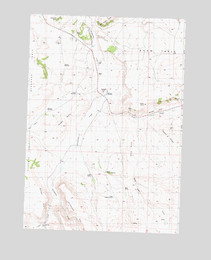
Angell Butte, OR USGS Topographic Map
Click on map above to begin viewing in our Map Viewer.

This topographic map contains these locations and features:
Feature Name Type Latitude Longitude GNIS ID View Map
Angell ButteSummitN44.0607°W119.8464°1157482View Map
Angell RanchLocaleN44.0722°W119.8142°1161239View Map
Axtell GapGapN44.0721°W119.7719°1157484View Map
Brennan DamDamN44.0816°W119.8107°1638212View Map
Brennan RanchLocaleN44.0915°W119.8189°1157494View Map
Brennan ReservoirReservoirN44.0818°W119.8108°1157496View Map
Coffee CreekStreamN44.0213°W119.8511°1157662View Map
Coyote SpringSpringN44.0322°W119.8215°1157493View Map
Davin SpringSpringN44.1150°W119.8379°1157480View Map
Dorschied ButteSummitN44.1226°W119.8541°1157605View Map
Forbes ButteSummitN44.0746°W119.7814°1157483View Map
Gollum ReservoirReservoirN44.0958°W119.8464°1157481View Map
Grindstone RimCliffN44.0069°W119.8278°1161151View Map
Halfway WaterholeReservoirN44.0696°W119.8589°1157485View Map
Hardin (historical)LocaleN44.0707°W119.8094°1129642View Map
Hardin Post Office (historical)Post OfficeN44.0707°W119.8094°1165368View Map
Kuhn RanchLocaleN44.1074°W119.8247°1167447View Map
Layton Dam Number 2DamN44.1083°W119.8227°1133584View Map
Layton Reservoir Number 2ReservoirN44.1076°W119.8231°1133585View Map
Lower Coyote ReservoirReservoirN44.0344°W119.8102°1157492View Map
Oberg RidgeRidgeN44.0565°W119.7605°1157488View Map
Ryegrass TableSummitN44.0696°W119.8708°1136717View Map
Scareoff PointSummitN44.0813°W119.8155°1157487View Map
Shaw TableSummitN44.0782°W119.7691°1136747View Map
Stump WaterholeReservoirN44.0801°W119.8361°1157486View Map
Trail BasinBasinN44.0610°W119.8691°1157495View Map
Trout CreekStreamN44.0813°W119.8108°1157465View Map
Upper Coyote ReservoirReservoirN44.0200°W119.8032°1157491View Map
Wade SpringSpringN44.0254°W119.7948°1157490View Map
White Butte CreekStreamN44.0660°W119.7850°1152224View Map
Yreka RimCliffN44.0179°W119.8566°1157489View Map

Note: Coordinates in the location and feature list above are referenced to NAD83 datum.


Copyright (C) 2008-2025 Ryan Niemi / Sunset Dynamics ... All Rights Reserved