TopoQuest Logo
Do you find TopoQuest useful?
Help keep TopoQuest running and adding new maps/features by donating!
Bitcoin:  19c7KJd3qBynnjoSw5npx9KScwjBe4ifkT
Litecoin:  LXs6TkuXGGXo1vDsWCkWVdjQX94eUKd6ui
Home View Maps Find Maps Find Places Resources & Links


Denham, Indiana Topographic Map

USGS Map Title: Denham, IN
USGS Map MRC: 41086B6
DRG (GeoTIFF) Download: o41086b6.tif


Neighboring USGS Topographic Map Quads:


  English Lake, IN  
41086C7
 

  Knox West, IN  
41086C6
 

  Knox East, IN  
41086C5
 

  North Judson, IN  
41086B7
 

  Denham, IN  
41086B6
 

  Bass Lake, IN  
41086B5
 

  North Judson SE, IN  
41086A7
 

  Ripley, IN  
41086A6
 

  Winamac, IN  
41086A5


Map MRC Location:

N42°
W87°
N42°
W86°
H8 H7 H6 H5 H4 H3 H2 H1
G8 G7 G6 G5 G4 G3 G2 G1
F8 F7 F6 F5 F4 F3 F2 F1
E8 E7 E6 E5 E4 E3 E2 E1
D8 D7 D6 D5 D4 D3 D2 D1
C8 C7 C6 C5 C4 C3 C2 C1
B8 B7 B6 B5 B4 B3 B2 B1
A8 A7 A6 A5 A4 A3 A2 A1
N41°
W87°
N41°
W86°

Denham, IN USGS 1:24K Topographic Map Preview:
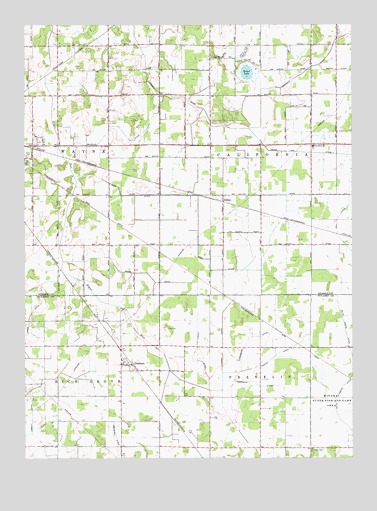
Denham, IN USGS Topographic Map
Click on map above to begin viewing in our Map Viewer.

This topographic map contains these locations and features:
Feature Name Type Latitude Longitude GNIS ID View Map
AldinePopulated PlaceN41.2009°W86.6745°430054View Map
Bass Lake - California Township Fire Department Station 2BuildingN41.2443°W86.6795°2626465View Map
Bass Lake Station 2BuildingN41.2443°W86.6796°2701375View Map
Beebe DitchCanalN41.1787°W86.7117°430710View Map
California Elementary SchoolSchoolN41.2150°W86.6397°447104View Map
Cedar Lake DitchCanalN41.2134°W86.6447°432288View Map
Center CemeteryCemeteryN41.1273°W86.6411°432313View Map
Craigmile DitchCanalN41.2203°W86.6695°433081View Map
DenhamPopulated PlaceN41.1520°W86.7136°433469View Map
Hanley DitchCanalN41.1539°W86.6556°435683View Map
Hartwick DitchCanalN41.1470°W86.6633°435844View Map
Hook DitchCanalN41.2003°W86.6842°436404View Map
James DitchCanalN41.1653°W86.7486°436922View Map
Lena ParkPopulated PlaceN41.1945°W86.7172°446765View Map
Lougis DitchCanalN41.1570°W86.6750°438342View Map
Maciolek DitchCanalN41.2209°W86.7178°438457View Map
Passmore DitchCanalN41.1598°W86.6647°440918View Map
Podell Airport (historical)AirportN41.1271°W86.6901°449146View Map
Podell DitchCanalN41.1553°W86.6847°441381View Map
Round LakeLakeN41.2362°W86.6655°442350View Map
Township of CaliforniaCivilN41.2156°W86.6404°453153View Map
Township of FranklinCivilN41.1283°W86.6411°453311View Map

Note: Coordinates in the location and feature list above are referenced to NAD83 datum.


Copyright (C) 2008-2025 Ryan Niemi / Sunset Dynamics ... All Rights Reserved