TopoQuest Logo
Do you find TopoQuest useful?
Help keep TopoQuest running and adding new maps/features by donating!
Bitcoin:  19c7KJd3qBynnjoSw5npx9KScwjBe4ifkT
Litecoin:  LXs6TkuXGGXo1vDsWCkWVdjQX94eUKd6ui
Home View Maps Find Maps Find Places Resources & Links


Depoe Bay, Oregon Topographic Map

USGS Map Title: Depoe Bay, OR
USGS Map MRC: 44124G1
DRG (GeoTIFF) Download: o44124g1.tif


Neighboring USGS Topographic Map Quads:


  Lincoln City, OR  
44124H1
 

  Devils Lake, OR  
44123H8


  Depoe Bay, OR  
44124G1
 

  Mowrey Landing, OR  
44123G8


  Newport North, OR  
44124F1
 

  Toledo North, OR  
44123F8


Map MRC Location:

N45°
W125°
N45°
W124°
H8 H7 H6 H5 H4 H3 H2 H1
G8 G7 G6 G5 G4 G3 G2 G1
F8 F7 F6 F5 F4 F3 F2 F1
E8 E7 E6 E5 E4 E3 E2 E1
D8 D7 D6 D5 D4 D3 D2 D1
C8 C7 C6 C5 C4 C3 C2 C1
B8 B7 B6 B5 B4 B3 B2 B1
A8 A7 A6 A5 A4 A3 A2 A1
N44°
W125°
N44°
W124°

Depoe Bay, OR USGS 1:24K Topographic Map Preview:
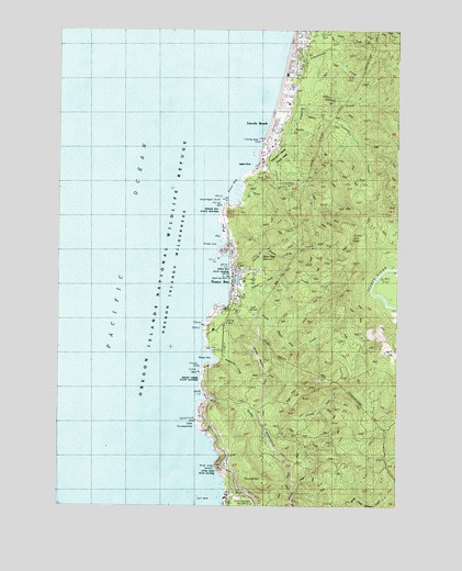
Depoe Bay, OR USGS Topographic Map
Click on map above to begin viewing in our Map Viewer.

This topographic map contains these locations and features:
Feature Name Type Latitude Longitude GNIS ID View Map
Ben Jones BridgeBridgeN44.7582°W124.0609°1851909View Map
Boiler BayBayN44.8332°W124.0629°1117912View Map
Boiler Bay State ParkParkN44.8279°W124.0646°1117913View Map
Briggs LandingLocaleN44.8282°W124.0637°1851913View Map
Cape FoulweatherCapeN44.7723°W124.0759°1118595View Map
City of Depoe BayCivilN44.8091°W124.0597°2410325View Map
Coronado ShoresPopulated PlaceN44.8651°W124.0396°1136949View Map
Deadhorse CreekStreamN44.7879°W124.0654°1119751View Map
Depoe BayPopulated PlaceN44.8084°W124.0632°1119868View Map
Depoe BayBayN44.8092°W124.0606°1158906View Map
Depoe Bay City HallBuildingN44.8056°W124.0605°2661057View Map
Depoe Bay City ParkParkN44.8121°W124.0634°1119869View Map
Depoe Bay CreekStreamN44.8059°W124.0596°1132479View Map
Depoe Bay HarborHarborN44.8092°W124.0602°2668325View Map
Depoe Bay Post OfficePost OfficeN44.8180°W124.0625°1165148View Map
Depoe Bay Public WorksBuildingN44.8056°W124.0605°2661529View Map
Depoe Bay Rural Fire Protection District Station 2300 Depoe BayBuildingN44.8074°W124.0618°2577096View Map
Depoe Bay Wastewater Treatment PlantLocaleN44.8006°W124.0664°2660654View Map
Depoe Bay Water Treatment PlantLocaleN44.8120°W124.0557°2660695View Map
Dope CreekStreamN44.7504°W124.0651°1132481View Map
Finger RockIslandN44.7507°W124.0651°1132485View Map
Fishing RockCapeN44.8459°W124.0523°1120787View Map
Fishing Rock State ParkParkN44.8459°W124.0518°1851884View Map
Flat RockBarN44.8076°W124.0693°1134555View Map
Fogarty CreekStreamN44.8390°W124.0540°1120856View Map
Fogarty Creek State ParkParkN44.8423°W124.0457°1120857View Map
Government PointCapeN44.8309°W124.0671°1121274View Map
Gull RockIslandN44.7515°W124.0748°1121484View Map
H2O and S Sewage DisposalLocaleN44.7605°W124.0667°2697174View Map
Imperial Marine Services Boat RampLocaleN44.8079°W124.0601°2668406View Map
KNPT-FMTowerN44.7565°W124.0476°1131192View Map
Lincoln BeachPopulated PlaceN44.8504°W124.0468°1136480View Map
Lincoln Beach Post Office (historical)Post OfficeN44.8504°W124.0468°1165543View Map
Lincoln Beach WaysideParkN44.8484°W124.0498°1132483View Map
North Depoe Bay CreekStreamN44.8101°W124.0601°1124740View Map
North Depoe Bay Creek ReservoirReservoirN44.8159°W124.0515°1132484View Map
North ReefBarN44.8115°W124.0701°1134556View Map
Otter CrestCapeN44.7612°W124.0648°1125063View Map
Otter Crest Rest AreaAreaN44.7554°W124.0629°1132480View Map
Otter Crest State ParkParkN44.7604°W124.0665°1125064View Map
Pacific PalisadesPopulated PlaceN44.8443°W124.0507°1132478View Map
Pirate CoveBayN44.8190°W124.0671°1125444View Map
Rabbit RockIslandN44.8376°W124.0596°1132477View Map
Rocky CreekStreamN44.7784°W124.0718°1148658View Map
Rocky Creek State ParkParkN44.7815°W124.0723°1126236View Map
Sabre CreekStreamN44.8321°W124.0012°1148890View Map
Salmon CreekStreamN44.8546°W124.0346°1132500View Map
Schoolhouse CreekStreamN44.8729°W124.0418°1126661View Map
Siletz HillSummitN44.8201°W124.0182°1136755View Map
South Depoe Bay CreekStreamN44.8065°W124.0596°1127247View Map
United States Coast Guard Motor Lifeboat Station Depoe BayBuildingN44.8098°W124.0593°2661394View Map
Whale CoveBayN44.7887°W124.0721°1128927View Map
Whale Watching CenterParkN44.8101°W124.0624°2113435View Map
Williams CreekStreamN44.8026°W124.0637°1132482View Map

Note: Coordinates in the location and feature list above are referenced to NAD83 datum.


Copyright (C) 2008-2024 Ryan Niemi / Sunset Dynamics ... All Rights Reserved