TopoQuest Logo
Do you find TopoQuest useful?
Help keep TopoQuest running and adding new maps/features by donating!
Bitcoin:  19c7KJd3qBynnjoSw5npx9KScwjBe4ifkT
Litecoin:  LXs6TkuXGGXo1vDsWCkWVdjQX94eUKd6ui
Home View Maps Find Maps Find Places Resources & Links


Devils Lake, Oregon Topographic Map

USGS Map Title: Devils Lake, OR
USGS Map MRC: 44123H8
DRG (GeoTIFF) Download: o44123h8.tif


Neighboring USGS Topographic Map Quads:


  Neskowin, OR  
45123A8
 

  Dolph, OR  
45123A7
 

  Lincoln City, OR  
44124H1
 

  Devils Lake, OR  
44123H8
 

  Stott Mountain, OR  
44123H7
 

  Depoe Bay, OR  
44124G1
 

  Mowrey Landing, OR  
44123G8
 

  Euchre Mountain, OR  
44123G7


Map MRC Location:

N45°
W124°
N45°
W123°
H8 H7 H6 H5 H4 H3 H2 H1
G8 G7 G6 G5 G4 G3 G2 G1
F8 F7 F6 F5 F4 F3 F2 F1
E8 E7 E6 E5 E4 E3 E2 E1
D8 D7 D6 D5 D4 D3 D2 D1
C8 C7 C6 C5 C4 C3 C2 C1
B8 B7 B6 B5 B4 B3 B2 B1
A8 A7 A6 A5 A4 A3 A2 A1
N44°
W124°
N44°
W123°

Devils Lake, OR USGS 1:24K Topographic Map Preview:
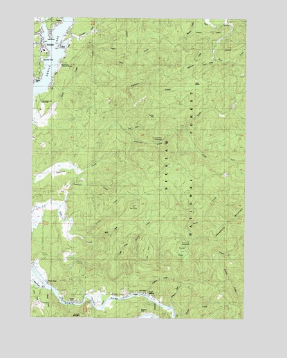
Devils Lake, OR USGS Topographic Map
Click on map above to begin viewing in our Map Viewer.

This topographic map contains these locations and features:
Feature Name Type Latitude Longitude GNIS ID View Map
Abrams CreekStreamN44.9312°W123.9984°1153686View Map
Anderson CreekStreamN44.9226°W123.9887°1158104View Map
Baldy Creek QuarryMineN44.9461°W123.9945°2664316View Map
Ball MountainSummitN44.9221°W123.9409°1137481View Map
Barhaven CreekStreamN44.8793°W123.9184°1137512View Map
Bear CreekStreamN44.8837°W123.9698°1153689View Map
Blue Heron Boat LandingLocaleN44.9960°W123.9965°2668312View Map
Blue Heron DockLocaleN44.9959°W123.9961°2668530View Map
Bluff CreekStreamN44.9057°W123.9637°1138343View Map
Bones CreekStreamN44.8871°W123.9971°1153688View Map
Callow CreekStreamN44.9832°W123.8940°1153657View Map
Cannery MountainSummitN44.8757°W123.9718°1139306View Map
Chinook BendBendN44.8812°W123.9612°1139696View Map
Coyote RockPillarN44.8818°W123.9768°1140336View Map
Coyote Rock RV ParkHarborN44.8814°W123.9801°2668248View Map
Coyote Rock RV Park Boat RampLocaleN44.8814°W123.9801°2668221View Map
Deadwood MountainRidgeN44.9140°W123.8859°1140757View Map
Department of Motor Vehicles Lincoln CityBuildingN44.9982°W123.9963°2661067View Map
Devils LakeLakeN44.9824°W123.9921°1158204View Map
Drift Creek Bridge (historical)BridgeN44.9929°W123.8876°1955641View Map
Drift Creek CampLocaleN44.9032°W123.9123°1167202View Map
Drift Creek County ParkParkN44.9168°W123.9809°2022208View Map
Drift Creek TrailTrailN44.8934°W123.9321°1141250View Map
East Devils Lake State Park Boat RampLocaleN44.9677°W123.9972°2668257View Map
East Fork Quarry CreekStreamN44.8984°W123.9357°1141594View Map
Echo FallsFallsN44.8868°W123.9323°1141662View Map
Elos PrairieFlatN44.9751°W123.9048°1141844View Map
Erickson CreekStreamN44.9554°W123.9526°1141887View Map
Fall CreekStreamN44.9518°W123.9471°1153439View Map
Gordey CreekStreamN44.9118°W123.9776°1142865View Map
Holmes Road ParkLocaleN44.9901°W123.9954°2668238View Map
KBCH-AMTowerN44.9907°W123.9804°1153904View Map
Kernville - Gleneden Beach - Lincoln Beach Water District Water Treatment PlantLocaleN44.8989°W123.9726°2660792View Map
Lake PointCapeN44.9932°W123.9912°1144784View Map
Lincoln City - Schooner Creek Water Treatment PlantLocaleN44.9354°W123.9716°2660769View Map
Lincoln City DivisionCivilN44.9740°W123.8997°1937999View Map
Medicine RockPillarN44.8800°W123.9358°1146077View Map
North CreekStreamN44.9032°W123.9093°1146893View Map
North Creek Campground (historical)LocaleN44.9021°W123.9071°1153685View Map
North Fork Schooner CreekStreamN44.9544°W123.9117°2086440View Map
North Lincoln Fire and Rescue District 1 Station 1700 KernvilleBuildingN44.8846°W123.9447°2576902View Map
Oceanlake DamDamN44.9823°W123.9429°1153684View Map
Odell CreekStreamN44.8968°W123.9476°1147155View Map
Pacific View Memorial GardensCemeteryN44.9809°W123.9845°1135168View Map
Pacific West AmbulanceBuildingN44.9869°W123.9974°2553809View Map
Pikes CampLocaleN44.8896°W123.9912°1147664View Map
Prairie HillSummitN44.9576°W123.9301°1147985View Map
Quarry CreekStreamN44.8971°W123.9371°1148079View Map
Reed ReservoirReservoirN44.8862°W123.9713°1153687View Map
Regatta Grounds Park Boat RampLocaleN44.9739°W123.9986°2668191View Map
Regatta ParkParkN44.9740°W123.9998°1162279View Map
Samaritan North Lincoln HospitalHospitalN44.9855°W123.9963°2610857View Map
Samaritan North Lincoln Hospital HeliportBuildingN44.9863°W123.9941°1154020View Map
Sand Point Boat LaunchLocaleN44.9870°W123.9862°2668322View Map
Schooner Creek Campground (historical)LocaleN44.9509°W123.9237°1153683View Map
Skunk CreekStreamN44.8771°W123.9162°1149643View Map
South Fork Schooner CreekStreamN44.9544°W123.9117°1150010View Map
Southman CreekStreamN44.9868°W123.8951°1153655View Map
Sportsmans LandingLocaleN44.8844°W123.9421°2668429View Map
Sunset LandingHarborN44.8850°W123.9343°2668250View Map
Sunset LandingLocaleN44.8848°W123.9344°2668163View Map
Sunset LandingLocaleN44.8846°W123.9376°1150678View Map
Tarry CreekStreamN44.9840°W123.8946°1153656View Map
The LoopBendN44.9012°W123.9107°1151024View Map
Thompson CreekStreamN44.9896°W123.9821°1151099View Map
Wildcat CreekStreamN44.9018°W123.8901°1152345View Map
Wildcat CreekStreamN44.8804°W123.9262°1153690View Map

Note: Coordinates in the location and feature list above are referenced to NAD83 datum.


Copyright (C) 2008-2025 Ryan Niemi / Sunset Dynamics ... All Rights Reserved