TopoQuest Logo
Do you find TopoQuest useful?
Help keep TopoQuest running and adding new maps/features by donating!
Bitcoin:  19c7KJd3qBynnjoSw5npx9KScwjBe4ifkT
Litecoin:  LXs6TkuXGGXo1vDsWCkWVdjQX94eUKd6ui
Home View Maps Find Maps Find Places Resources & Links


Jericho Valley, California Topographic Map

USGS Map Title: Jericho Valley, CA
USGS Map MRC: 38122G4
DRG (GeoTIFF) Download: o38122g4.tif


Neighboring USGS Topographic Map Quads:


  Lower Lake, CA  
38122H5
 

  Wilson Valley, CA  
38122H4
 

  Glascock Mountain, CA  
38122H3
 

  Middletown, CA  
38122G5
 

  Jericho Valley, CA  
38122G4
 

  Knoxville, CA  
38122G3
 

  Detert Reservoir, CA  
38122F5
 

  Aetna Springs, CA  
38122F4
 

  Walter Springs, CA  
38122F3


Map MRC Location:

N39°
W123°
N39°
W122°
H8 H7 H6 H5 H4 H3 H2 H1
G8 G7 G6 G5 G4 G3 G2 G1
F8 F7 F6 F5 F4 F3 F2 F1
E8 E7 E6 E5 E4 E3 E2 E1
D8 D7 D6 D5 D4 D3 D2 D1
C8 C7 C6 C5 C4 C3 C2 C1
B8 B7 B6 B5 B4 B3 B2 B1
A8 A7 A6 A5 A4 A3 A2 A1
N38°
W123°
N38°
W122°

Jericho Valley, CA USGS 1:24K Topographic Map Preview:
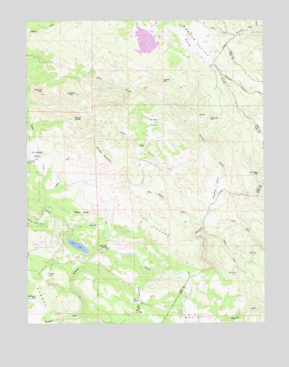
Jericho Valley, CA USGS Topographic Map
Click on map above to begin viewing in our Map Viewer.

This topographic map contains these locations and features:
Feature Name Type Latitude Longitude GNIS ID View Map
Amel LakeLakeN38.7819°W122.4744°218225View Map
Bishop MountainSummitN38.8238°W122.4661°219329View Map
Bucksnort CreekStreamN38.7802°W122.4544°255073View Map
Butcherknife CreekStreamN38.7702°W122.4300°220274View Map
Cedar CreekStreamN38.7938°W122.4075°220767View Map
Dunnigan HillSummitN38.8110°W122.3789°1658449View Map
Gunther CreekStreamN38.8038°W122.4919°224745View Map
Hells Half AcreFlatN38.7932°W122.4966°225136View Map
Hennesey RanchLocaleN38.7810°W122.4589°225176View Map
Hole CreekStreamN38.8388°W122.4303°225441View Map
Hunting CreekStreamN38.7682°W122.4161°225798View Map
Ink RanchLocaleN38.7591°W122.4458°225936View Map
Jericho CreekStreamN38.7988°W122.4044°226208View Map
Jericho ValleyValleyN38.8355°W122.4355°226209View Map
Jerusalem ValleyBasinN38.8199°W122.4958°226217View Map
Jim Davis PeakSummitN38.7660°W122.4900°1657257View Map
Jim Dollar MountainSummitN38.8438°W122.4783°226238View Map
John Thomas CreekStreamN38.7907°W122.4083°226282View Map
Morgan ValleyValleyN38.8560°W122.4019°234329View Map
Mysterious CreekStreamN38.7510°W122.4036°229401View Map
Norman SpringsSpringN38.8349°W122.4766°229587View Map
Oat HillSummitN38.8352°W122.4089°1659279View Map
Paradise ValleyBasinN38.8060°W122.4016°230324View Map
Petticoat MountainSummitN38.8460°W122.4925°230583View Map
Pocock CreekStreamN38.7880°W122.4089°230841View Map
Red Elephant MineMineN38.8346°W122.4050°231324View Map
Round CorralLocaleN38.7532°W122.4194°231954View Map
Round MountainSummitN38.8499°W122.4303°1659553View Map
Soda CreekStreamN38.7960°W122.4880°253908View Map
The CedarsSummitN38.7913°W122.4369°1659978View Map
Watson RangeRidgeN38.7960°W122.4725°1660137View Map
West Coast Radio Receiving StationMilitaryN38.7807°W122.4964°2512387View Map
Wildcat LakeLakeN38.7702°W122.4904°237797View Map

Note: Coordinates in the location and feature list above are referenced to NAD83 datum.


Copyright (C) 2008-2025 Ryan Niemi / Sunset Dynamics ... All Rights Reserved