TopoQuest Logo
Do you find TopoQuest useful?
Help keep TopoQuest running and adding new maps/features by donating!
Bitcoin:  19c7KJd3qBynnjoSw5npx9KScwjBe4ifkT
Litecoin:  LXs6TkuXGGXo1vDsWCkWVdjQX94eUKd6ui
Home View Maps Find Maps Find Places Resources & Links


Grass Mountain, Oregon Topographic Map

USGS Map Title: Grass Mountain, OR
USGS Map MRC: 44123D6
DRG (GeoTIFF) Download: o44123d6.tif


Neighboring USGS Topographic Map Quads:


  Elk City, OR  
44123E7
 

  Harlan, OR  
44123E6
 

  Marys Peak, OR  
44123E5
 

  Hellion Rapids, OR  
44123D7
 

  Grass Mountain, OR  
44123D6
 

  Alsea, OR  
44123D5
 

  Five Rivers, OR  
44123C7
 

  Digger Mountain, OR  
44123C6
 

  Prairie Peak, OR  
44123C5


Map MRC Location:

N45°
W124°
N45°
W123°
H8 H7 H6 H5 H4 H3 H2 H1
G8 G7 G6 G5 G4 G3 G2 G1
F8 F7 F6 F5 F4 F3 F2 F1
E8 E7 E6 E5 E4 E3 E2 E1
D8 D7 D6 D5 D4 D3 D2 D1
C8 C7 C6 C5 C4 C3 C2 C1
B8 B7 B6 B5 B4 B3 B2 B1
A8 A7 A6 A5 A4 A3 A2 A1
N44°
W124°
N44°
W123°

Grass Mountain, OR USGS 1:24K Topographic Map Preview:
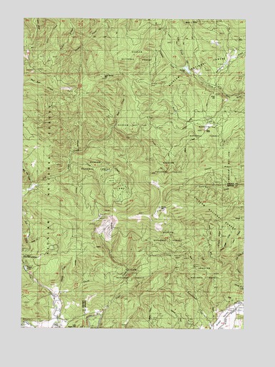
Grass Mountain, OR USGS Topographic Map
Click on map above to begin viewing in our Map Viewer.

This topographic map contains these locations and features:
Feature Name Type Latitude Longitude GNIS ID View Map
Angora Post Office (historical)Post OfficeN44.3790°W123.7304°1164839View Map
Bear CreekStreamN44.4568°W123.6998°1137659View Map
Bull Run CreekStreamN44.4321°W123.7473°1138916View Map
Cove CreekStreamN44.4418°W123.7240°1140263View Map
Creel HillSummitN44.4693°W123.6423°1134455View Map
Digger CreekStreamN44.3801°W123.7065°1141025View Map
Fall CreekStreamN44.3762°W123.7326°1141984View Map
Fall Creek FallsFallsN44.3918°W123.7398°1153623View Map
Grass MountainSummitN44.4240°W123.6729°1142956View Map
Hatchery CreekStreamN44.3893°W123.7298°1134454View Map
Horse CreekStreamN44.4082°W123.7465°1153659View Map
Kimble RidgeRidgeN44.4123°W123.6393°1159246View Map
Kimble Ridge CreekStreamN44.4040°W123.6393°1134453View Map
Klickitat CreekStreamN44.4798°W123.6615°1144664View Map
Klickitat LakeLakeN44.4795°W123.6589°1144665View Map
Lake CreekStreamN44.4810°W123.6584°1144756View Map
Lake Ridge CreekStreamN44.4026°W123.6309°1163825View Map
Little Digger MountainSummitN44.3765°W123.7184°1145150View Map
Lone Spring MountainSummitN44.4787°W123.6918°1145366View Map
Mason CreekStreamN44.3782°W123.6457°1153626View Map
Mill Creek Boat LandingLocaleN44.3850°W123.6282°2668549View Map
Mill Creek County ParkParkN44.3837°W123.6282°1159248View Map
North Fork Mill CreekStreamN44.4043°W123.6448°1159245View Map
Racks CreekStreamN44.4673°W123.6323°1148129View Map
Rocky PointCapeN44.4954°W123.6601°1148669View Map
Sharp RanchLocaleN44.4554°W123.6468°1149290View Map
Skunk CreekStreamN44.3879°W123.7315°1149641View Map
Slate CreekStreamN44.3846°W123.6290°1153627View Map
Stiltner CreekStreamN44.4582°W123.6554°1153625View Map
Sweethome CreekStreamN44.4735°W123.6457°1159252View Map
Thissell PondReservoirN44.3989°W123.7490°1159247View Map
West Fork Mill CreekStreamN44.4043°W123.6448°1159244View Map

Note: Coordinates in the location and feature list above are referenced to NAD83 datum.


Copyright (C) 2008-2025 Ryan Niemi / Sunset Dynamics ... All Rights Reserved