TopoQuest Logo
Do you find TopoQuest useful?
Help keep TopoQuest running and adding new maps/features by donating!
Bitcoin:  19c7KJd3qBynnjoSw5npx9KScwjBe4ifkT
Litecoin:  LXs6TkuXGGXo1vDsWCkWVdjQX94eUKd6ui
Home View Maps Find Maps Find Places Resources & Links


Dinwiddie, Virginia Topographic Map

USGS Map Title: Dinwiddie, VA
USGS Map MRC: 37077A5
DRG (GeoTIFF) Download: o37077a5.tif


Neighboring USGS Topographic Map Quads:


  Church Road, VA  
37077B6
 

  Sutherland, VA  
37077B5
 

  Petersburg, VA  
37077B4
 

  DeWitt, VA  
37077A6
 

  Dinwiddie, VA  
37077A5
 

  Carson, VA  
37077A4
 

  McKenney, VA  
36077H6
 

  Cherry Hill, VA  
36077H5
 

  Stony Creek, VA  
36077H4


Map MRC Location:

N38°
W78°
N38°
W77°
H8 H7 H6 H5 H4 H3 H2 H1
G8 G7 G6 G5 G4 G3 G2 G1
F8 F7 F6 F5 F4 F3 F2 F1
E8 E7 E6 E5 E4 E3 E2 E1
D8 D7 D6 D5 D4 D3 D2 D1
C8 C7 C6 C5 C4 C3 C2 C1
B8 B7 B6 B5 B4 B3 B2 B1
A8 A7 A6 A5 A4 A3 A2 A1
N37°
W78°
N37°
W77°

Dinwiddie, VA USGS 1:24K Topographic Map Preview:
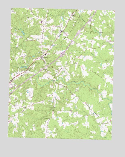
Dinwiddie, VA USGS Topographic Map
Click on map above to begin viewing in our Map Viewer.

This topographic map contains these locations and features:
Feature Name Type Latitude Longitude GNIS ID View Map
Ampy CemeteryCemeteryN37.0796°W77.5411°1462454View Map
Appomattox Regional Library System Dinwiddie LibraryBuildingN37.0774°W77.5881°2519896View Map
BonnevillePopulated PlaceN37.0965°W77.5900°1690717View Map
Butterworth CemeteryCemeteryN37.0510°W77.6233°1464189View Map
Calvary Episcopal ChurchChurchN37.0774°W77.5867°1690722View Map
Chamberlains BedStreamN37.0882°W77.6086°1464718View Map
Colina (historical)Populated PlaceN37.0713°W77.5025°1690730View Map
Confederate WoodsPopulated PlaceN37.0938°W77.5842°1690731View Map
Crawford ChurchChurchN37.0735°W77.5442°1465415View Map
DinwiddiePopulated PlaceN37.0779°W77.5867°1498473View Map
Dinwiddie AcresPopulated PlaceN37.1007°W77.5253°1690738View Map
Dinwiddie Census Designated PlaceCensusN37.0775°W77.5864°2629020View Map
Dinwiddie County CourthouseBuildingN37.0776°W77.5872°1690740View Map
Dinwiddie County Division of Fire / Emergency Medical ServicesBuildingN37.0800°W77.5860°2331848View Map
Dinwiddie County Office of Public SafetyBuildingN37.0802°W77.5857°2331828View Map
Dinwiddie County Sheriff's OfficeBuildingN37.0765°W77.5869°2331930View Map
Dinwiddie County Sheriff's OfficeBuildingN37.0771°W77.5873°2075422View Map
Dinwiddie Elementary SchoolSchoolN37.0808°W77.5820°1690741View Map
Dinwiddie High SchoolSchoolN37.1139°W77.5825°1690745View Map
Dinwiddie High School (historical)SchoolN37.0640°W77.5853°1690743View Map
Dinwiddie Middle SchoolSchoolN37.1034°W77.5638°1474914View Map
Dinwiddie Post OfficePost OfficeN37.0738°W77.5835°1690744View Map
Dinwiddie Volunteer Fire and Emergency Medical Services Station 1BuildingN37.0861°W77.5791°2075467View Map
District 4CivilN37.0228°W77.5352°1927241View Map
Glendoyle (historical)Populated PlaceN37.0521°W77.5622°1690752View Map
HamiltonPopulated PlaceN37.0293°W77.6053°1477389View Map
Hawkins Memorial CemeteryCemeteryN37.0196°W77.5750°1690762View Map
Hawkins Memorial ChurchChurchN37.0193°W77.5742°1467845View Map
Hawkins RunStreamN37.0529°W77.5522°1467847View Map
Interchange 53CrossingN37.0818°W77.5617°1690769View Map
Jericho Church (historical)ChurchN37.0924°W77.5328°1690772View Map
Jessup StoreLocaleN37.1124°W77.5864°1690773View Map
Laird (historical)Populated PlaceN37.0040°W77.5769°1690775View Map
Lebanon ChurchChurchN37.0768°W77.5869°1469242View Map
Mount Level CemeteryCemeteryN37.0657°W77.5805°1690789View Map
Mount Level ChurchChurchN37.0654°W77.5789°1470927View Map
Mount Level SchoolSchoolN37.0663°W77.5800°1470929View Map
Olive Branch CemeteryCemeteryN37.1179°W77.5514°1690797View Map
Olive Branch ChurchChurchN37.1182°W77.5503°1471901View Map
Quaker BridgeBridgeN37.1079°W77.5283°1472885View Map
Richardsons PondReservoirN37.0681°W77.6081°1473191View Map
Saint Thomas CemeteryCemeteryN37.0290°W77.6044°1690813View Map
Saint Thomas ChurchChurchN37.0290°W77.6047°1473924View Map
Seat Island BranchStreamN37.0868°W77.6197°1474130View Map
Smyrna Baptist ChurchChurchN37.0810°W77.5805°1690819View Map
Stony SpringsPopulated PlaceN37.0546°W77.5636°1690822View Map
Waldemar (historical)Populated PlaceN37.0076°W77.5230°1690831View Map
Wilkinson PondReservoirN37.1011°W77.5178°1476740View Map
Wittbuish CemeteryCemeteryN37.1035°W77.5608°1476889View Map

Note: Coordinates in the location and feature list above are referenced to NAD83 datum.


Copyright (C) 2008-2025 Ryan Niemi / Sunset Dynamics ... All Rights Reserved